I am working with sentinel-1 SLC product on A1 platform (Ascending and Descending) to get Sigma nought VV and VH values for 5 months.
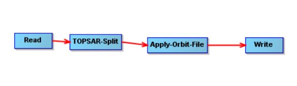
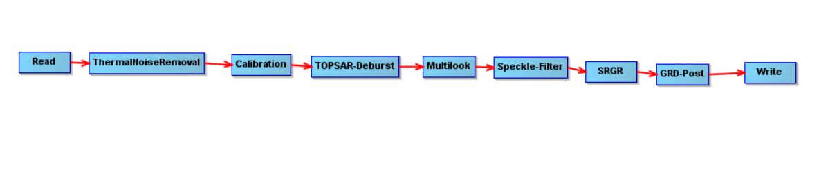
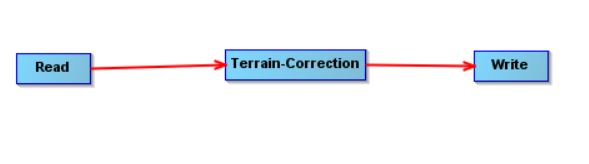
I processed the SLC files in SNAP following the below steps. After I processed them when I checked values in boxplot the Sigma VV and Sigma VH values were very low (-24 db to -28 db) in range as if the area is water surface but my study area is agriculture land and not very rainy.
I don’t know what exactly causes the very low value range could it be the memory issue of my laptop cause the problem and change the values?
if there is no vegetation on this area, there is simply surface scattering which can be considerably lower in the cross-polarized channels compared to the co-polarized channel.
How large is this area of interest?
Thanks for your reply
The area is plantation of walnut ,chestnut and olive trees and the area is about 22 hectares
actually I have Sigma VH and VV from Sentinel-1 B paltform which I didnt processed them and the range over the same time is as follows: Sigma VV (between 0 to -12 db) and Sigma VH (between 9 and - 13 db).
I dont know what can goes wrong to give values between -22 db to -28 db over same time
Yes my study area is located on 2 relative orbits 124 and 44 on Sentinel-1 A and B platform and my study period is from November 2018 until end of March 2019. I didnt combine images from different orbits.
As the values of Sigma VH and VV db on the platform B are in acceptable range on same orbits (I didnt processed them) I just dont know what in my applying processes can cause these range of values (-22 to -24db) for Sigma VV and values (-27 to -28 db) for Sigma VH.
For the same period, the Sigma VV value is between 0 to -12 db and Sigma VH value is between 9 and - 13 db on the platform B and on platform A Sigma VV value is between -22 to -24db and Sigma VH value is between -27 to -28 db. I don’t think the too much difference between Sigma values from platform A and B are correct.
Yes for the platform I mean Sentinel-1 A and Sentinel-B the only difference is for example on the date 16 Nov 2018 Sentinel-1 A is on ascending mode and Sentinel-B is on descending mode.
on the same date Sentinel-1 A (ascending) Sigma VV values between -22 to -24db and Sigma VH value is between -27 to -28 db.
on the same date Sentinel-1 B (descending)Sigma VV value is between 0 to -12 db and Sigma VH value is between 9 and - 13 db.
There is a high difference between Sigma VV and VH values on Sentinel-1 A and Sentinel-B.Is the range difference correct?
so they look at your area from entirely different angles and positions.
Backscatter is very sensitive to orientation of objects and surfaces, especially in agriculture.
This is why I included the reference to this topic in the first answer: Unexplained differences between different orbits
You can only compare images which are acquired from the same relative orbit. Sentinel-1 A and B have a revisit time of 6 or 12 days. Images from the same date are acquired from different relative orbits and can have large differences.
Terrain Flattening will reduce radiometric distortions caused by the topography, but orientation-specific characteristics of crops will probably remain.
Hello Andreas, I just need small info, so in order to compare images, I’ll have to choose either Ascending or Descending for the entire time period right?
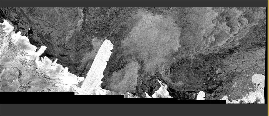
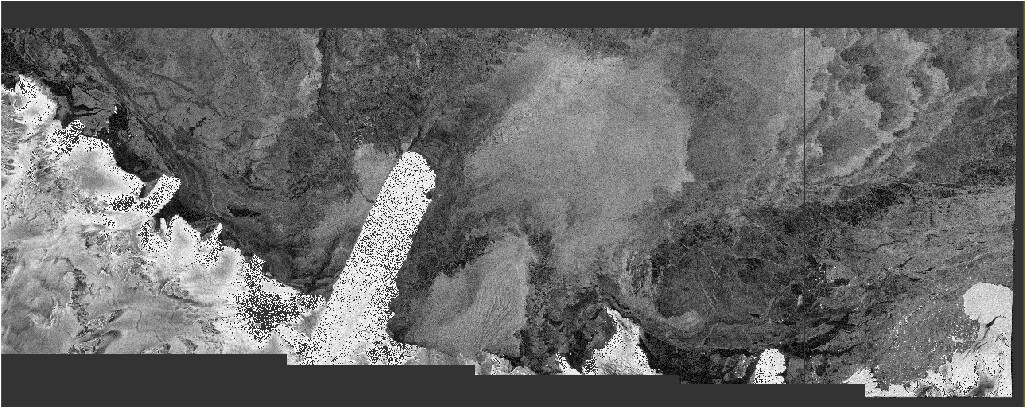
Secondly, can you please see the image below, I know that everything above a certain range in my image is noise - so i removed them through masking, thereafter, i removed all the +ve data values too - Hence, it gives me these spots over the brighter parts which was not there before.
Before
it depends on your analysis if you have to stick to one flight direction, but in most cases this helps to reduce unwanted differences resulting from the look angle and direction.
The spots over your bright areas are probably extremely high and after removal they are displayed as nodata.