there is no direct transfer of backscatter intensity to soil moisture. Please go through the suggestions made here: Soil moisture mapping using Sentinel-1-Data and SNAP? and here Soil moisture identification -Sentinel
This could be helpful as well,
How to Download Daily Soil Water Index from Copernicus Global Land Service
Determination of Soil Moisture for a Region Using open Source Data
Thank you for information
Can you help me to find paper or reference to calculate soil moisture with GRH product.
Regards
@johngan has given very valuable comments and literature references here: Soil moisture identification -Sentinel
Thanks for your response
you need a shapefile with attributes (moisture), import it in SNAP and use the correlative plot view.
how can i get shapefile sir?
measure soil moisture in your study area at the time when the image is acquired and locate the meastrements by a GPS device, for example.
Yes sir, I have these data
But i don’t know how to import these data to SNAP
Why not try this one - https://land.copernicus.eu/global/themes/Vegetation . This is verified product.
For SHP files import just do File->Import->VectorData->ESRI Shapefile
Hi @hriston_bg,
But when I search Surface Soil Moisture, I don’t find my study area because Spatial information is only in Europe
@Andiray You may try Vegetation Condition Index as a proxy for SM.
The global product is here - https://land.copernicus.eu/global/products/vci
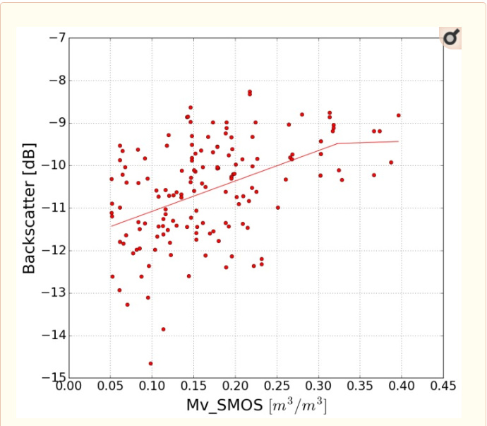
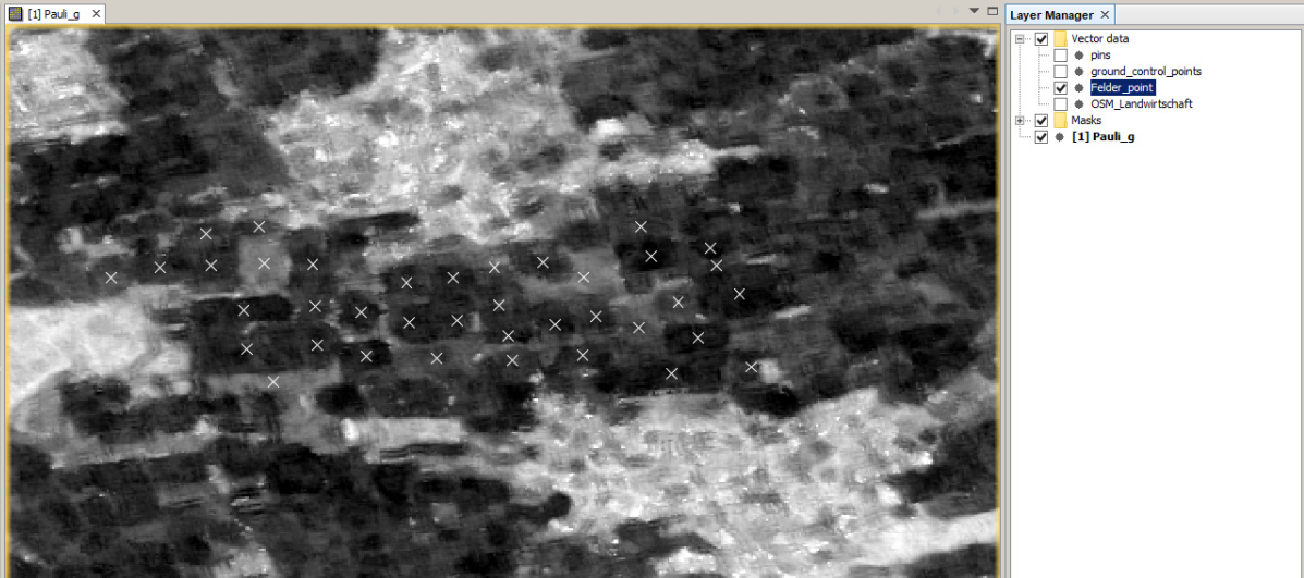
First you need a shapefile with numerical values (hoehe_cm in my case)
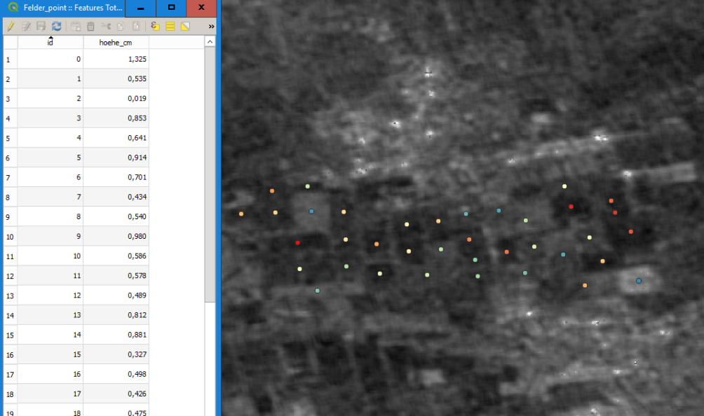
Load it into SNAP and overlay it with your SAR data
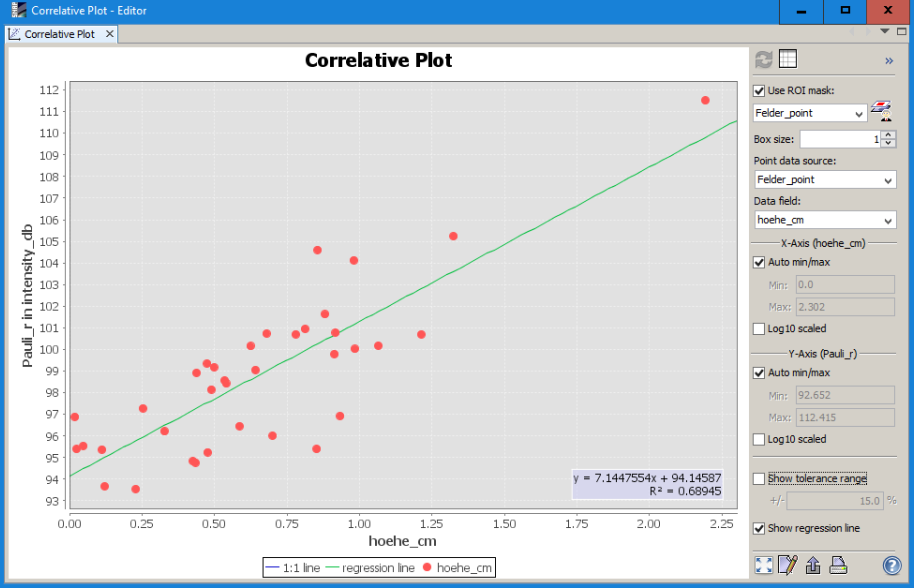
Then open the correlative plot view ![]()
Select the point shapefile and the attribute and correlate the raster values with the point information
1 Like
Hi @ABraun, how to make this shapefile? I only have ground data but I don’t know how to make it to shapefile.
I have coordinate point and value of soil moisture in ground data. I’m so sorry. I don’t have basic in SNAP
Thanks
SNAP can import csv files when they are formatted correctly.
If not, load the coordinates (and moisture attribute) in a GIS and export it as a shapefile. There are lots of tutorials on this around.