I ran into a problem trying to open a multitemporal composite (lately added feature in radiometric processing) in ArcGIS/QGIS since the spatial reference (“map info” in the ENVI-hdr) got lost in in the process. So no spatial reference was assigned in the GIS when opening the IMG-files but also a GeoTiff-file export from SNAP wasn’t successful. Checking for the source of the problem, I realised that the spatial reference is already lost in the stacking process. The following two terrain-flattened and terrain corrected GRD products I wanted to stack still contained the spatial reference in the ENVI-hdr.
Has nobody else run into this issue? Or do I need to provide more specific information on the processing chain I applied to produce the terrain-flattened and terrain corrected images that served as input for the stack?
I tried it with the Collocation operator. The spatial reference remains there in the IMG-files and it is therefore possible to open them in GIS software.
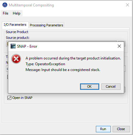
However, when I try to start the Multitemporal Compositing this error message appears:
Yes. S1A_IW_GRDH_1SDV_20190821T053409_20190821T053434_028663_033E6E_DFEE.zip is from the relative orbit 66 (descending) and S1A_IW_GRDH_1SDV_20190824T170816_20190824T170841_028714_034031_6FC7.zip is from the relative orbit 117 (ascending). And just as a subnote: I used an external DEM for the TF and TC.
Thank you for spending your valuable time on the issue!
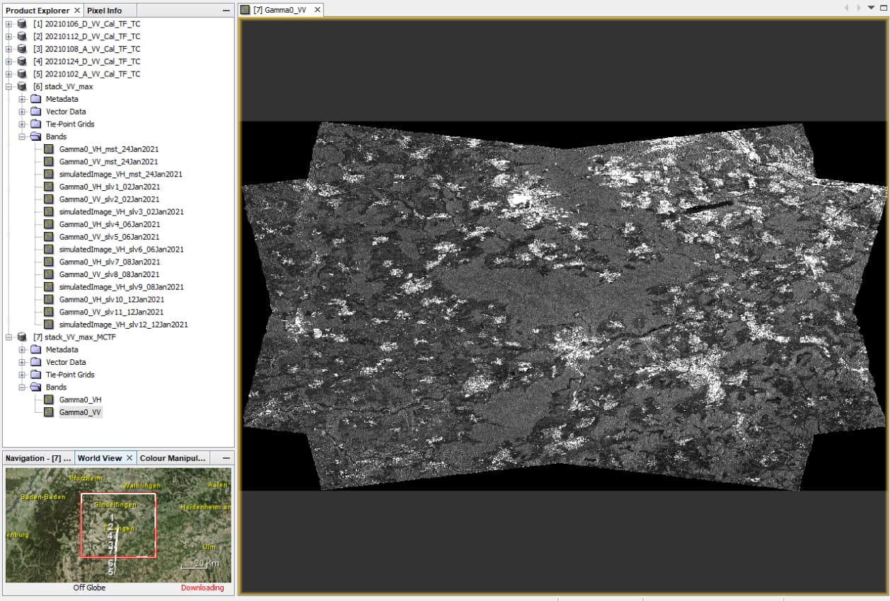
I just tested the approach with 5 products of both ascending and descending orbit.
I applied calibration and Terrain Flattening, then used “Create Stack” as suggested in the Help.
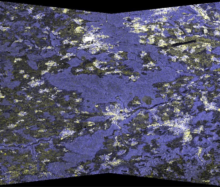
Yes! The results are beautiful. These local resolution weighting composites are great to work with and finally enable an easy combination of ascending and descending tracks! See Small et al. (2021) for more details.
But do you also have problems to open the composite (IMG-file) in a ArcGIS/QGIS?
The only thing which did not work was using the Copernicus DEM. It produced weird patterns, probably because of resampling issues. I remember that this was reported/demonstrated in another thread, but I can’t find it at the moment.
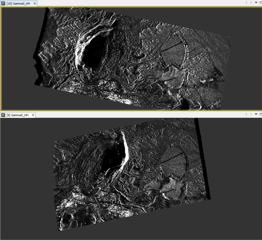
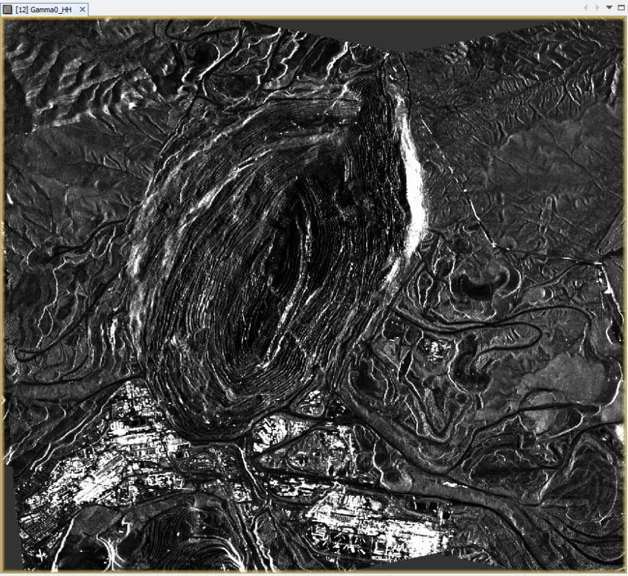
I’m impressed. I tested it for one of the most extreme landforms (the Cuquicamata copper mine) with VHR TerraSAR-X data resampled to 5 m in combination with 30m SRTM.
Data provided by Airbus: Sample Imagery