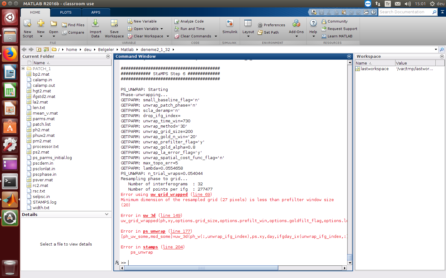
I am using 32 SLC and 1 Master for PSI study. I used 25X41 km area approximately (very small area). I used in the mt_prep step mt_prep_gamma_snap 0.4 1 1 50 200.
Then I used stamps then I am giving this following error.Also I found in the forum someone also faced with same error. And he or she fixed it via changing filter window size to less than pixel size. I also tried that but it doesnt work on my process. Could anybody help me? I also tried PSI process before with very big area and I got an error in the step 8 cause of memory. I decreased my area size but not I got an error in step 6. Thanks all.
"Error using uw_grid_wrapped (line 69)
Minimum dimension of the resampled grid (27 pixels) is less than prefilter window size
(20)
Error in uw_3d (line 149)
uw_grid_wrapped(ph,xy,options.grid_size,options.prefilt_win,options.goldfilt_flag,options.lowfilt_flag,options.gold_alpha);
Error in ps_unwrap (line 177)
[ph_uw_some,msd_some]=uw_3d(ph_w(:,unwrap_ifg_index),ps.xy,day,ifgday_ix(unwrap_ifg_index,:),ps.bperp(unwrap_ifg_index),options);
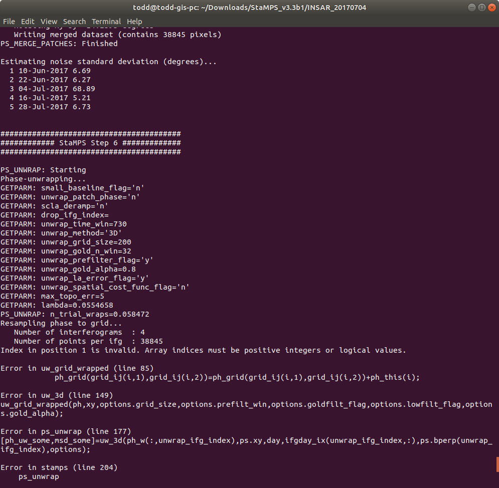
This problem occurs because using images from the different source (copernicus and asf). I fix this by only use image from copenicus and the process will run smoothly
@reyhanrere
Have you found Stamps handles a stack created from granules sourced from Copernicus differently than the same stack created from granules sourced from ASF?
Following a computer crash, I had to reconfigure stamps intallation again, on cygwin/Windows, which in that time worked perfectly.
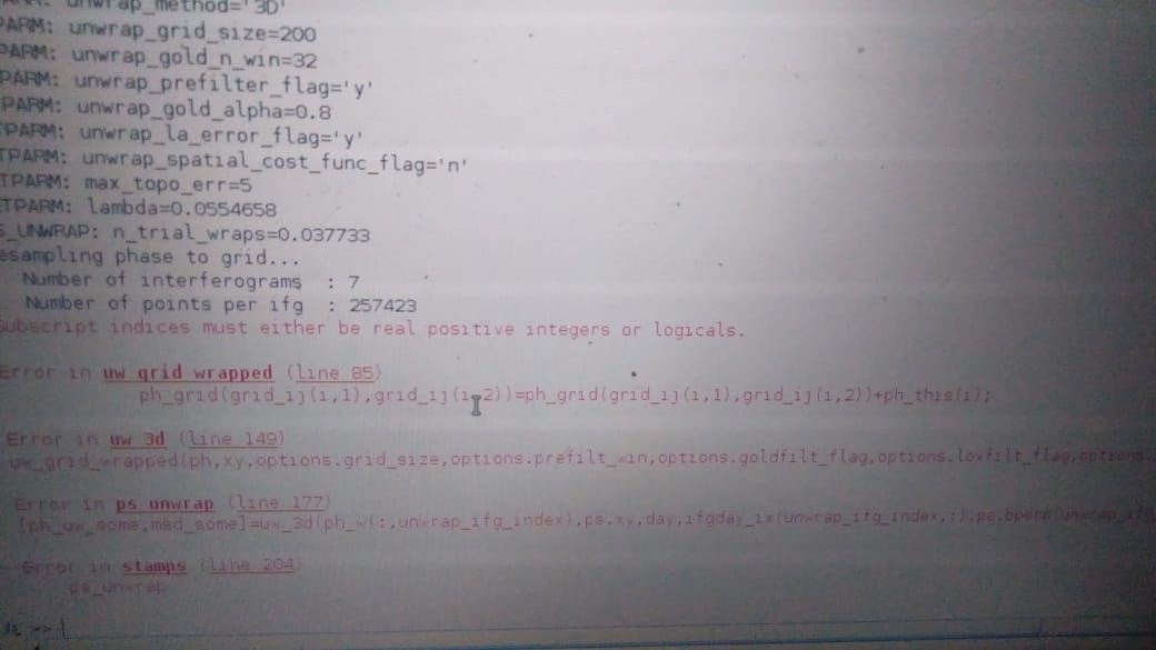
Now, I got exactly the same issue that you say concerning the “Subscript indices must either be real positive integers or logicals.” at Step 6. I’m still investigating where that error comes from, but from now I’m clueless! If I find something I’ll share it obviously.
In my particular case the issue comes from the parameters that have issues and are unstable between folders. For a reason I still do not understand, the points with no coordinates (NaN values) are not deleted. A workaround is to delete manually these values in planty of files, but it is kind of annoying, and I think linked with folders misconnections. But it works, though…
@reyhanrere: Thank you for sharing your experience. You mean you manually created the lat and lon file based on the stack_deburst product and replaced them in the StaMPS output “geo” folder?
Then you ran the whole process again: mt_prep_gamma, stamps(1,6) ?
Edit: I compared and noticed the lines/rows are different. I’ll give it a try.
I created lat/lon bands in band maths and then exported them in Gamma format. I copied the metadata (was only exported once) so now I have
@ABraun thank you for helping me in explaining it
And actually the files that work later are only .lat and .lon
So files with extension .lat.par and .lon.par can be deleted