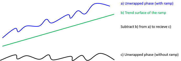
what I meant was to somehow create a raster that shows the overall trend of your ramp. If you can get that, for example by selecting and interpolating points at regularly distributed points you can then subtract it from your unwrapped phase.
My colleague does this because his TanDEM-X data maybe lack of precise orbit state vectors and this creates a ramp that superimposes his interferogram. With basic GIS steps (creating points between fringes, reading out phase values, interpolating points to get a surface of the ramp) he managed to reduce the ramp to a acceptable degree. But it’s just a work-around.
I quickly made a image to illustrate it:
