I’m trying to geocode/terrain-correct RCM GRD data that cover the North Pole via the SNAP GUI (SNAP 9.0.8, s1tbx 9.0.4) and am not getting any results. I’m using the “Range-Doppler Terrain Correction” process in an effort to receive an image that is correctly projected to the surface of the ocean, instead of an image in radar geometry with only tie points attached (i.e. GRD). I’m using the GETASSE30 DEM and I’m unchecking the “mask areas without elevation” box as it is often my workflow to geocode images over open ocean. EPSG:3413 is selected as a “Predefined CRS” in the “Map Projection” dialogue.
When clicking “run”, the progress bar stalls after some time (usually towards the end) and I can’t close the “Writing Target Product” window. After some time (enough time for the process to finish) I kill the process and try to load the result image, but QGis tells be that reading it failed. The behaviour is observed when trying this with other methods like an average height ellipsoid correction.
However if I subset the GRD image in azimuth direction such that it does not extent as close to / over the pole anymore, the TC works as expected.
I’m guessing from this that the TC process can’t properly handle data north of some threshold around 89° or so. Or is there something that I’m missing?
A good example is “RCM1_OK2776036_PK2924960_1_SCLND_20240130_043334_HH_HV_GRD”. It can be easily found in the EODMS graphical search mask by looking for “Low Noise” data with a relative orbit of 108 and the point “87N, 137E” as an area of interest.
Can someone confirm this behaviour and tell me whether this is a bug?
@jun_lu I did some further tests, and it seems to me that data of specific beam mnemonics can’t be processed rather than the issue being connected to the north pole itself.
An example: Testing data from the RCM “Low Noise” mode, we have different swath modes, varying in incidence angle range: SCLNA, SCLNB, SCLNC and SCLND (with SCLND being the only mode that uses incidence angles large enough to cover the pole). I only have trouble processing the images from “SCLND”. The same problem appears when investigating the “Low resolution” beam modes. “SC100MHVA” to “SC100MHVD” work fine, only “SC100MA” cannot be processed correctly.
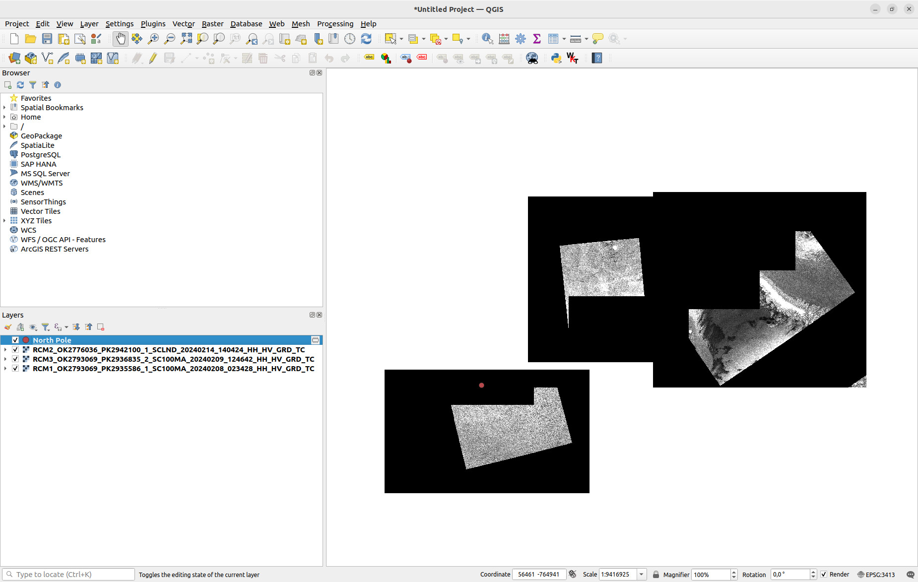
Another note that I have not encountered before: For some “SCLND” and “SC100MA” scenes, the processing does not produce 0-filled output as described above, but partially filled tif images. This can be seen in the screenshot attached below, which shows some low noise / low resolution scenes after the processing process stalled.
I initially described that subsetting the scene such that it does not cover the pole anymore, and running the geocoding op on the subset scene does produce results. I have now found this to be generally true for the “SCLND” scenes when they are subset in range direction. Cutting off the far range leads to correctly processed images.
This issue is resolved with the release of SNAP 11.0 - I can now correctly process data from the previously not covered acquisition modes SC100MA, SCLND and SC50MD that lead to the above mentioned problems. thank you, nicely done!