Good morning everyone,
I’m processing some interferograms from Sentinel 1 images but I’m facing some problems at the end of the processing chain with the Terrain Correction (Range-Doppler Terrain Correction) tool.
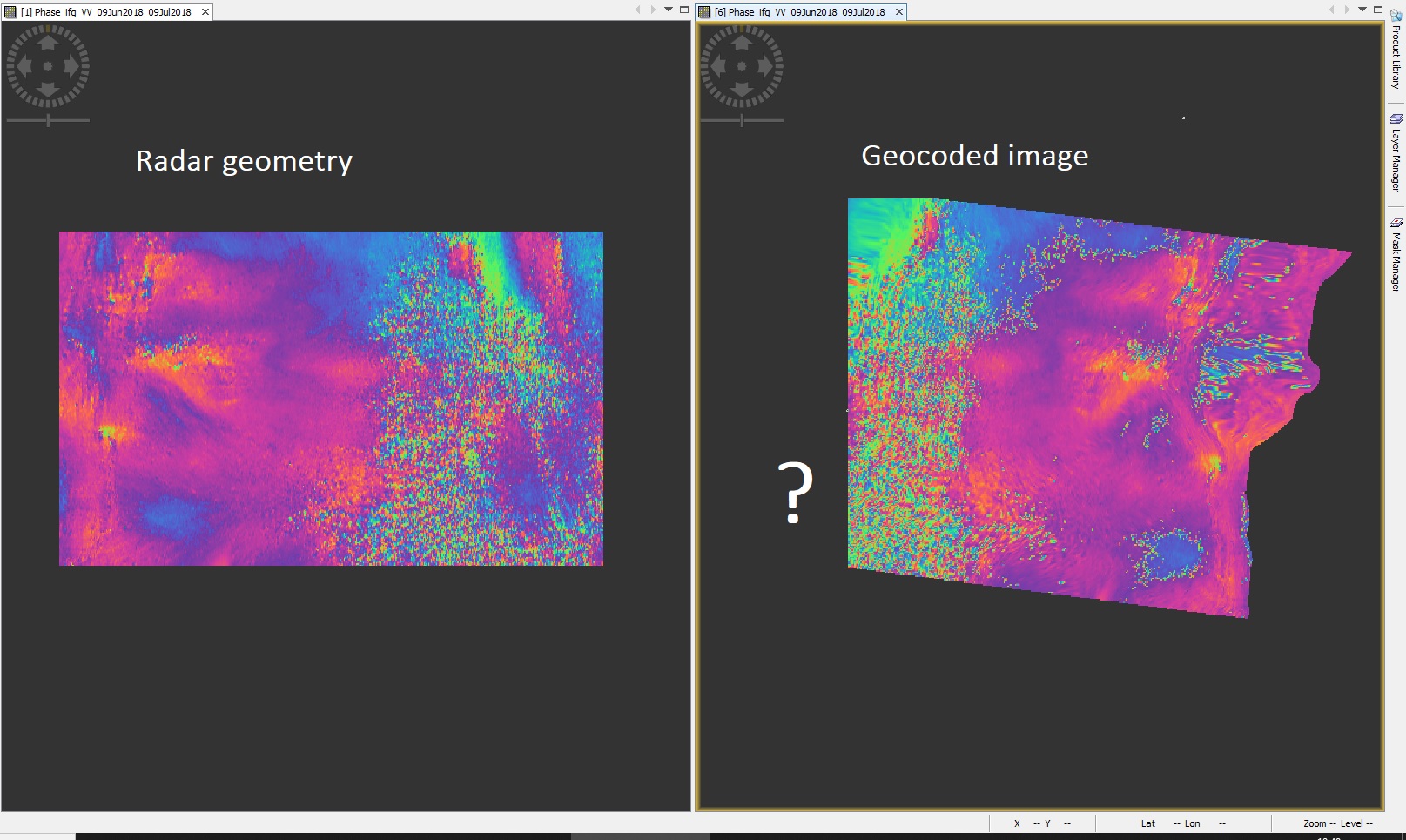
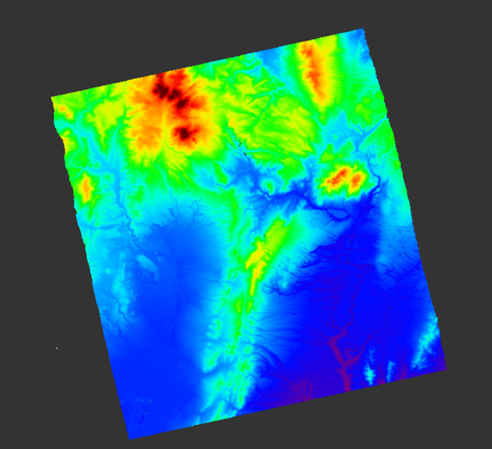
The problem is that sometimes (not always and I can’t understand why) my interferogram is cut passing from radar to geo coordinates.
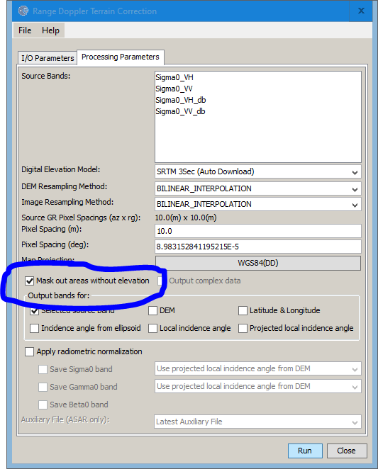
Thanks, @ABraun! my area is in the middle of the Alps, no water close to it… however, I tried without that option, but I still get the same results.
I’m disappointed because It’s not a constant error. Sometimes I can get the entire scene well reprojected, but other times,for unknown reasons, it doesn’t work and cut part of it.
then this line is not because data is left out but because pixels are moved to their correct position. The geometric distortions are corrected in the image, causing one (or both) border in range direction to be adjusted to the terrain topography.
This is completely normal and should actually happen for every image in this region. The stronger the topography, the stronger this effect.
Has anyone found a way to work around this SNAP TC issue? I am aware it does not always happen, so I don’t know exactly how to replicate it universally.
Edit: I tried downloading the SRTM and using it as an external DEM, ensuring that the area is larger than the SAR image, but it still produces the same error, so whatever causes the edge cut off is probably does not appear the SRTM data being missing, but rather the boundaries of the corrected raster being calculated incorrectly, somehow.
Edit 2: It also happens with the ellipsoid terrain correction, but not with the geolocation grid.
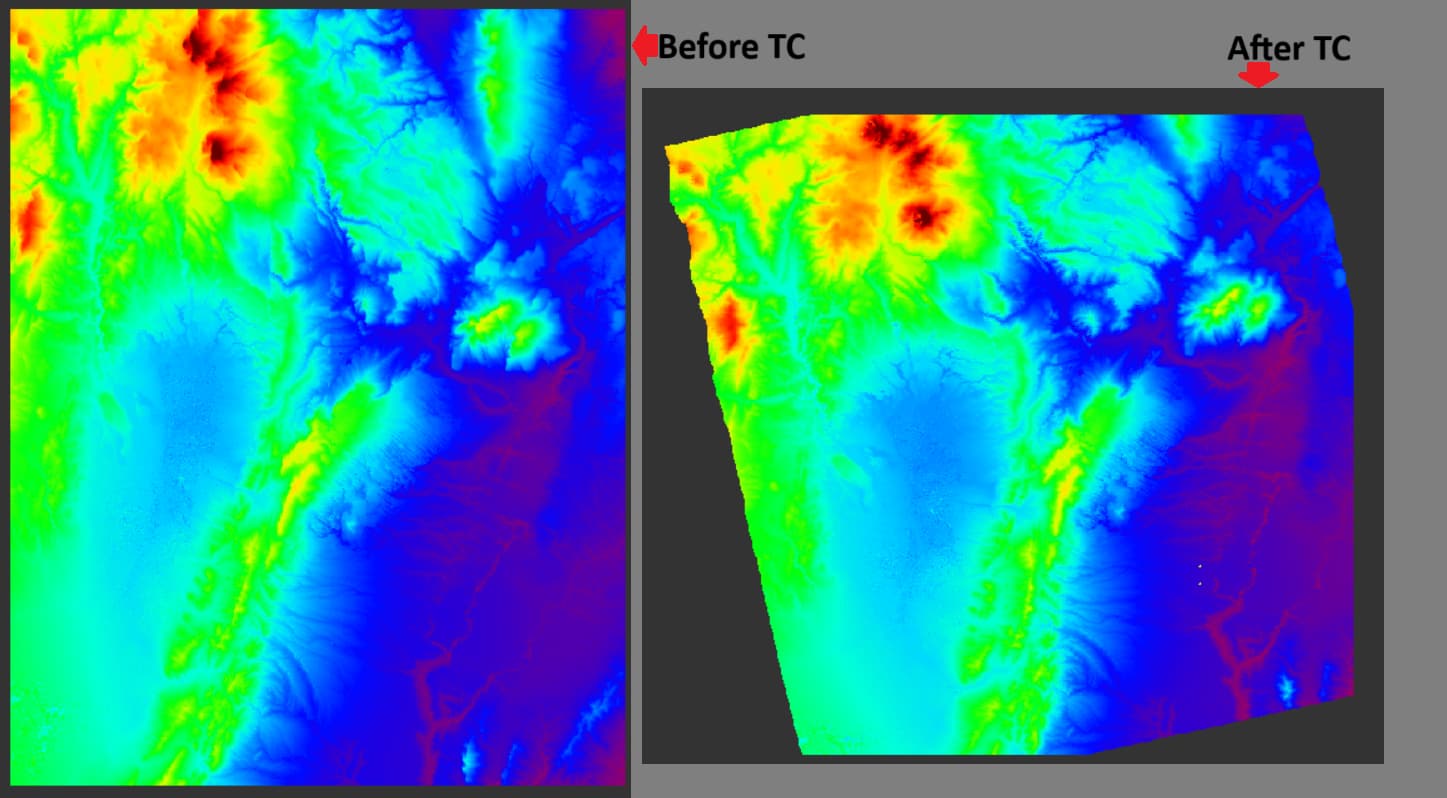
For reference, here is the same DEM terrain-corrected using SARscape, it does not cut off the edges.