about the statistical validation: Currently, there is no implementet accuracy assessment, but you could randomly place pins in your raster and export the elevation values of the SRTM and the S1 DEM and then statistically compare them outside SNAP.
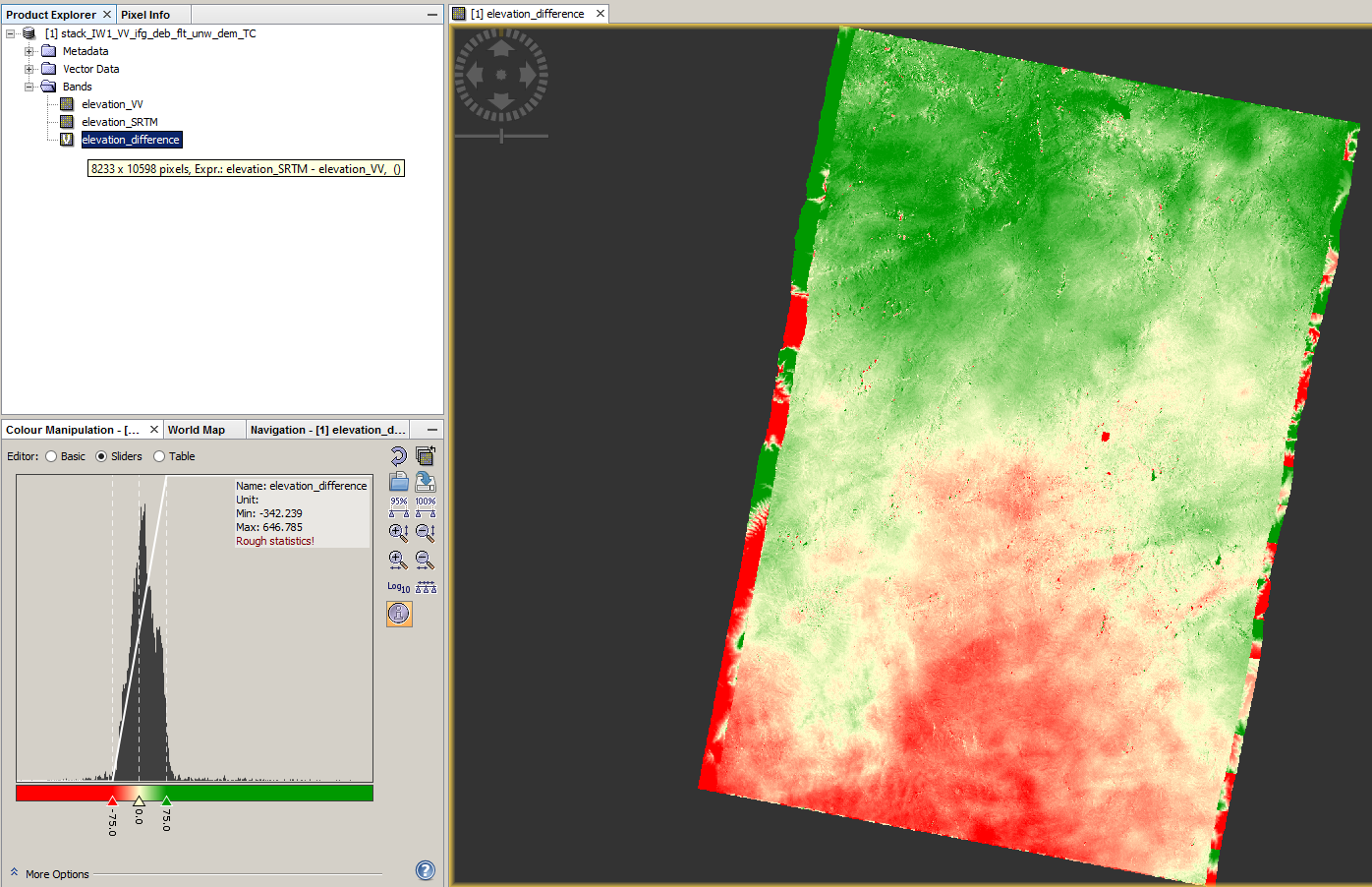
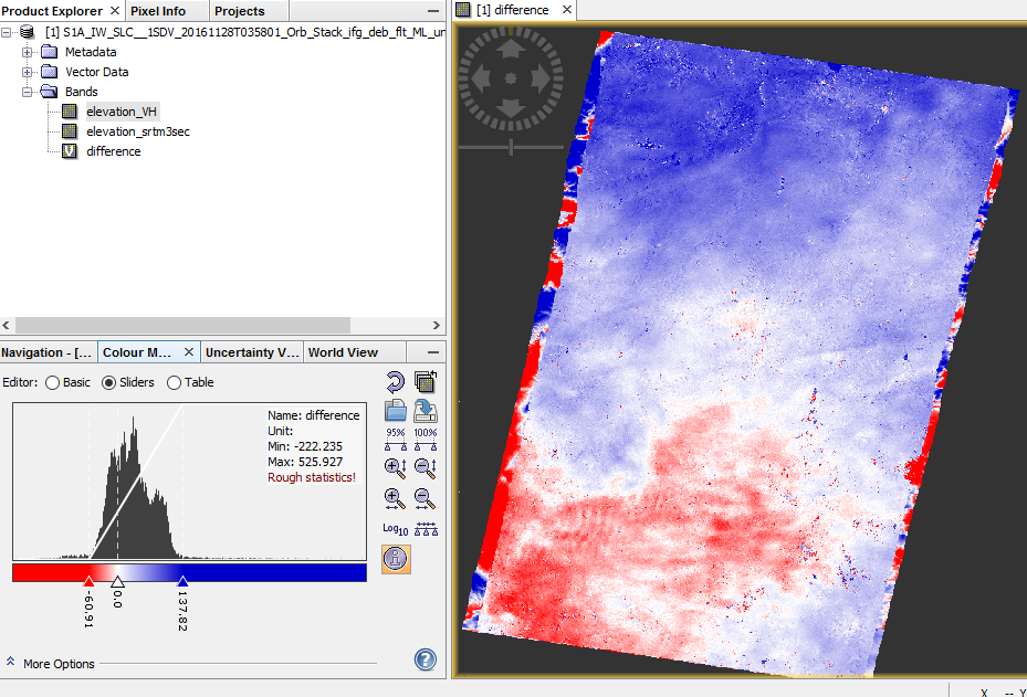
Or you calculate a difference image (SRTM-S1 DEM) to see where they are alike and where there are the largest mismatches.
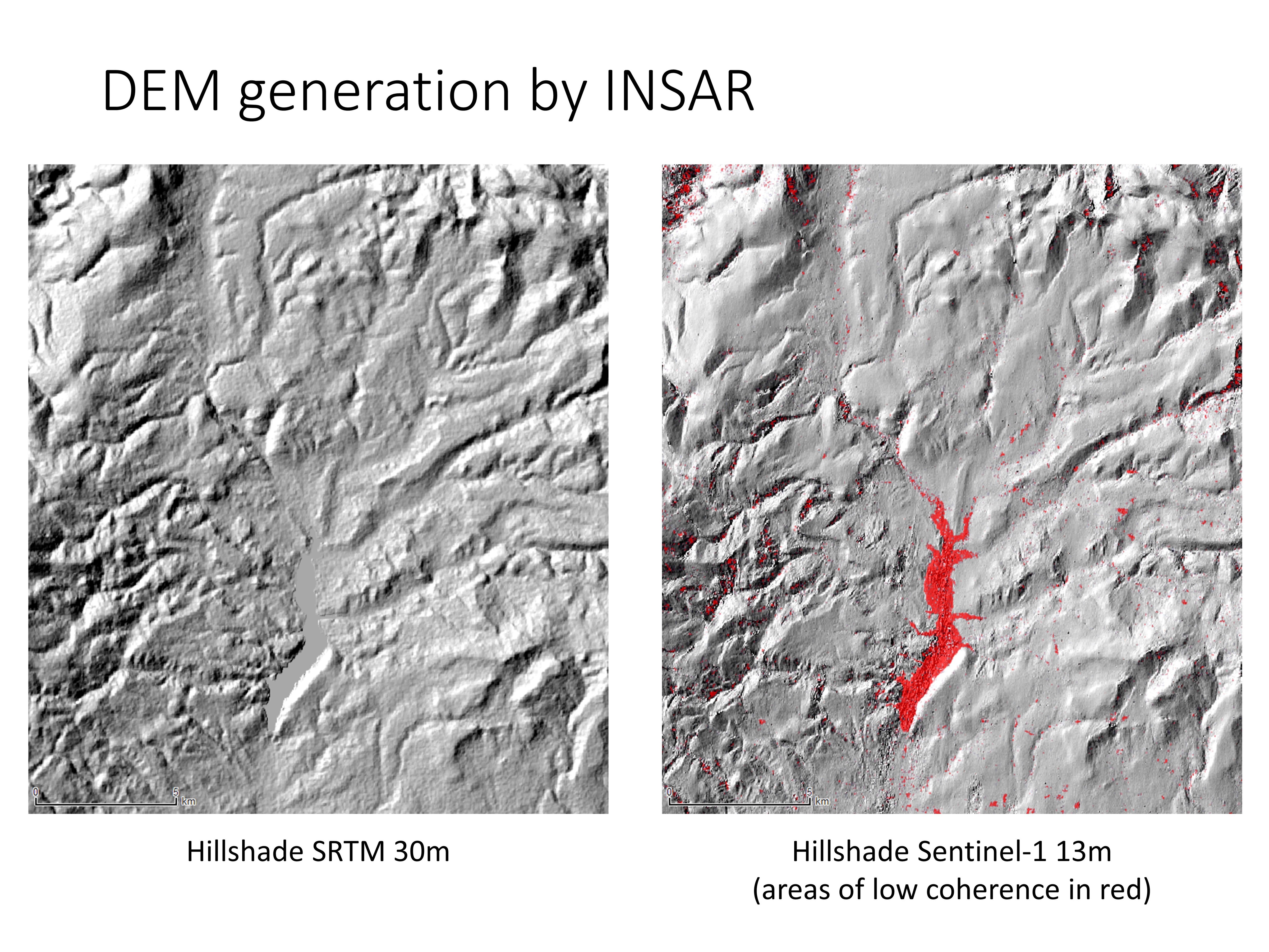
The pixel size which can be achieved is shown in the Range Doppler Terrain Correction module. To me it was about 13 meters when I tried it with your data. I’m quite impressed by the results.
Thank you for the information. May I ask which software and tool did you use to calculate the difference between created and SRTM DEMs?
Your application with the same data resulted better as far as I see. And my coherence values were a bit lower. Did you use any other filtering like Speckle Filter?
@janaya I saw that you applied Topgraphic Phase Removal step. To generate a DEM, topographic phase should not be removed.
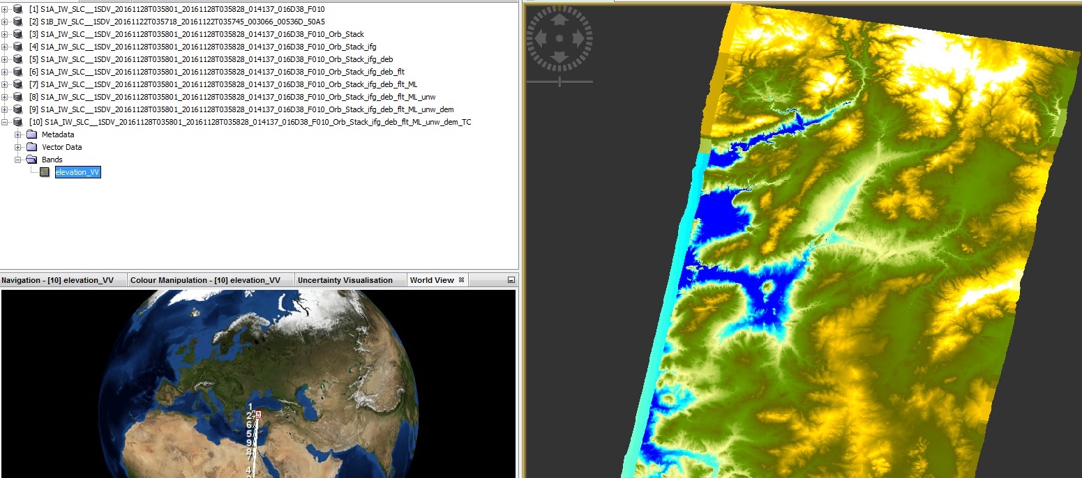
you can display the DEM by right-clicking on your SAR band and > add elevation band. It will then be downloaded and stored as an additional band. Open it to check if it is complete and has no errors and then you can use it in SNAP band math.
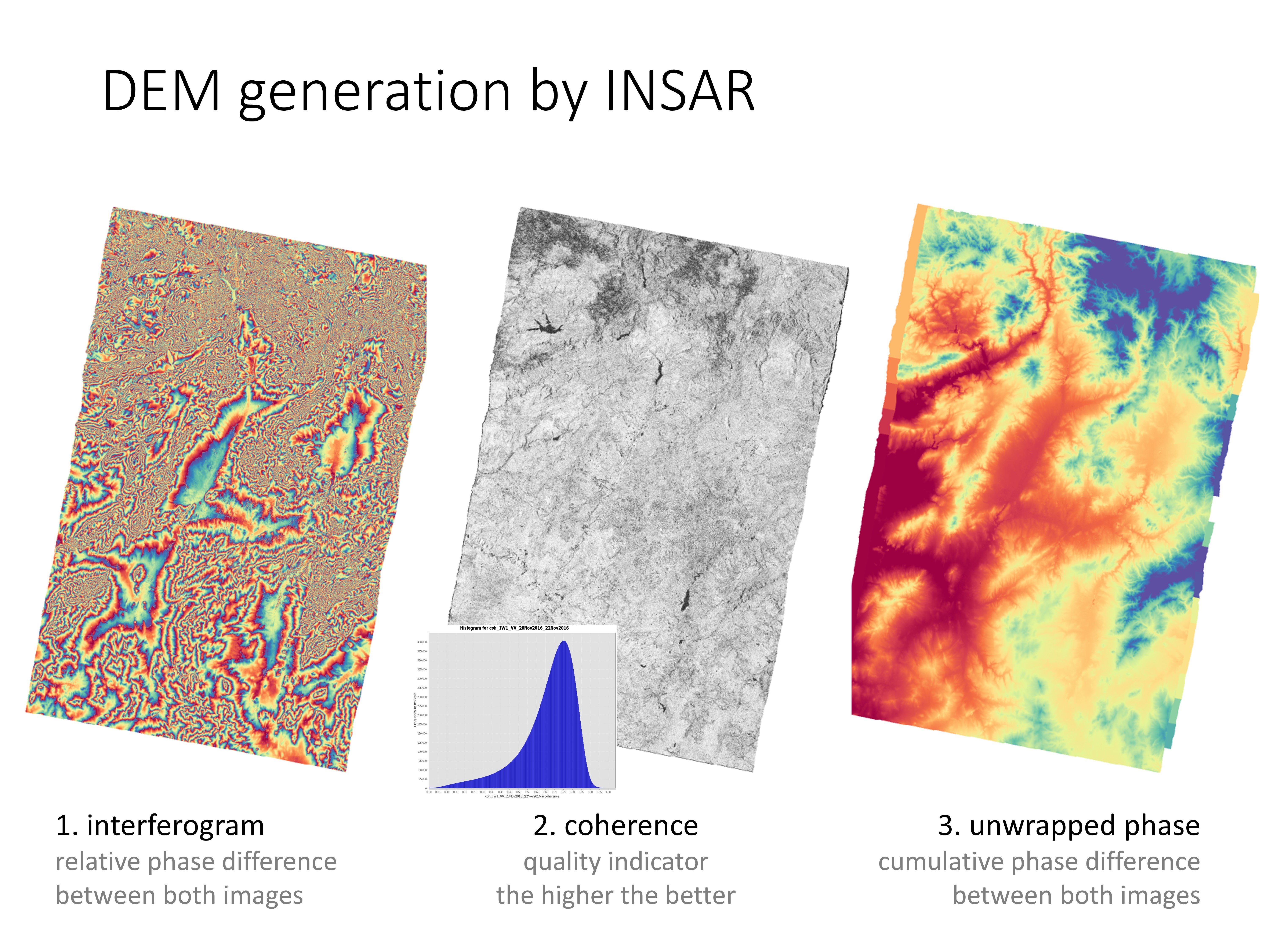
I only used Golstein Phase filtering after the generation of the interferogram.
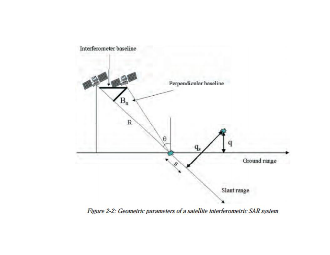
I found this from TM-19 ESA about baseline, I quote:
Once a ground reference point has been identified, the variation of the travel
path difference Δr that results in passing from the reference resolution cell to
another can be given by a simple expression (an approximation that holds for
small baselines and resolution cells that are not too far apart) that depends on
a few geometric parameters shown in Figure 2-2.
the whole forum is full of examples and workflows on how to do it. Just do a bit of research and you’ll find out.
The first post in this topic lists all required steps
If your study depends on it you should be willing to learn it instead of waiting for solutions coming to your inbox. If you have questions on specific steps, feel free to ask in here! But don’t expect others to do your research.