Continuing the discussion from Offset tracking results- Negative and Outliers:
Hello everyone,
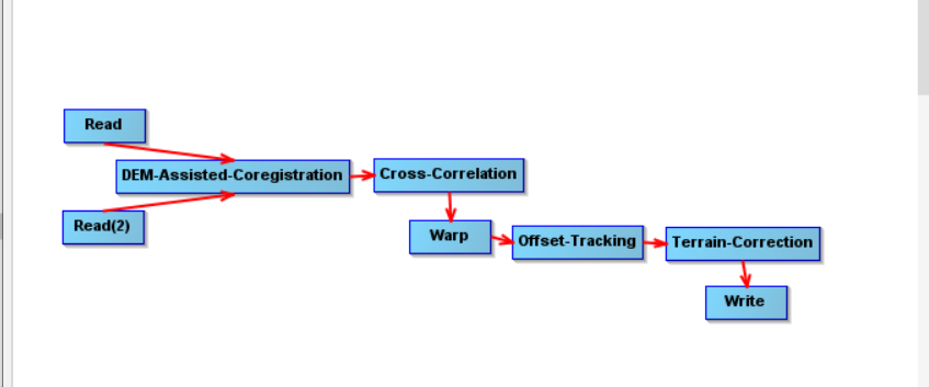
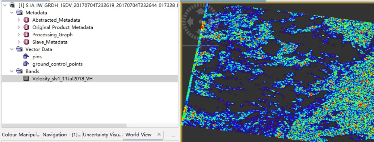
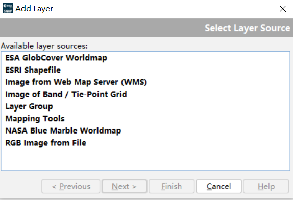
I used the offset tracking tool to explore the movement of desert dunes. The data I used was S1_IW_GRD. My processing flow is shown in the first figure, and the second figure is my processing result. So far, I don’t know what the pixels in this result represent. If it’s a vector, how can I view the direction and length? Also, I wanted to add GCPS display according to the tutorial, but there was no such option, as shown in the third figure. I’m very confused and don’t know what went wrong.
Tnank you for your reply