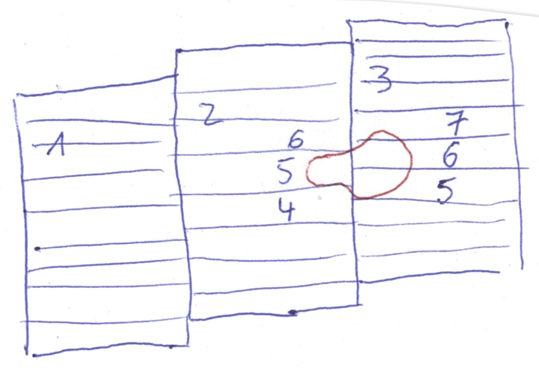
But why you don’t process the Sub swath 2 burst 5, Separately and the same to the Sub swath 3 bursts 5 and , 6 and 7 in an individual processing chains, and then create mosaic, I think this is the easiest way to skip the processing complications.
As I mentioned complete the two parallel processing’s chains until reaching the unwrapped phases of both results and convert the phase to displacement, then create the mosaic
But I didn’t see any refers in your above question that you gonna to create a DEM, Otherwise my answer would be different.
And my answer is I have no idea about your study area and this is important, also in this case to avoid the problematic issues especially in the neighbors area, I’d suggest process the sub swath 4,5,6 and their opposites sub swaths together, Finally aftermath getting your DEM, subset the area of interest you’d like to work in.
sorry, I should have pointed that out. Actually, a nice interferogram (and a coherence image) without phase jumps would be sufficient at first.
My study area is in a very arid region in Mai with low vegetation cover. So actually quite suitable conditions for interferometry.
I now debursted the full scene and made a subset. Takes longer but better handles the sub-swaths.
Thanks for your suggestions and comments, Falah!
you can open the different sub-swaths in SNAP and check visually. Or you open the kmz file in the preview folder and have a look at the area in Google Earth. But it is not geocoded very well.
I also have a region that I need to create a DEM which overlaps swaths IW1 & IW2.
Furthermore, I also wish to process only the subswaths of each swath that contains my ROI
I have read the posts above, however I am still confused on the process.
Could you please check my workflow:
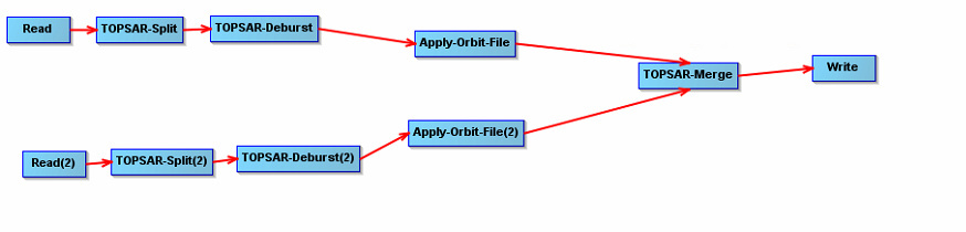
For IW1 and IW2:
(1) Coregistration (TOPSAR split + apply orbit file)
(2) Interferogram formation
(3) Deburst
Once steps (1) to (3) have been completed for IW1 and IW2 then:
(4) TOPS merge?
Sorry, I’m not experienced with analysis of two swaps and am not sure ar which step the merge should occur ar best.
I would test it directly after the TOPS coregistration step. What happens when you apply Merge after debursting as you suggested.
Just a remark on DEM generation. The results are often very bad compared to freely available DEMs like SRTM or AW3D30, despite of the higher spatial resolution, because of temporal decorrelation over vegetation and atmospheric artefacts.
Use image pairs with a temporal baseline as short aa possible and a perpendicular baseline larger than 100 meters. Also, avoid data from rainy days.
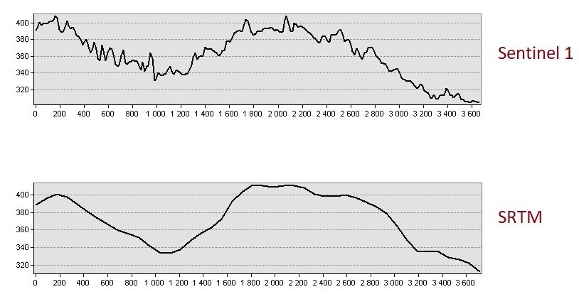
not bad! You already did anything to create a good DEM (baselines, data…), there is no bad trend in your data and the overall elevations seem very reasonable. I just gave these hints because many people expect any SAR data pair to produce flawless DEMs without knowing about the error sources.
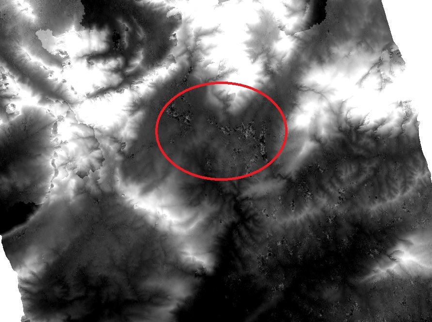
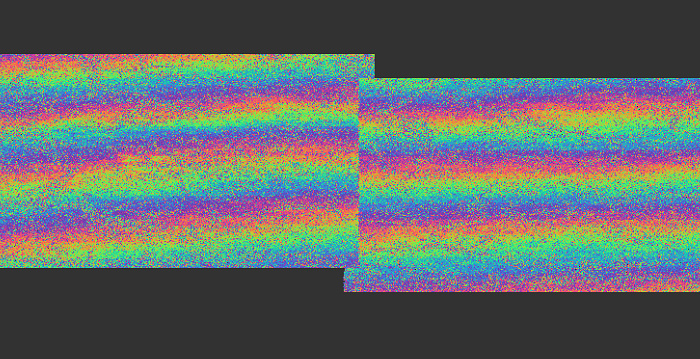
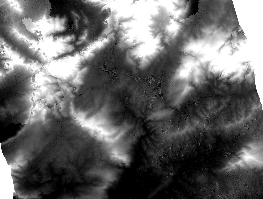
I see a few unwrapping errors in the middle left. Maybe you can try unwrapping again with SMOOTH instead of TOPO but I can’t promise that this will solve them. But you can simply copy the exported folder, change the snaphu.conf file directly (open it with a text editor) and run it again.
For a Sentinel-1 DEM this is fine I would say, most others I have seen are way worse. Another successful example: The Order of DEM Creating Steps
Thank you @ABraun! All your help is much appreciated I will try unwrap export with Smooth.
One last question, please. How does one visually identify unwrapping errors?
Also could please let me know if you are referring to the region within the red circle (below). It is a reservoir:
 I will try unwrap export with Smooth.