Dear all, I’ve encountered a problem while unwrapping an interferogram using snaphu. My processing chain was as follows: S1 TOPS Coregistration -> Interferogram Formulation -> TOPS Deburst -> Multilooking -> GoldStein Phase Filtering -> snaphu export, snaphu unwrap (overlap set to 200), and snaphu import.
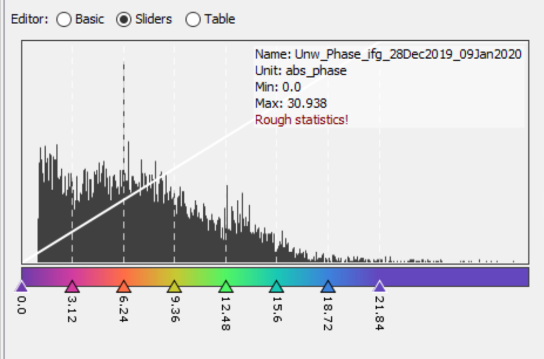
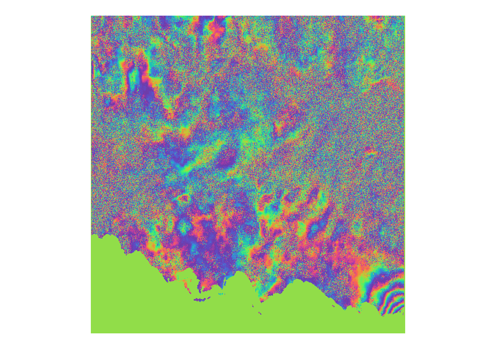
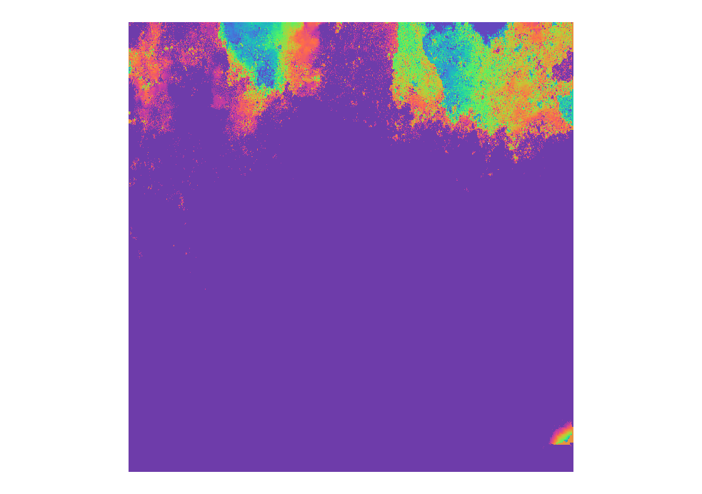
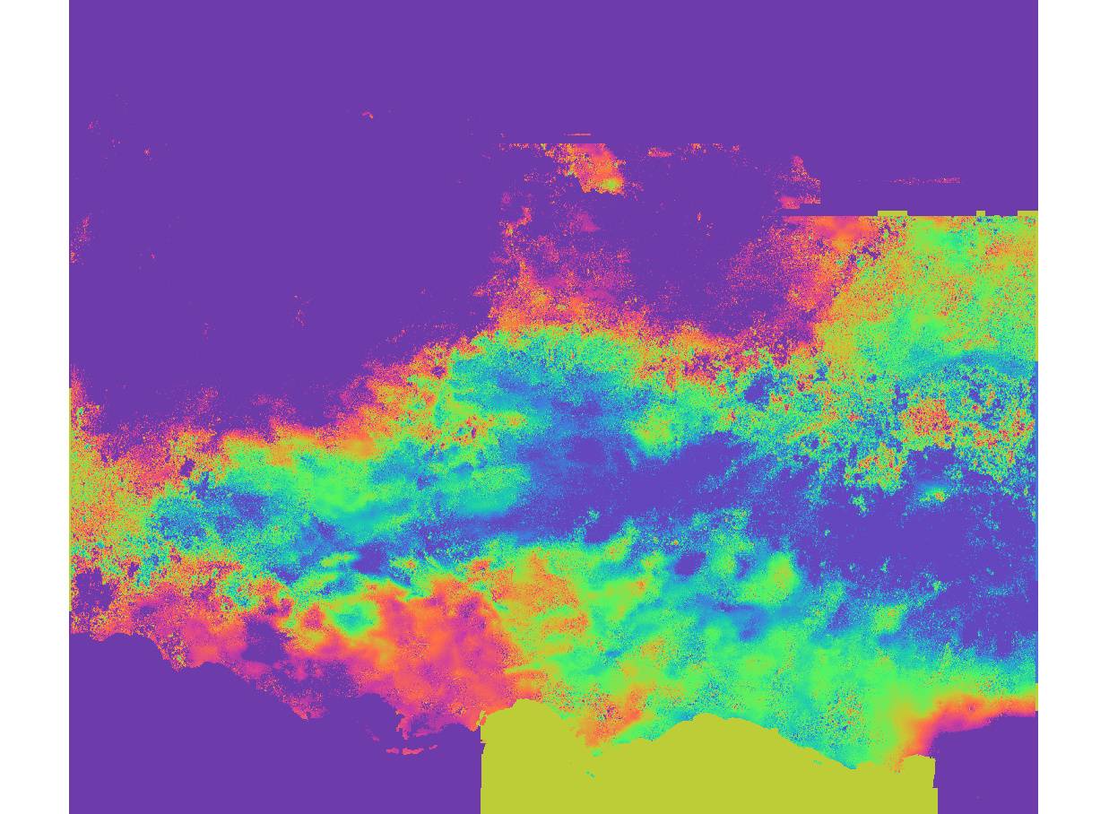
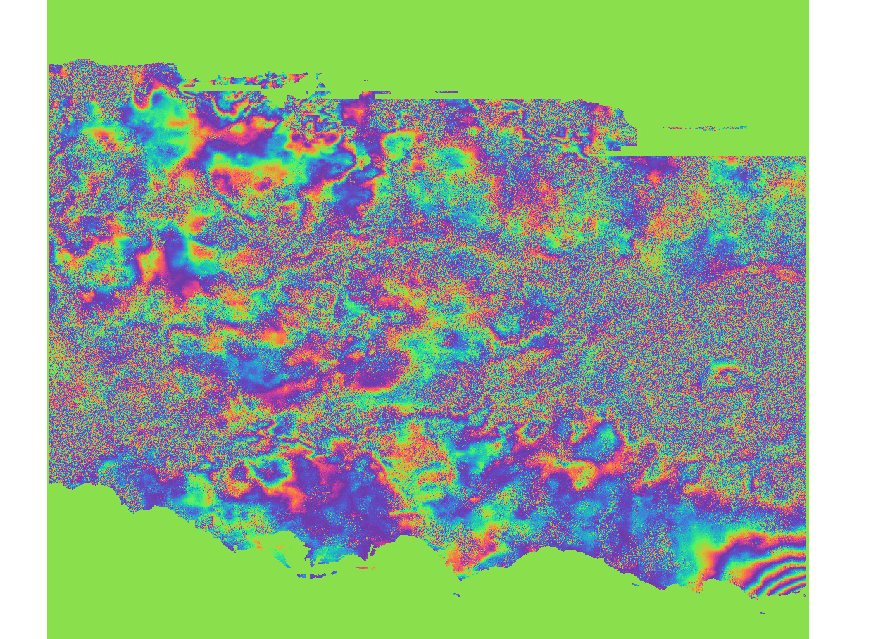
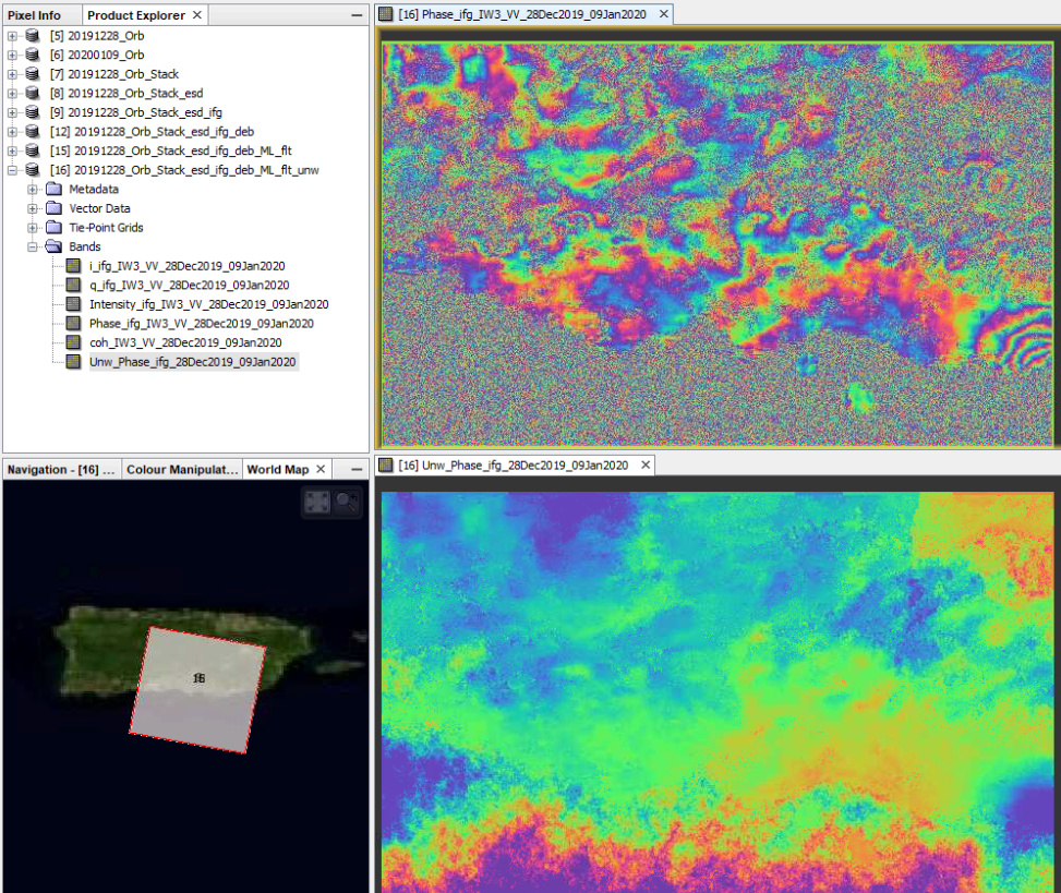
The entire process ran without any errors or problems until I imported the unwrapped interferogram. It appears most of the data has been eliminated. I’ve posted images of the wrapped and unwrapped interferogram for comparison, as well as a histogram and a profile of the unwrapped interferogram.
Any ideas about what could be causing this? Thank you in advance for your help
My input image IDs are as follows:
S1A_IW_SLC__1SDV_20191228T101434_20191228T101501_030547_037FA1_1EF1
S1A_IW_SLC__1SDV_20200109T101433_20200109T101500_030722_0385AE_B3A1
Intuitively, I would test if “SMOOTH” results in better unwrapping (instad of TOPO or DEFO) and also check if the progress wrks better
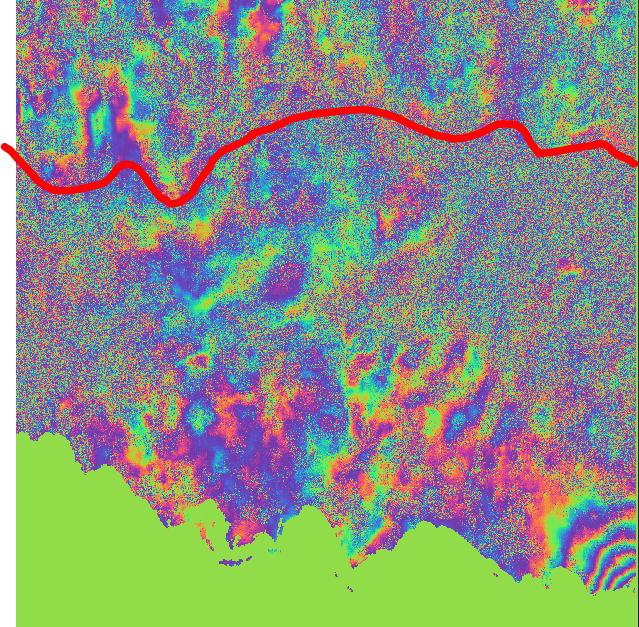
Maybe the water areas in the bottom are also a source of error. You might want to try with this proposed method on masking decorrelated areas: Is it the right way to create mask for phase unwrapping?
Thank you for the quick response and help. I used a 10x10 tiling scheme. I’ll rerun a few different tiling schemes and also try “SMOOTH” when exporting to snaphu. Also thank you for the link, I’ll try that as well. Kind regards
I exported to snaphu using “smooth” at 10x10, 20x20, and 50x50 tiling schemes. Much more of the island was processed but there’s still quite a few issues including a new artifact generated in the bottom/center and the earthquake epicenter being stripped out (fringes in lower right hand corner of wrapped phase image).
I’ve read through ESA’s and ADF’s respective TOPS INSAR tutorials as well as the Stanford SNAPHU manual and I don’t see any details on the snaphu export parameters such as when to use MCF vs MST, SMOOTH vs DEFO vs TOPO, and number of tiles and amount of row/column overlap, for example. Same with the tile cost threshold. Are there times where certain parameter selections are more appropriate? Is there an ideal number of tiles to use?
Dear Andreas, thank you for your reply. I have not tried to run it unchecked so I will do that next. I also realized I was processing all 9 bursts in the IW3 swath so I’m going to rerun the whole process with reduced bursts when splitting. Thank you for your help.
I reran the entire processing chain, this time with only four bursts selected and leaving the DEM masking unchecked. The unwrapped interferogram looks great! Now I can generate my first displacement product. Thank you again for all of the help. Out of curiosity, which DEM do you find is best to use for the co-registration process and topographic phase removal? I had been using the default but on my 2nd run through I used the 1 arc second SRTM and noticed my co-registration results were greatly improved when I displayed them as RGB.
Thank you Sir, I reran the process removing tropographic phase this time and am generating the displacement now. Is there a difference between the 1 arc second SRTM Gridded vs 1 arc second SRTM (HGT)?
I’ve seen lots of references in the STEP Forum for free SAR educational material here: https://saredu.dlr.de/ but most or even all of the resources seem to be missing. Would you happen to know if there’s an updated website?