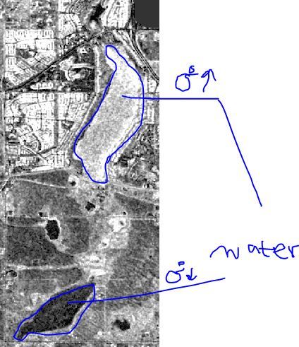
I have a hard time to define an appropriate water mask threshold where one water body looks too bright while others look too dark. This doesn’t allow me to give a low sigma0 range to the water bodies as usual. If I go with the brighter water mask threshold, several urban areas are misclassified as water.
The white color is water. its a man-made maintained water body. The other ones are natural.
I have already followed those steps with a little bit difference:
Radarsat2-SLC>> Range Doppler TC (calibration included to sigma0) >> Texture Analysis >> (for one area on linear sigma0, and for another area on sigma db) Water Thresholding by bandmath >> Filter by Arithmetic Mean