I’m resampling Sentinel Level 2A product bands using SNAP into geotiff format. As an example, I get B2 band values ranging ~0-20.000 but in the original product when I get the information from SNAP, I see reflectance values with smaller range boundaries.
I’m trying to understand what SNAP actually output and what is the default range of pixel values.
Sentinel-2 data is stored as Integer, but SNAP rescales them to values between 0-1 by dividing them by 10000. This is the quantification value and you find it in the metadata. Outside SNAP you have to apply it yourself.
Thanks @ABraun, I have seen the first URL already but I was thinking it only applies to the products that’s explained in the screenshots but not to Level 2A. Is it same for the level2A?
In addition to that, I still didn’t get why I get upper boundary around 20.000 while quantification value is 10.000 and SNAP rescale the values between 0-1. What I need is the upper and lower integer boundaries. Is it logical if I say the interval is 0-20.000 without re-scaling? Or in other words, the highest value that I can get is 20.000 without re-scale?
I don’t know why there is 20.000 in your case but the correction can have erros too and for clouds or metal surfaces the reflectance can exceed 1 (100%) as well, even it is not logical.
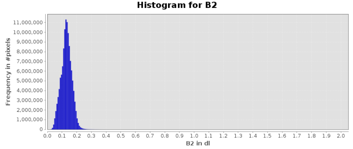
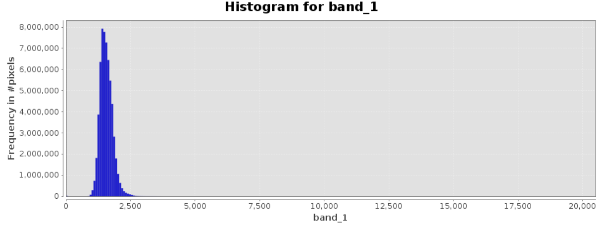
Below are the histograms from raw B2 band and it clipped and resampled version to geotif. Majority of the values relies around 0-1 (0-10.000 in the tif version). I guess the rest of the few values right to the 10.000 are the ones that have errors.