Dear Helper,
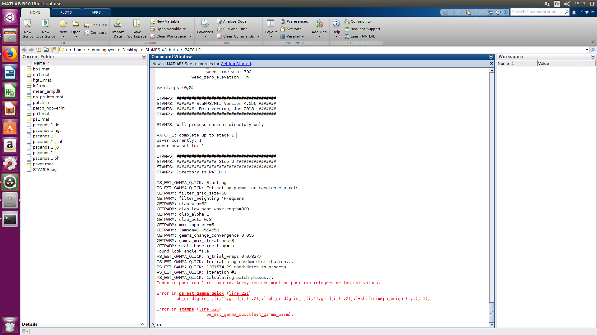
I am duoc nguyen, I have some problems when run step 2 (stamps) in matlab like figure.
Can you help me reslove and explain this problem.
Thank you so much.
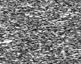
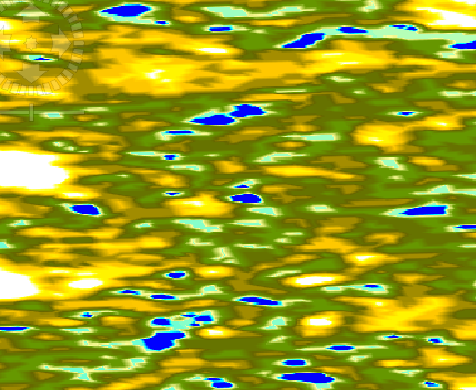
**After i execute the interferogram formation.**I got an unexpected result.The first picture is the cohenrence,and the second is the elevation.was I wrong.If that,please point that where was wrong.I got no idea. need help.thanks before.
yeah.you were right.the ROI with low coherence ,and much wet .but before i made a experience .I have
ten images,i only picked the last four images to coregistration and then picked master between this four images and done interferogram formation ,the phase of result could see fringles ,but this time they were going away.don’t know why.(note that this time i picked master using all ten images).Good
night!See you tomorrow.
it is important to keep the temporal baseline short and avoid images from the rainy season. So, different pairs can lead to distinctively different InSAR patterns.
@katherine,
Dear katherine, thank you for you processing,
When I run stamps in Matlab, I have some problem on Step 2.
Can you helop me solve this problem?
Thank you so much,
Thaks a lot for mentioning me, I came back aftermath almost half and one year of interrupting, I was engaging in Finnish language and getting the Finnish nationality, all this stuff has been done by hard working. Now I’m speaking Finnish as well as, I collected some money during the last period to buy my new laptop Dell, I’m working again, and I’m happy to help, in the same time I’m looking for a new position.
My best wishes to all community of STEP FORUM, and to the people behind the scene,
Hi ABraun, I have read your answer from some of the issue above that very helpful for me thank you so much,
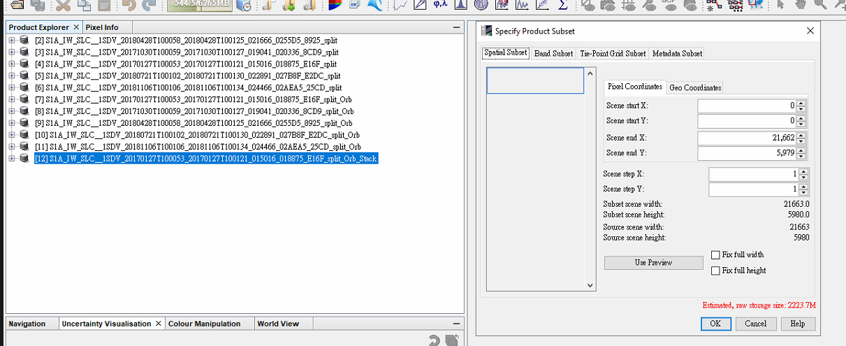
I have a question for the Snap processing, after I Back-Geocoding create stack–> I go to subset but I can not see anything in the subset area tool ??
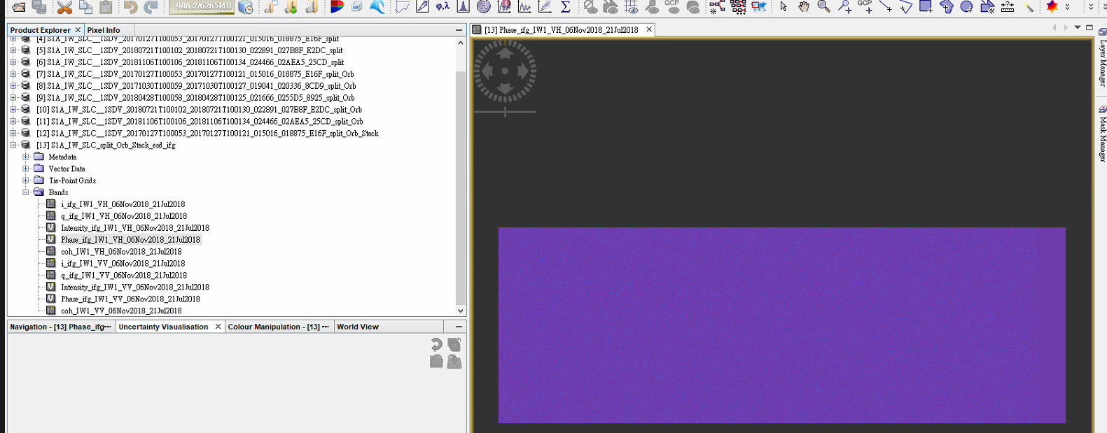
also I have that the same problem when I processing image in computing Interferogram I can not see the phase in the image (the phase show nothing)
Could you help me explain that thank you so much
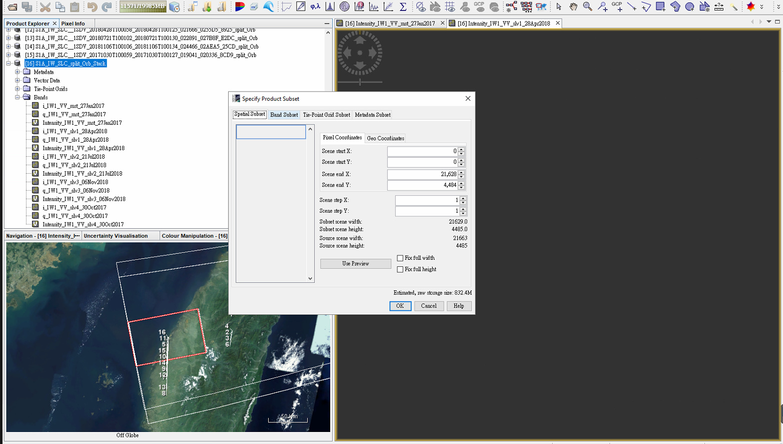
I use five images with 1 master and 4 slave images
your first screenshot indicates that the file is too large for SNAP to produce a quick overview. But as shown in the second, the data is not correct as well.
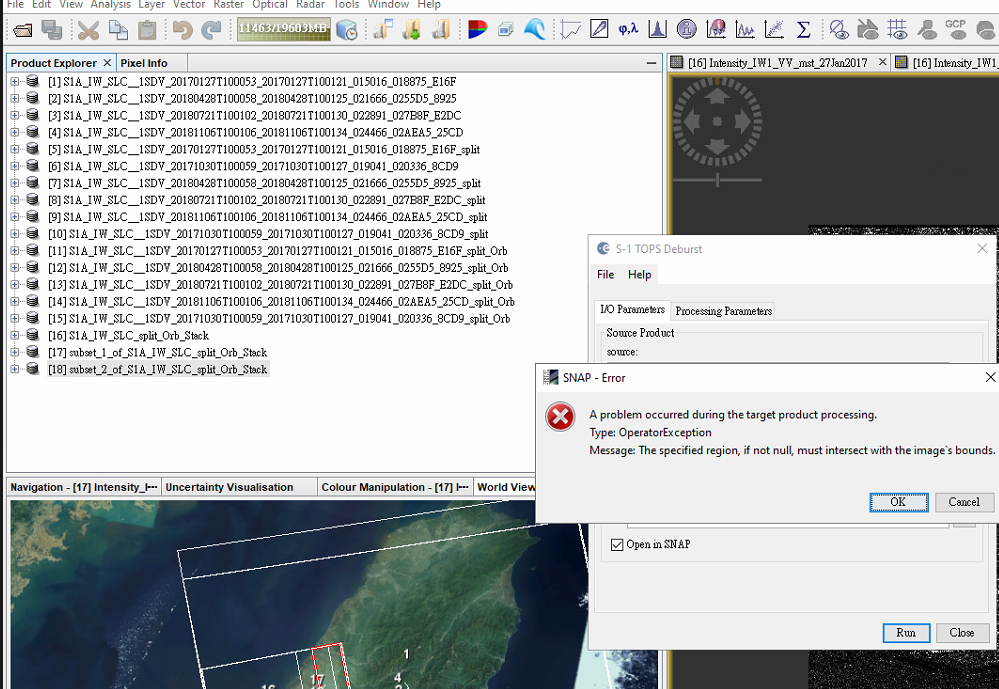
Please go through all input files (_split_Orb) and visually check if all contain correct data.
As for the stacking, I recommend to only use VV because VH doesn’t bring you any benefit regarding phase information (I made an example here: Effect of polarization on interferometric products). Furthermore, it reduces the file size of your stack by 50% and for InSAR you can use only one polarization anyways.
Finally, you can create an RGB composite after back geocoding using intensities of different dates to see if all were included correctly.
Hi ABraun, It’s me again after I try to reduces the file size there is still that problem and also when I click to Intensity of Slave image that will not show anything could you explain that again
second you have mentioned visually check all contain data ?? How could I check that in my data thank you so much for your time
the left side I open Intensity of slave image and al there is viewing map of my raw satellite image:
If I try to subset image without quick overview there is error but I don’t know exactly what that imply ?

 .
.
 as well as, I collected some money during the last period to buy my new laptop Dell, I’m working again, and I’m happy to help, in the same time I’m looking for a new position.