Good evening. Please tell me, I’m trying to export to PS. But my workflow has been going on for several days and it shows 8% all the time.
My computer has 32gb of ram and I’m running on an SSD. I tried to run it again, but again 8% and it’s been like this for a week and it doesn’t show any errors. I would be very grateful for your advice.
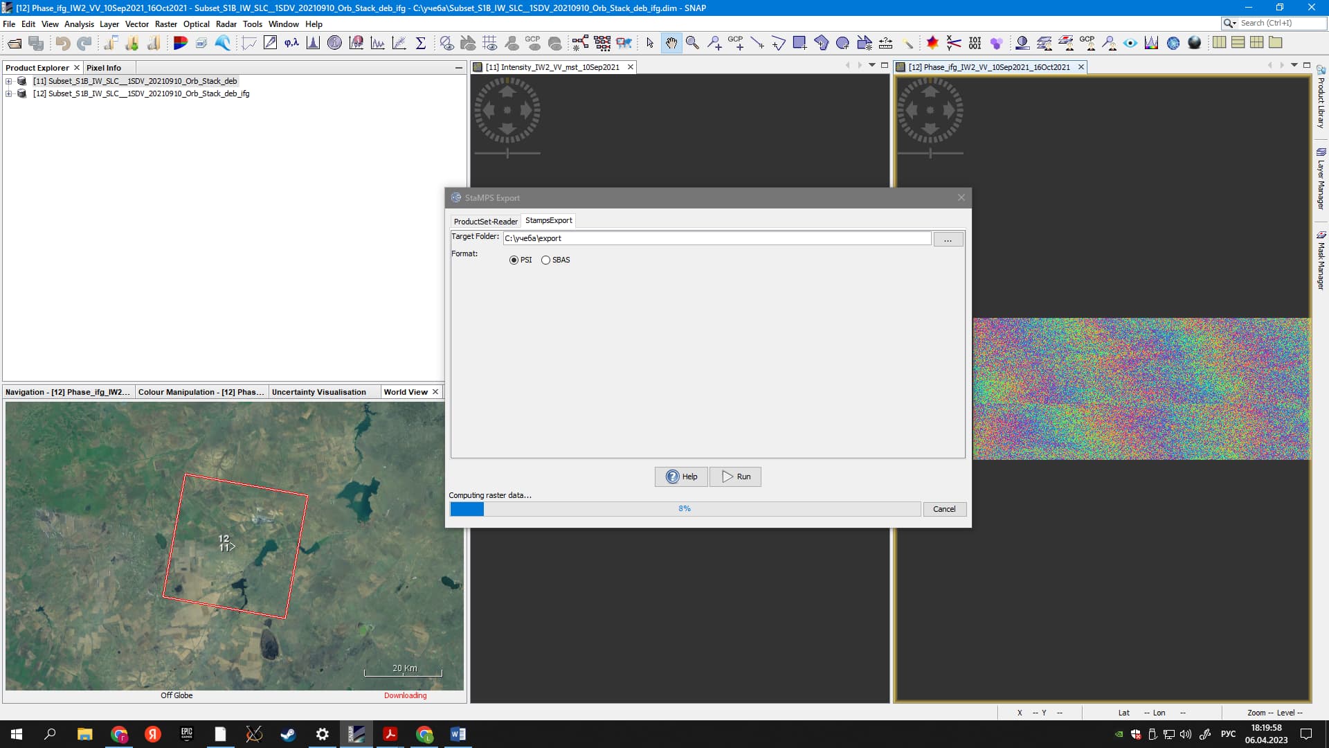
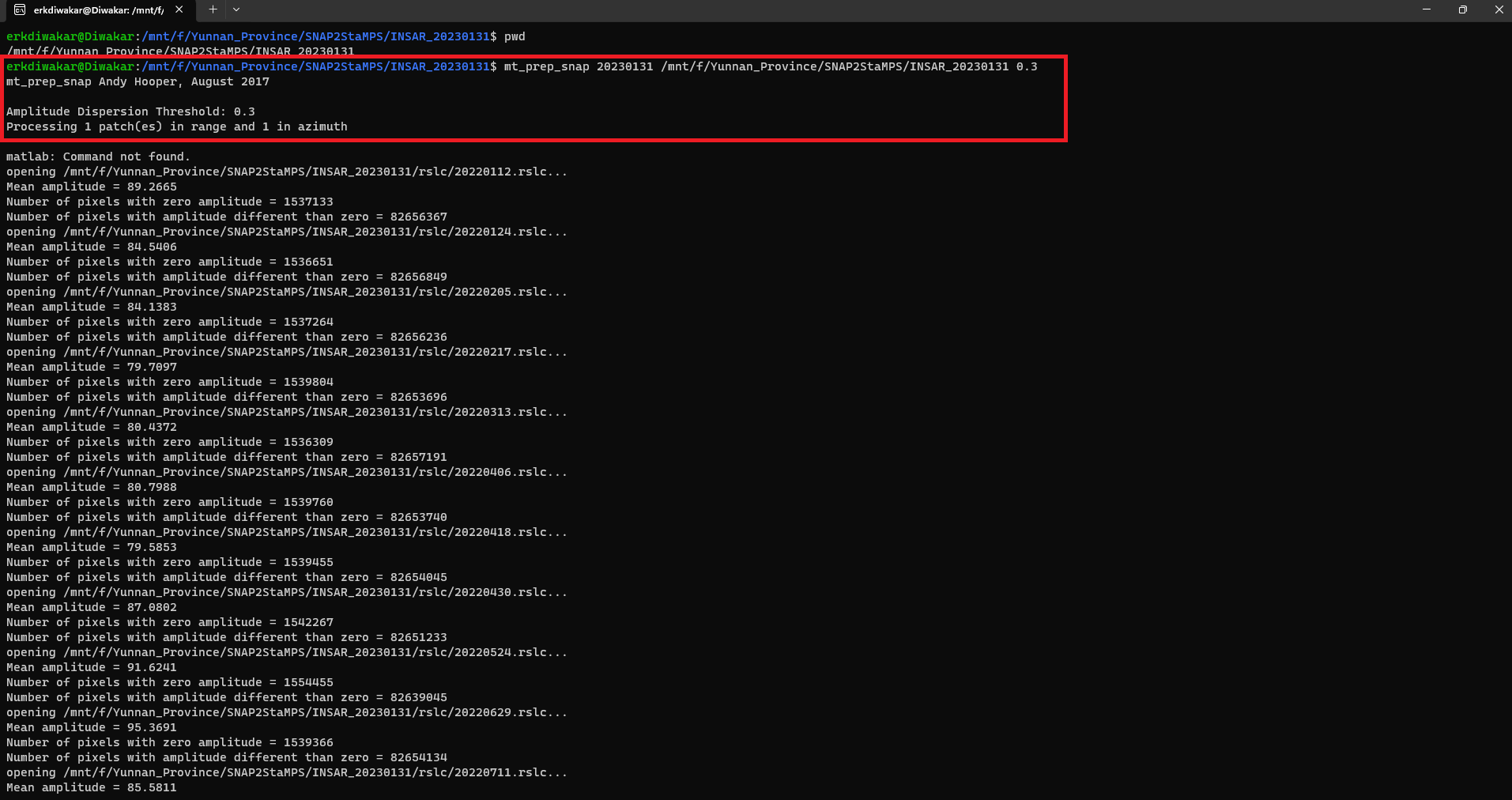
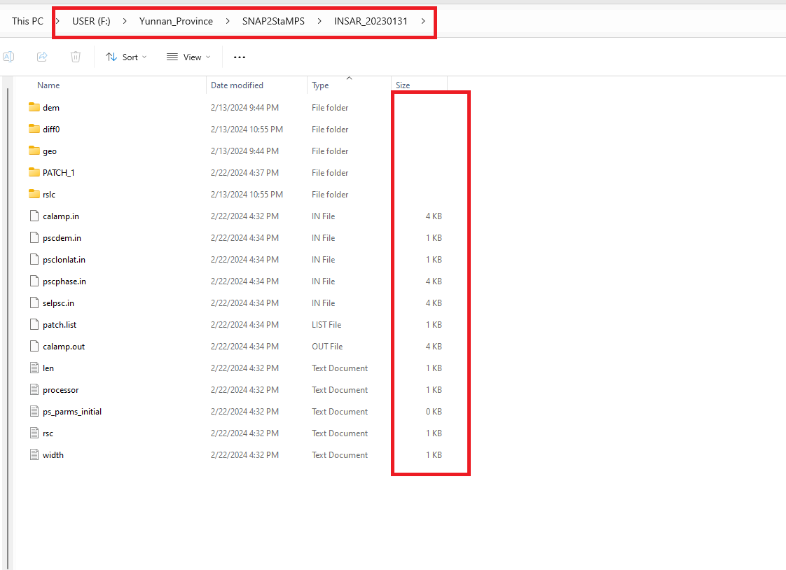
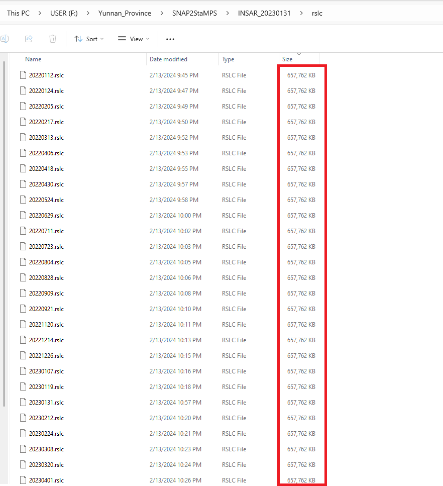
I tried to make Psinsar using the snap2Stemp workflow. Following the steps mentioned in the manual, I got to the StaMPS export step, and as a result, a project folder contains the final output structure in four folders: rslc, diff0, geo, and dem.
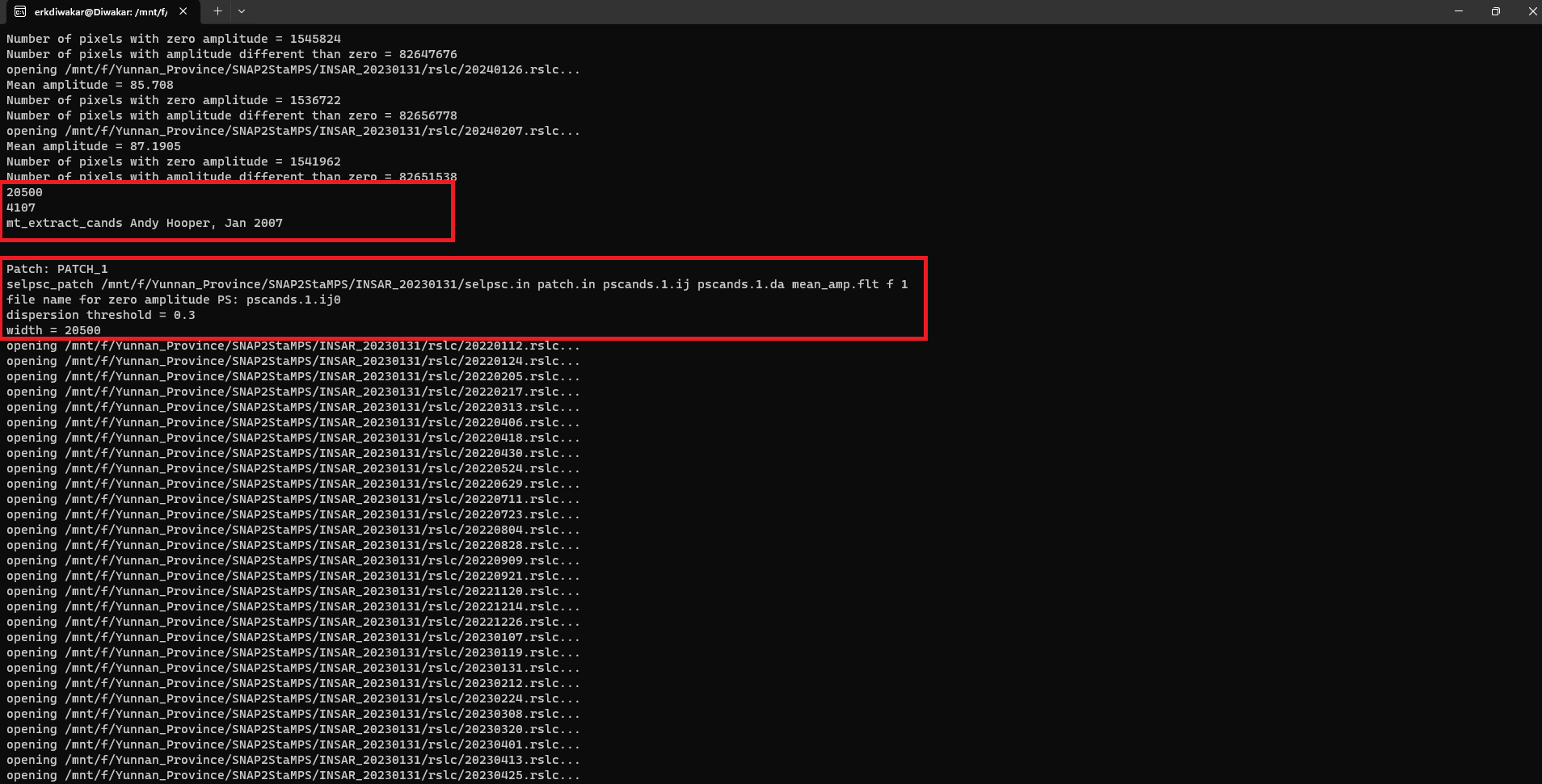
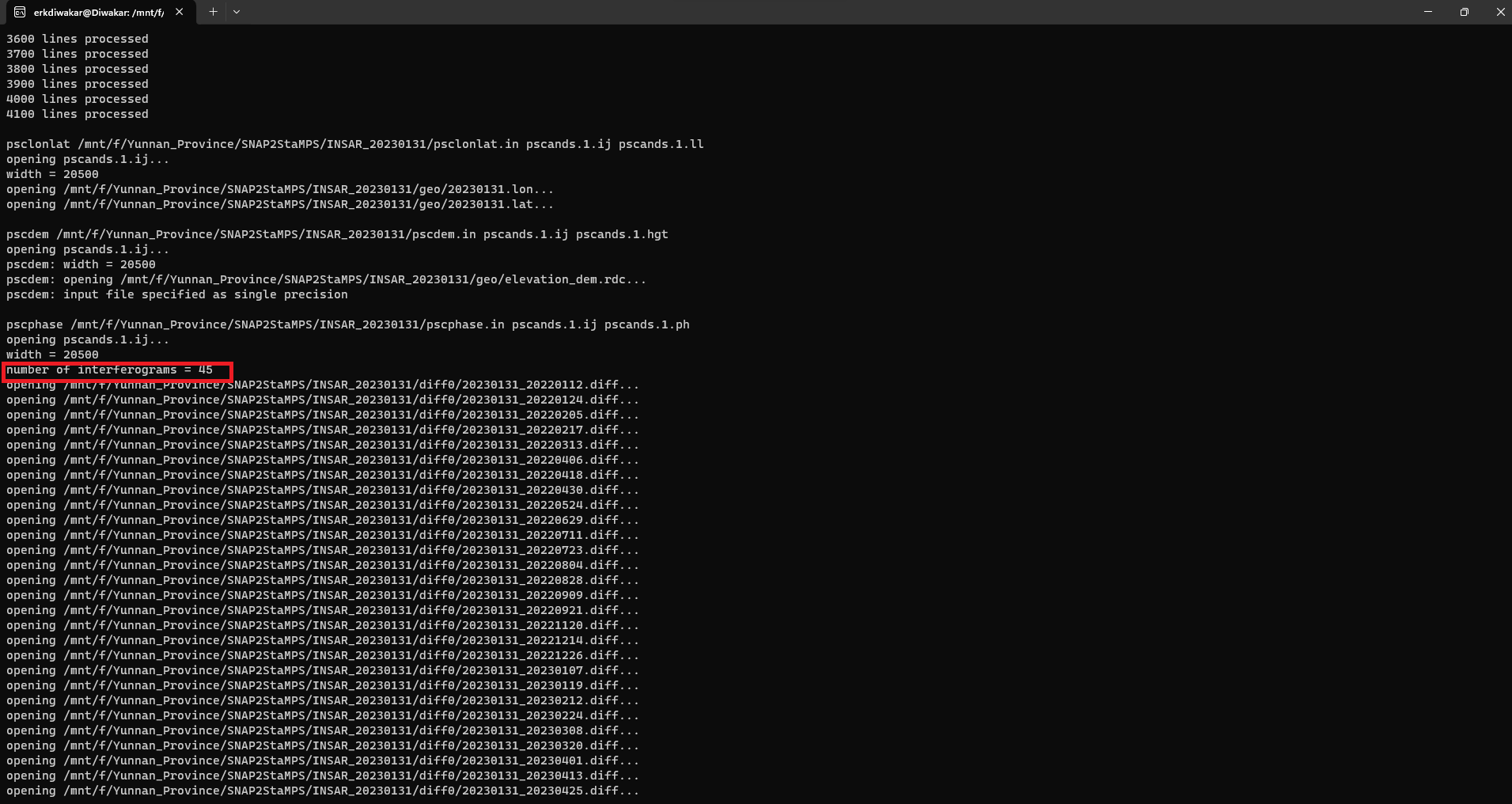
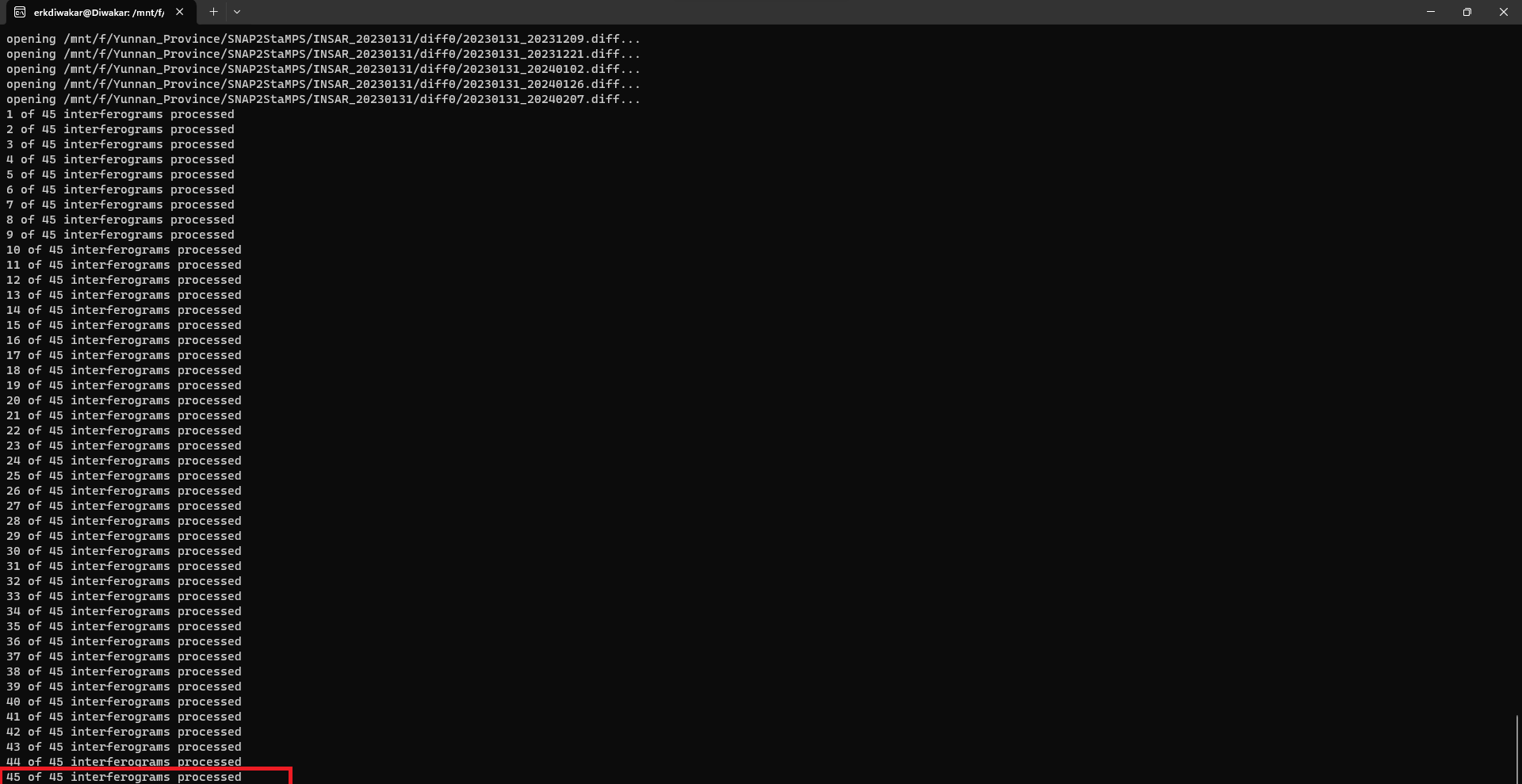
Later, I installed Stamps, in order to run mt_prep_snap.
I know that I have to make some modifications to the configuration.
My question is: which lines should I modify within StaMPS.CONFIG.bash?
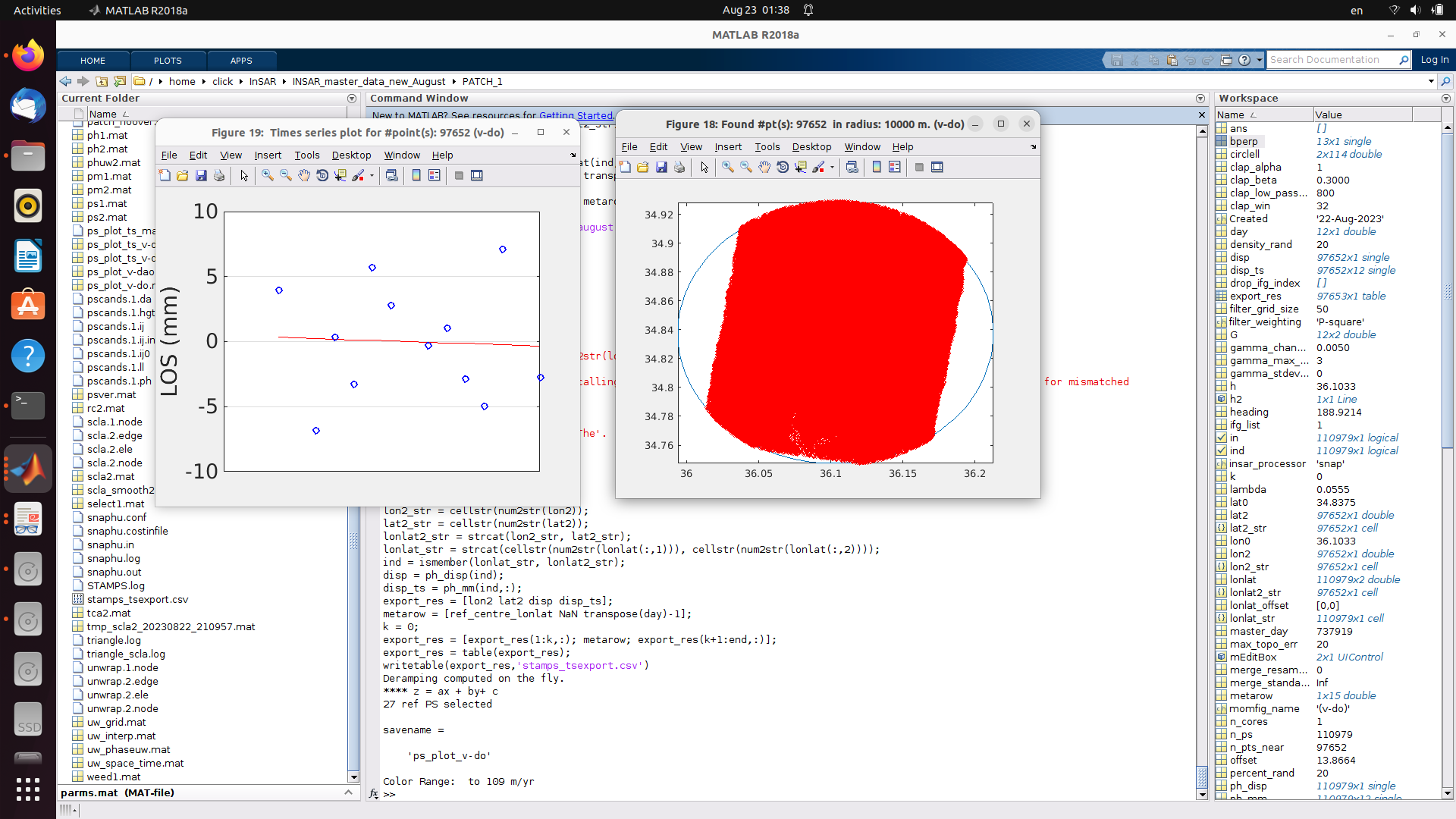
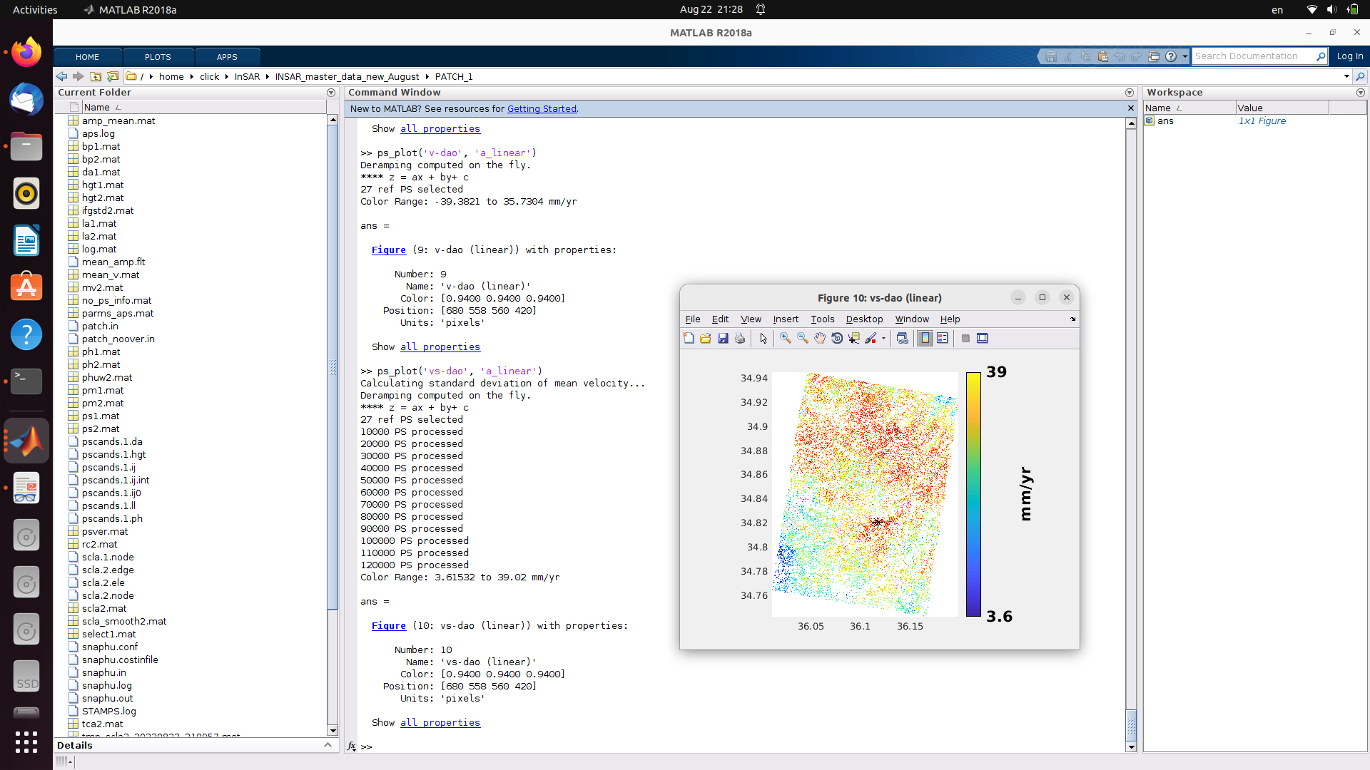
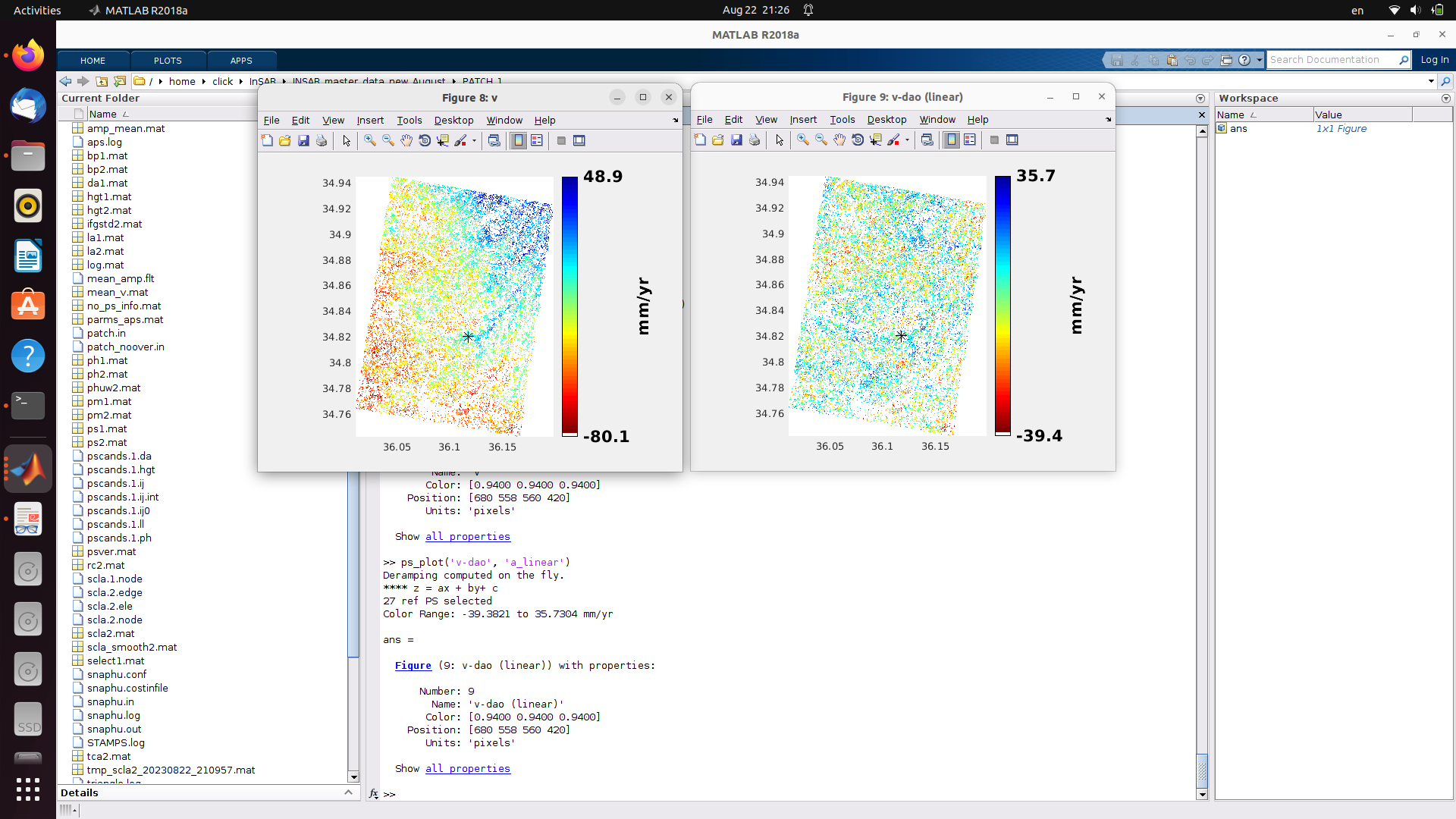
Hello, I have 12 interferograms from February 14, 2020 until July 31, 2020. I applied all the steps in stamps and got the results, but I want your help in evaluating the results of the processing in. Do I have any errors? Do the results look logical because I want to export the results to gis and calculate the vertical displacements in my area? Please help me. Evaluate my results before continuing to analyze them in gis
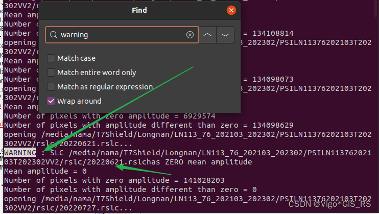
I have successfully resolved a similar problem. I followed the instructions on blog csdn net website
The main point is that because an image is not perfect, we just need to delete it from the list that we want to process or replace it with a new image.
How to check it at the terminal prompt after running mt_prep_snap, type in the search tab “warning”. Check the image date and you can change or replace it. Then repeat the process of backgeocoding, deburst, interferogram formation, export StamPS after replacing the imperfect image.
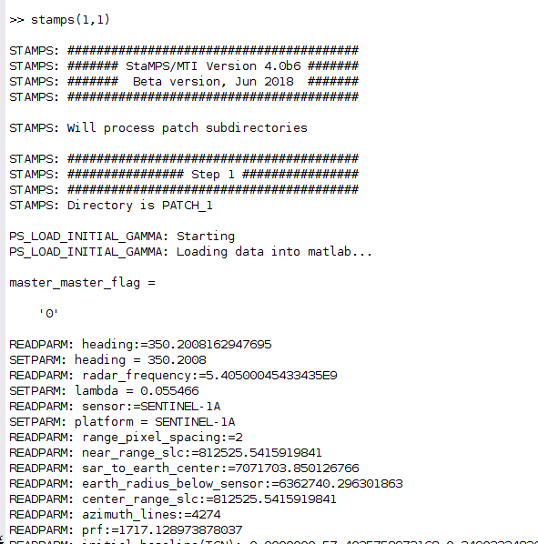
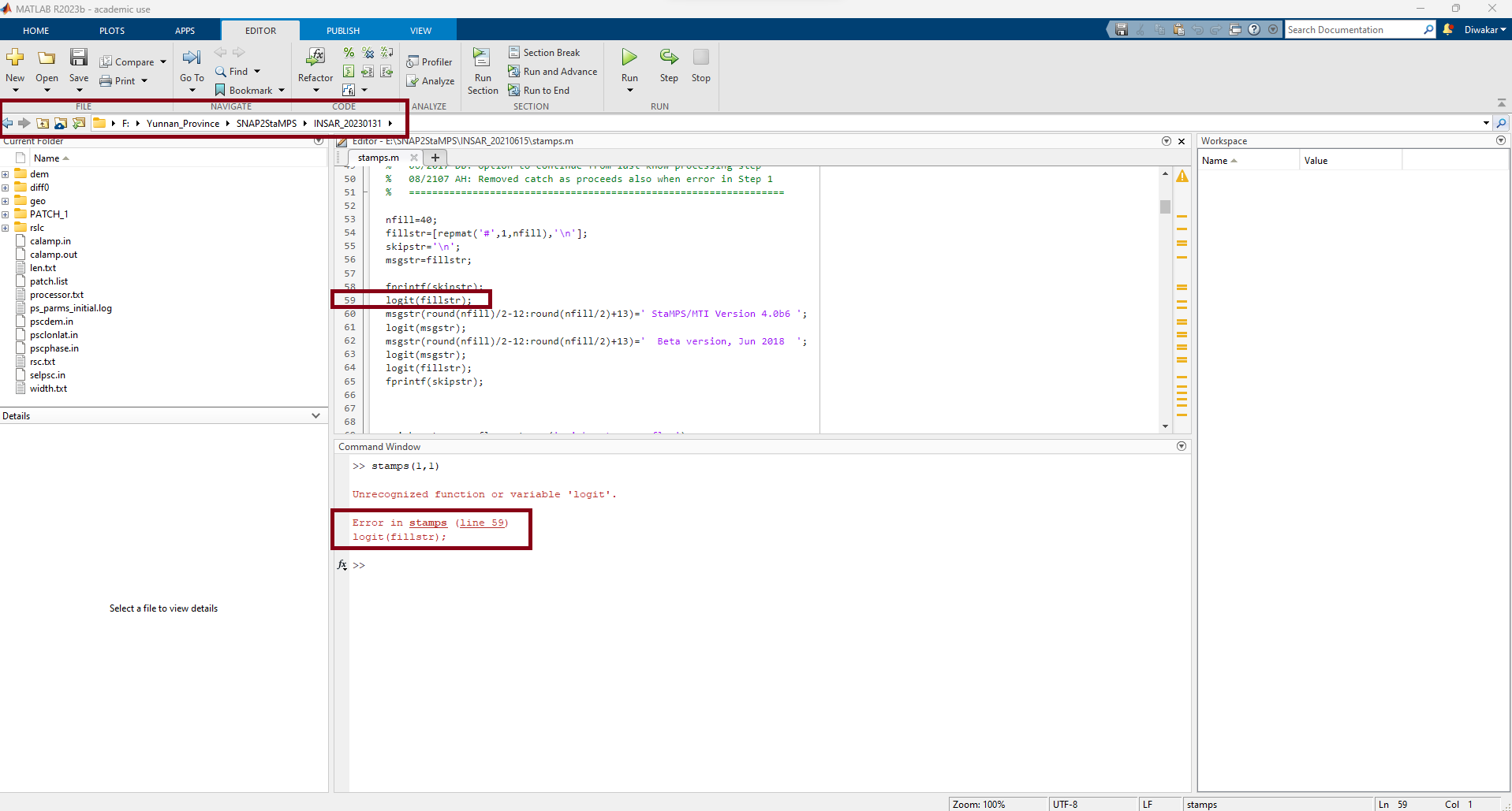
@ABraun@mdelgado: Dear Sir, I have been working on some research project using PS-InSAR for few months now. When i started working on one of my research work and followed all the steps for Data Preparation using SNAP2StaMPS and started to proceed with StaMPS using MATLAB. For the first time i find some error which is unique to me. I tried to find the solution of this problem for one week now but its just killing my time. I have worked with PS-InSAR in some other research work as well and i have some results before. But, i am stuck in stamps(1,1). The error is as follow. Please can one help me to get rid of this problem. It would be so greatful to receive your feedback and suggestion on the error below.
logit function :
The logit function is a function included in the StaMPS matlab folder, so it makes me think that you may need to add the stamps path in matlab PATH environment
Does anyone have experience using the latest SNAP 10.0 version in the Snap2STaMPS processing? The results are fine until the mt_prep_snap command, which fails. The reason is @badly formed number.
I noticed that when using the commands splitting_slaves.py, coreg_ifg_topsar.py and stamps_export.py the same message is received which reads: "SNAP STDOUT:b’WARNING: An illegal reflective access operation has occurred\r\nWARNING: Illegal reflective access by org. esa.snap.runtime.Engine (file:/C:/Program%20Files/snap/snap/modules/ext/org.esa.snap.snap-core/org-esa-snap/snap-runtime.jar) to method java.lang.ClassLoader.initializePath(java.lang.String)\r\nWARNING: Please consider reporting this to the maintainers of org.esa.snap.runtime.Engine\r\nWARNING: Use --illegal-access=warn to enable warnings of further illegal reflective access operations\r\nWARNING: All illegal access operations will be denied in a future release\r\nWARNING: org.esa.snap.core.util.ServiceLoader: org.esa.snap.core.gpf .OperatorSpi: Provider eu.esa.opt.meris.sdr.aerosol.AerosolMergerOp$Spi not found\r\nWARNING: org.esa.snap.core.util.ServiceLoader: org.esa.snap.core.gpf.OperatorSpi: Provider eu.esa.opt.meris.sdr.aerosol.ModisAerosolOp$Spi not found\r\nINFO: org.esa.snap.core.gpf.operators.tooladapter.ToolAdapterIO: Initializing external tool adapters\r\nINFO: org. esa.snap.core.util.EngineVersionCheckActivator: Please check regularly for new updates for the best SNAP experience.\r\nExecuting processing graph\r\n…10%…20%…30% …40%…50%…60%…70%…80%…90% done.\r\n’
Indeed, interferograms are successfully created using SNAP 10. The issue arises with the mt_prep_snap function, displaying the error message: “Badly formed number.” I don’t have coding expertise, but I suspect the problem lies with the interferograms, as there are no issues when using SNAP 9.
However, the SNAP 9 version usually does not display the third sub - swath (IW3) on the newer images from October 2023 onwards, and my AOI is located precisely in that band.
But since SNAP 10 is not fully operational yet, I will wait for its testing to be completed.
what you can do to allow SNAP9 recognise the IW3 is to unzip the S1 image and zip it again…or to unzip it and let snap2stamps find the SAFE folder instead of the zip file.
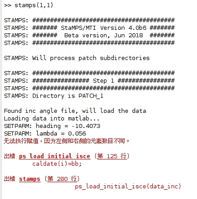
Hello everyone, I’m using isce-stamps for ps processing. I encountered the following problem at stamps (1,1). Could you please tell me how to solve it.The following is the output
STAMPS: Directory is PATCH1
Found inc angle file, will load the data
Loading data into matlab…
SETPARM:heading =10.4073
SETPARM:lambda=0.056
无法执行赋值,因为左侧和右侧的元索数目不同
出错 ps_load_initial_isce(第 125 行)
caldate(i)=bb;
出错stamps(第 280 行)
ps_load_initial_isce(data_inc)