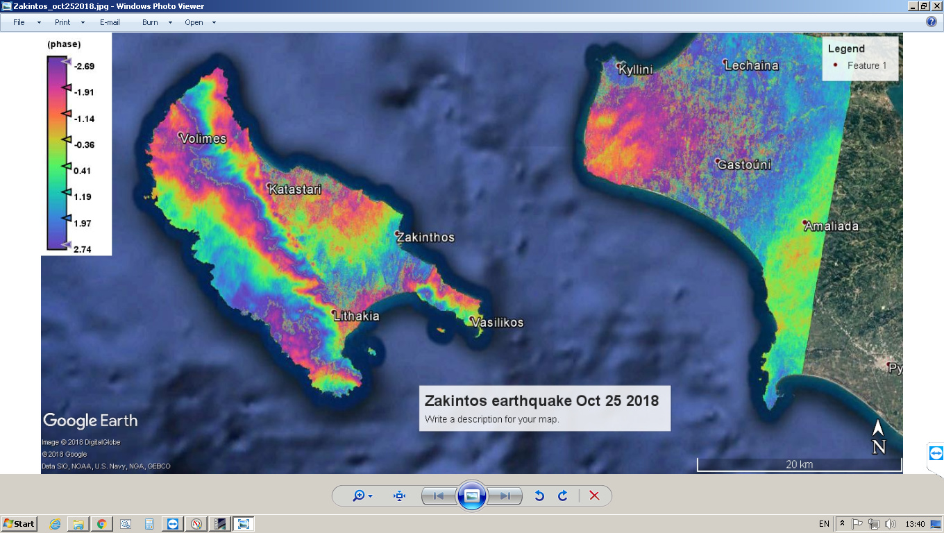
Just to share my first results for this earthquake after DInSAR processing.
4 Likes
Unfortunately the results after unwrapping are not so impressive. In my opinion this could be caused by:
- usage of restituted orbits
- presence of large water areas where the coherence is low.
I’ll be happy to have comments on this.
1 Like
I would actually expect a good result for the unwrapping, to be honest, because we clearly see large connected fringes, at least on the island on the left.
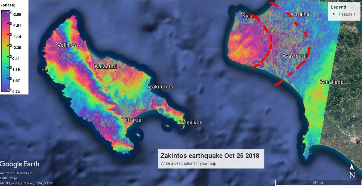
I see a potential error source for the unwrapping along the area marked in red where coherence is low. Unwrapping will probably be not corrected because the phase information will not be correctly transferred from one side to the other.
I don’t think orbit information will increase the quality as the interferogram already looks quite correct. Did you use topographic phase removal by the way? I wonder how the pattern on the left island can be caused by an earthquake.
@ABraun Thank you fir the comment. In the processing graph I use the topo phase removal is included.
Actually the epicenter should be on the west south side according to the European-Mediterranean Seismological Centre . The red area correspond to agricultural areas so low coherence is expected.
Also I’d be interested if sea mask can applied without affecting the unwrapping.
BTW Similar results are reported by NOA Greece - http://beyond-eocenter.eu/geohub/ionian-sea-2018-10-25-225451/?fbclid=IwAR0oIz1pg3HmwRZwN7azHyoxwzprKHWgOrAD1JpsrQE8XG8NcFRuH3gD-4E
One more interesting fact is that between the acquisition of the images I used for processing there are at least two events with Mw above 5.
Some addition to this topic - two unwrapped IFI with restituted and precise orbits.

I hope the difference is visible, especially in the south-east part of the island.
1 Like