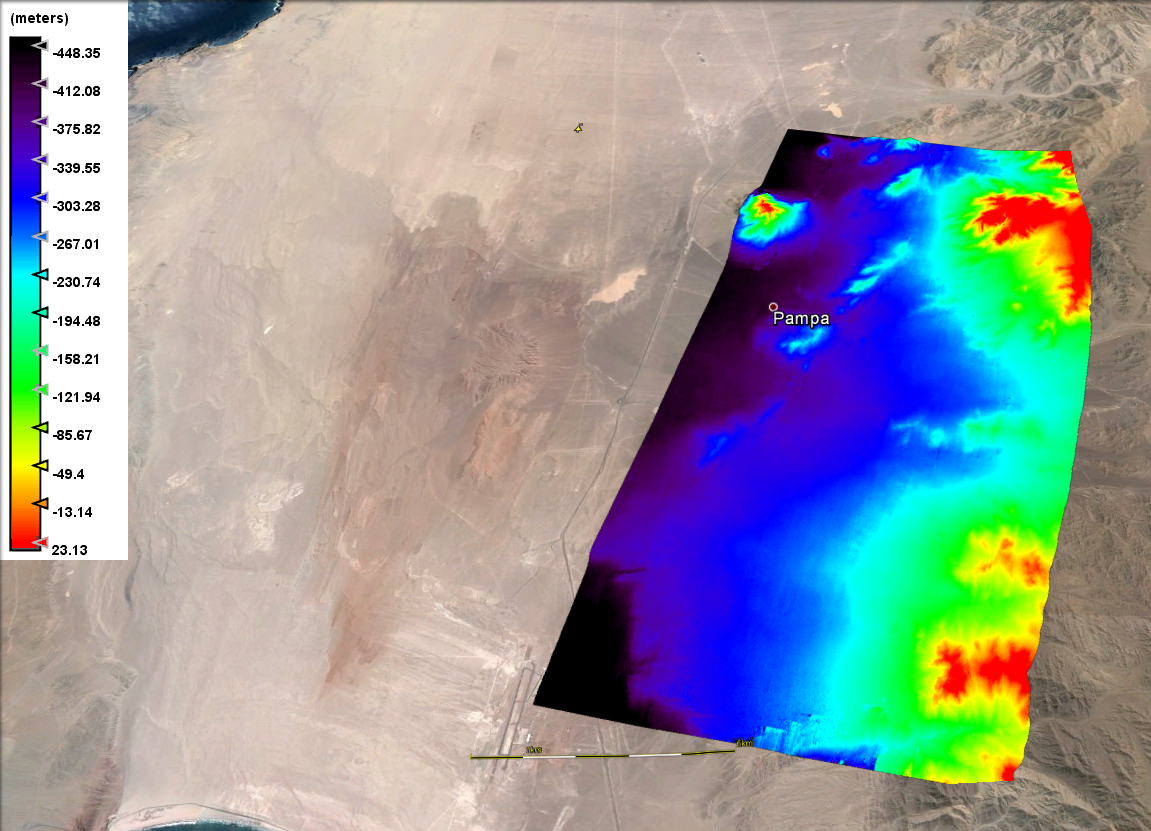
I tried to created a DEM for Atacama desert in SNAP, with the following steps:
Corregistration by using the function “S-1 TOPS Corregistration” (Sentinel 1 Toolbox)
“Interfarogram Generation”. In this step I’m considering the corregistered IW Swath;
deburst
“Goldstein Phase Filtering”;
“Snaphu Export”. I’m not applying the topographic phase removal, since I’m interest in the resulting DEM and not DinSAR,
“Snaphu Import” of the unwrapped phase;
Accordining to the Nest turtorial for Etna, I used:
7. Interferometrix-Products- PHASE to height
and Range-doppler creation.
The results in meters (negative) shows the distance from the satellite (relative distance)?
How could I ged the absolute height?
And how can I compare it with other dems(for example SRTM), to check the creted result?
Thanks
DEM-generation with InSAR gives you relative heights. In order to get absolute heights you need to identify a terrain feature with a known altitude and to adjust the generated DEM accordingly.
Probably because the point in the image that was taken as zero-reference (I’m guessing this is one of the image corners) happened to be on high ground so that most of the image was under this reference-altitude and therefore at negative altitude in relation to it.
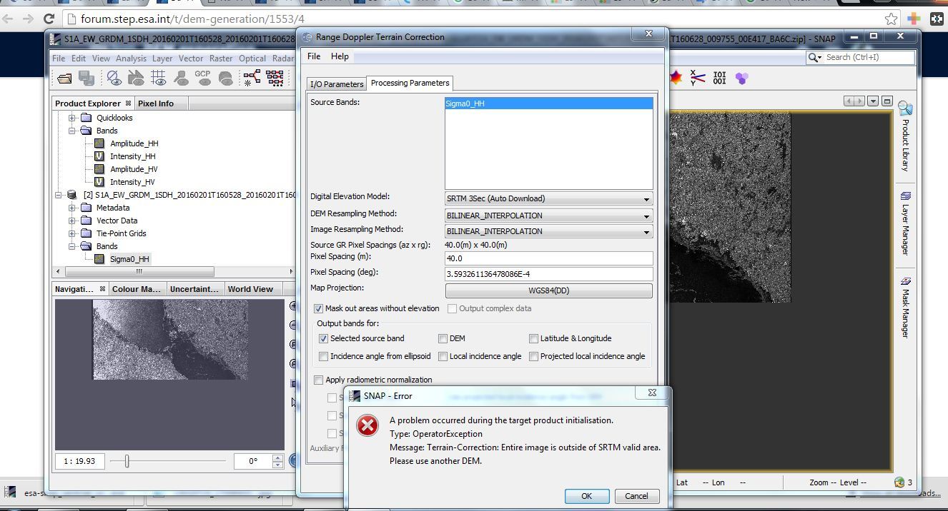
Hi …i am working with SENTINEL 1 and SNAP but i have problem when i want to display Terrian Correction. When I choose “SRTM3Sec”,there is an error. it says:
Terrian Correction: Entire image is outside of SRTM valid area. Use another DEM.
when I am using other DEMs, it does not work again.
Your scene must be outside of the valid area for SRTM which is ±60 deg latitude.
For polar areas you could use GETASSE30 or for higher resolution use ASTER DEM. For ASTER you need to download the tiles yourself and place them in the .snap/auxdata/ASTER DEM folder
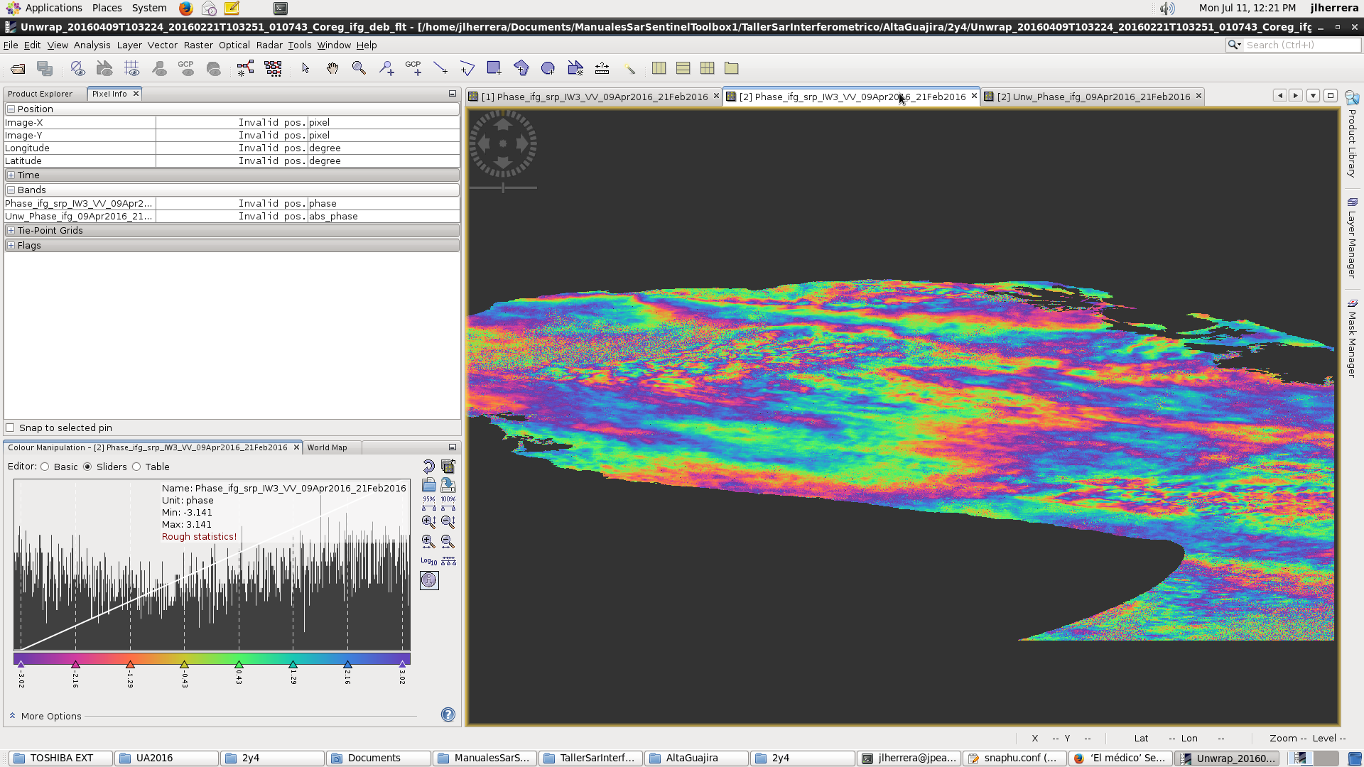
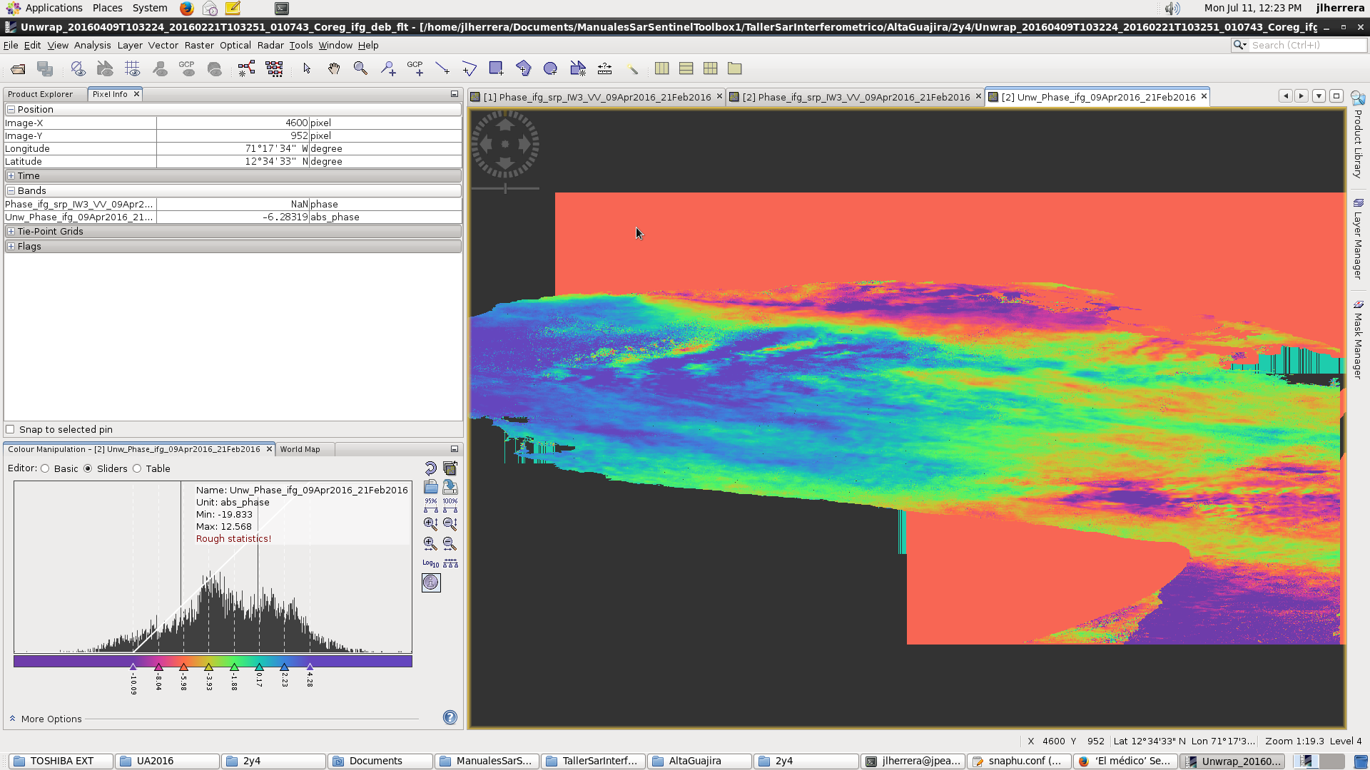
I have been working with images of Sentinel in Guajira (Colombian North Coast) and I have done coresgistration, interferogram formation, deburst and filtered and obtain this interferogram:
Right click on the band and go to band properties. Add an expression to valid pixel expression such as bandname > 0.5
You could also do this in band maths if you want to produce another band with your masked pixels.
You could also go to the mask manager toolview and add a new mask there.
Dear @Iveci, I have see your post, and I would like to ask for your help in this topic.
I want to try to do Terrain Correction using SNAP on a S1 image. It is outside the valid area for SRTM, could you explain me how to use GETASSE30 and/or ASTER tools?
I searched for it on SNAP, and it makes me browse on my folders… Should it go that way?
If your scene is above 60 lat or below -60 lat then it is outside the available SRTM tiles.
The GETASSE30 DEM is global but at a 30 arc second resolution (~1000m). You can simply select it in the SNAP operators that use DEMs like Terrain Correction and SNAP will automatically download the tiles needed for your scene.
With ASTER DEM due to redistribution restrictions, you need to download the tiles yourself from NASA or USGS and put them in your .snap/auxdata/dem/ASTER 1sec GDEM/ folder.
Does anyone know if the licensing for ASTER has changed or know of a better way to automatically get the tiles?
There are about 22000 ASTER tiles - what is the size of one in MB? Do they allow grabbing all of the tiles with a script? @lveci do you know?
edit: it looks like the uncompressed size of the ASTER DEM is 547GB and with lossless compression the size will be packed under 100GB. I think that’s manageable, if they allow downloading everything…
My scene is slightly above 60 lat. 65 in matter of fact.
I range-doppler Terrain correction, chosing for DEM the GETASSE30 and for map projection the Polar Stereographic. I am still unhappy with my result - I would expect that for now the mountains would like flattened…
Yes, GETASSE30 DEM has very low resolution, it’s OK for DEM-assisted co-registration but not for Terrain Correction. You should experiment with ASTER DEM.