Goodmornig,
I’ m trying to get RVI values by HV and VV polarization GRDH data of a two years (2017-2018) time lapse on meddle Portugal. Now, that’s the result of RVI=4*VH/VV+VH formula
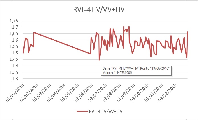
Values range is min=1,44 max=1,7, is it possible?
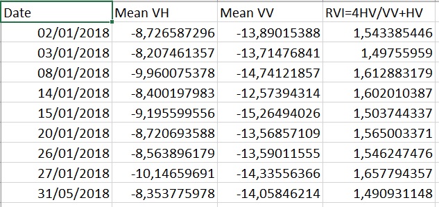
Starting values are the means dB values of the whole parcel pixels, ones of them are showed below
this parcel is an Eucalyptal forestry, and we would to detect the cut date, which has supose to be in 2017, using this data. Datas were getted with SNAP and S1B_IW_GRDH kind products by this process
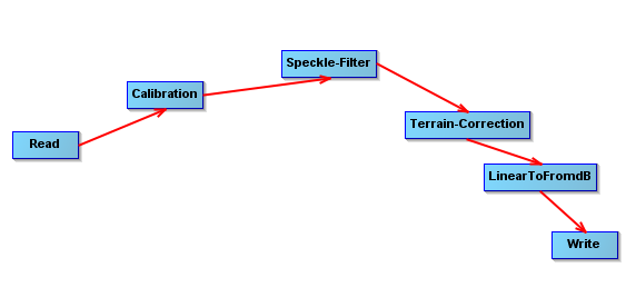 Calibration with sigma0band.
So, could I use RVI in this way?
Where I can find _Charbonneau, F., Trudel, M., and Fernandes, R. 2005. Use of Dual Polarization and MultiIncidence SAR for soil permeability mapping. In: Advanced Synthetic Aperture Radar (ASAR) 2005, St-Hubert, Canada. _
and _Kim, Y., and van Zyl, J. 2004. Vegetation effects on soil moisture estimation. In Geoscience and Remote Sensing Symposium, 2004. IGARSS ‘04. Proceedings. 2004 IEEE International, Vol. 2, pp. 800-802. _ used here to justify RVI?
Thanks for your attention