Dear all,
I tried to make DEM by using TanDEM-X products and then plan to compare with one DEM like ‘ASTER 1sec GDEM’.
I read some steps in STEP forum and even follow this utube toturial
I did like below:
Making interferogram from TDM-CoSSC-Experimental
Multilooking
Unwrapping
Phase to height
Geocoding (map projection: UTM zone, parameter projection:4north)
I do not know which kind of DEM, I should use in geocoding section?
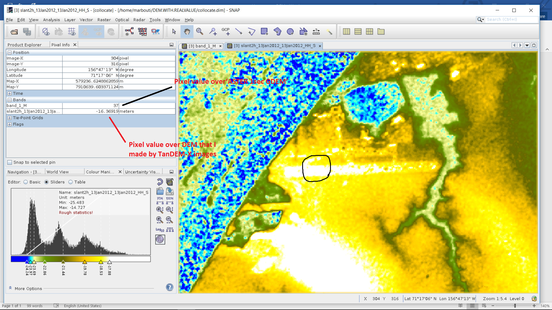
Actually I used one product from ‘ASTER 1sec GDEM’ and then compared my result with it over land but results were not the same (figure1).
I would suggest that you try “phase to elevation” instead and use the ASTER DEM as reference so both have the same base.
If both are in one product you can also create a scatter plot and see if the shift between both rasters is constant or just affecting values within a certain range.
Dear @ABraun
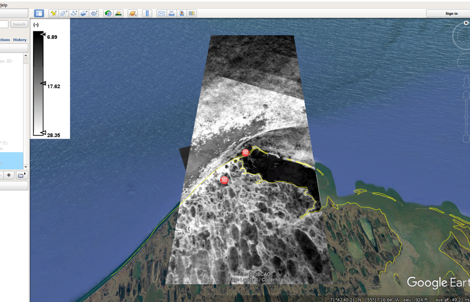
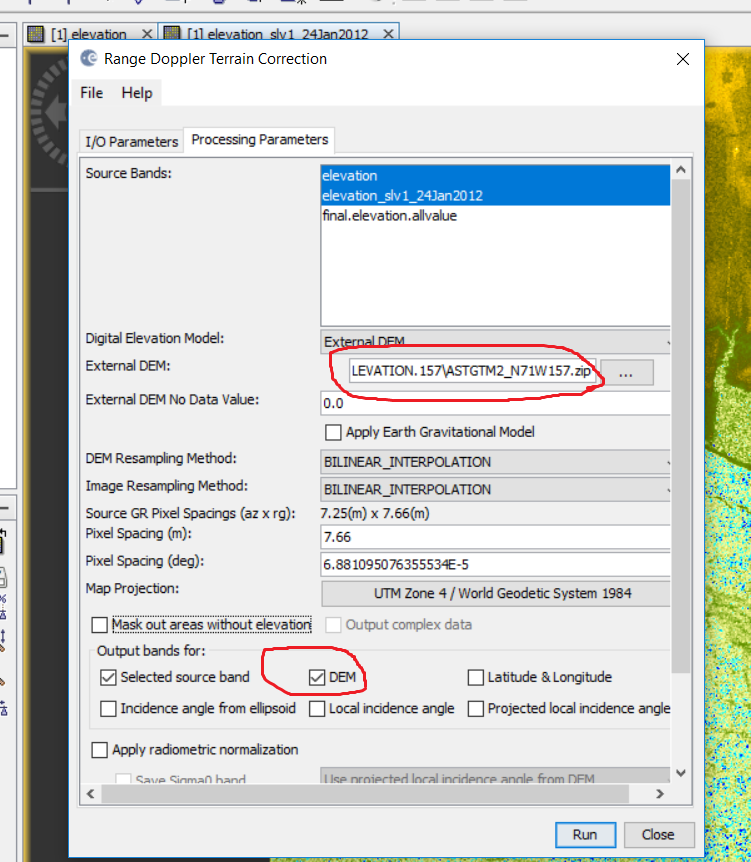
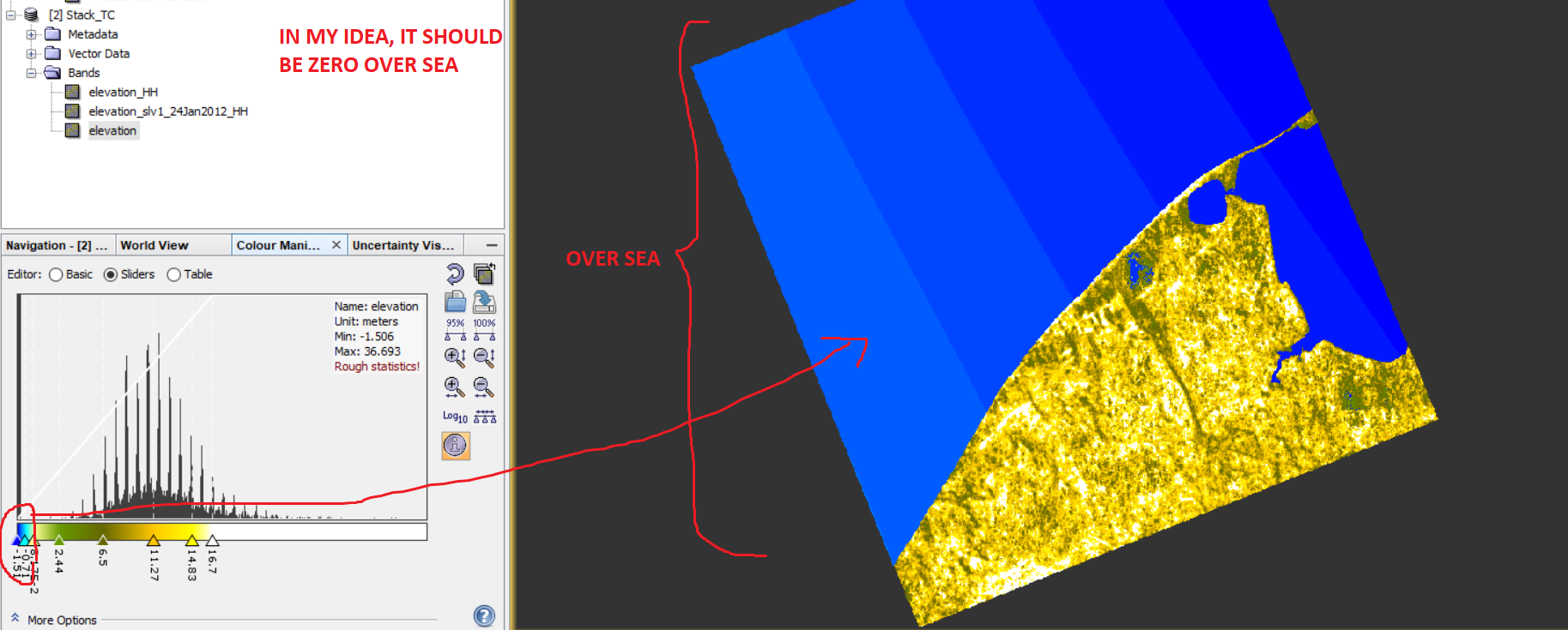
I used this ’phase to elevaton’ option in SNAP and then I used ‘External DEM’(figure1) but the problem is for ASTER data, there is some error values over sea (figure2 and 3) that I removed them by MATLAB (figure 4) and then used it in SNAP but when I made a DEM from TanDEM-X, I also chose ‘DEM’ option there (figure5) but I do not know why DEM values over sea are (-1,…). (Figure 6)
It is weird, it should be zero and I do not know this minus values are coming from where?
I don’t know how or why SNAP produced these negative values but you can easily remove them (make them 0) in the band maths.
IF elevation <0 THEN 0 ELSE elevation.
Another thing: You added the ASTER DEM as a zip file in the terrain correction after you removed the invalid values? I would rather use it as a TIF and later care about the negative values.
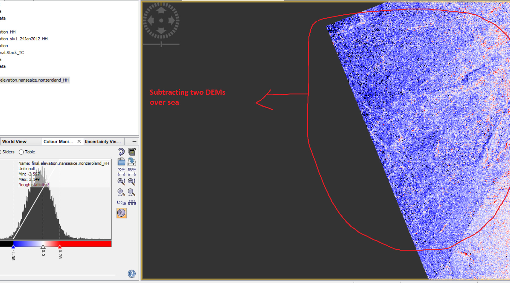
Yes I can remove them but my problem is not only with this DEM. It is easy to remove it in DEM but my problem is with DEM that I made by TanDEM-X images by using this DEM. When I made two DEMs for two different days and subtract from each other then I got minus value over sea.(fig1)
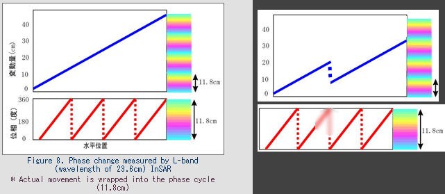
sorry, I don’t know your data as good as you. Could also be unwrapping errors towards the edges. Maybe worth a try with stronger filtered interferograms. But I can’t grant that it has an effect.
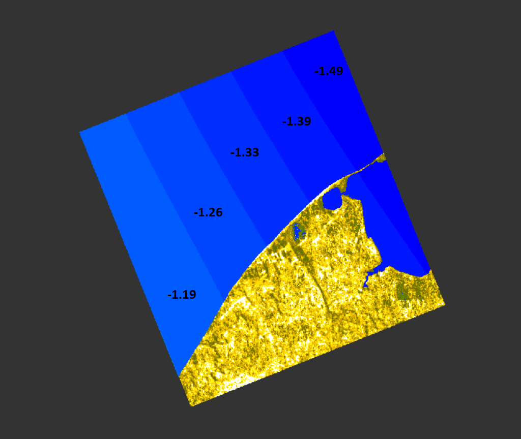
Thanks for your advice.I think this error coming from unwrapping. As you can see in DEM in below, I have a greenish gradient from right to left and a blueish gradient from left to right.
Dear @ABraun…you mentined here that ‘Could also be unwrapping errors towards the edges.’ . Is this error regular? because I did not find such a this error in that document you introduced me.
Dear @ABraun
I discussed with some of my colleagues about this DEM produces with SNAP and they guess that this minus values over water that actually are sea ice is here with high coherence could be a error in SNAP. So, I asked SNAP developers care about this issue and tell us their idea about it.
I do not know who are SNAP developers but I add some people that I think they are. If you know more people, please tag their names here. Thank you
I have trouble understanding what the issue is. Why should the generated DEM-height be zero over the sea? The real sea level is not at fixed height either.
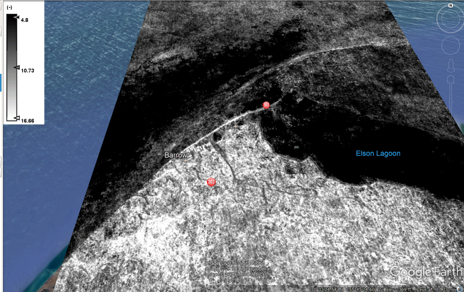
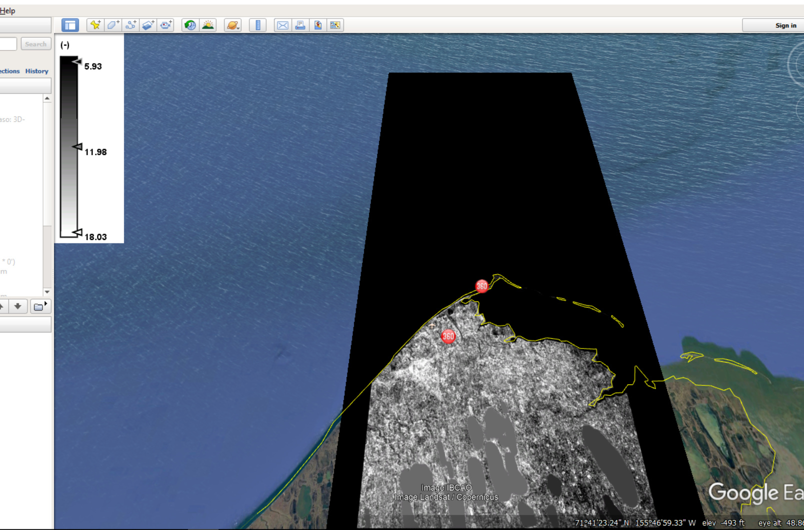
If you download ASTER DEM in that area I mentioned (ASTGTM2_N71W157), then you can see, it has some error values over sea(figure1) but we do not have any DEM over sea and it should be zero or maybe NAN. That’s why I used MATLAB and convert all ASTER DEM values over sea to zero (figure2) or NAN (figure3) and I used them in ‘phase to elevation’ and ‘geocoding’ but I do not know why I got minus values over sea. In my idea, it should be zero, NOT minus.
These minus value are coming from where?
I did not use sea level here? how should I use it in calculation?
I only convert ‘unwrapped phae’ to ‘phase-to-elevation’ and when I checked my result with ASTER DEM over land, they are same but they are not same over sea.
@mengdahl I even chose a lagoon part and got average over it and then subtracted my DEM prodused by SNAP from it but still I will get this blue values over sea or sea ice.
It looks a gradient.