Hi to all.
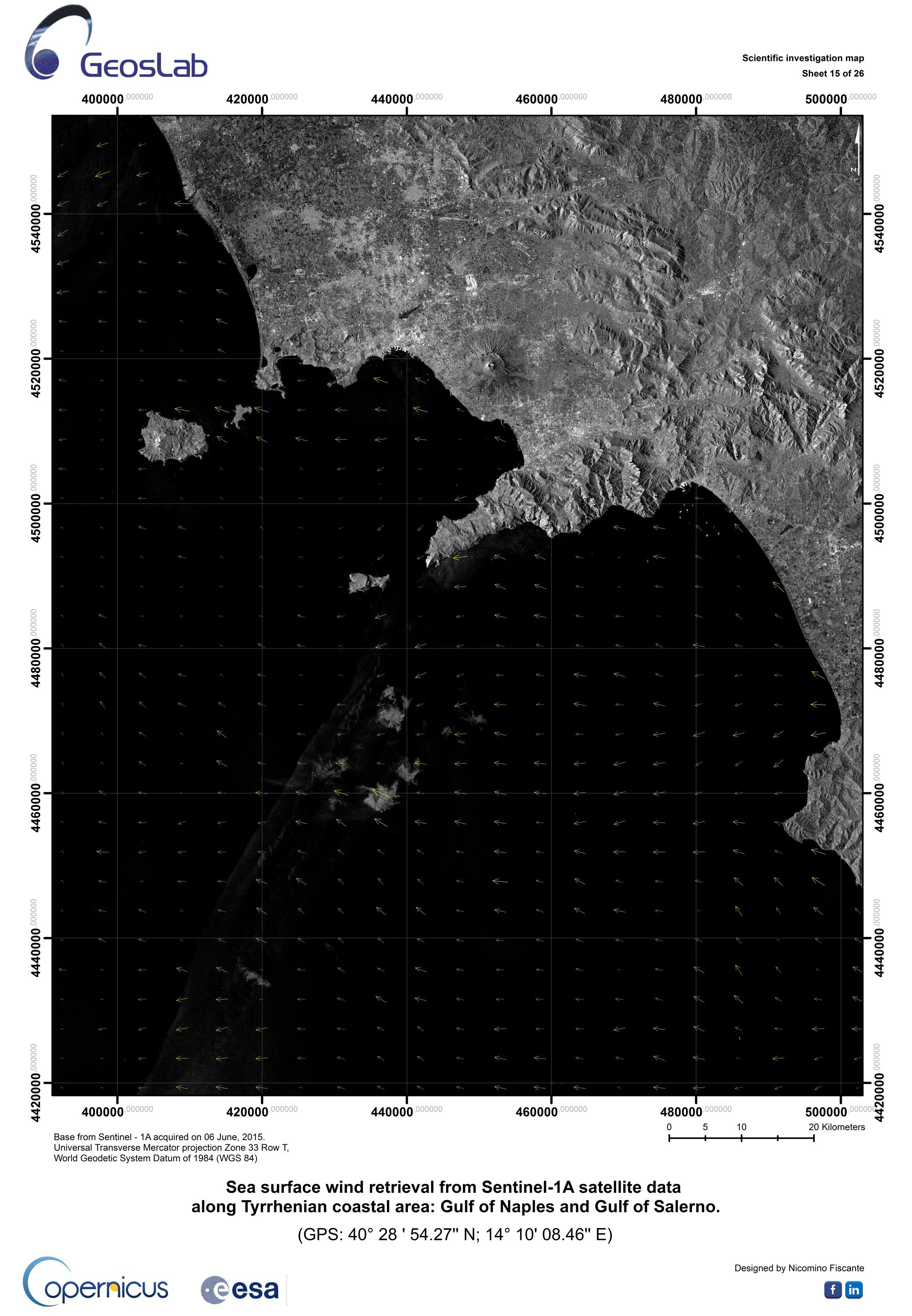
I have generated a wind field estimation map with Sentinel-1 data.
Is there a procedure to export the wind field estimation in term of intensity and direction?
Thanks in advance.
NF
Hi to all.
I have generated a wind field estimation map with Sentinel-1 data.
Is there a procedure to export the wind field estimation in term of intensity and direction?
Thanks in advance.
NF
Hi!
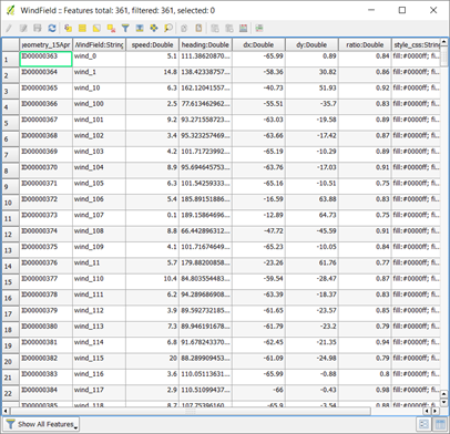
you can find an XML file with all that information in C:\Users\username.snap\var\log, or a similar folder on your OS.
Cheers,
Annekatrien
Dear nicominof,
As Annekatrien has stated, you may find the info at the XML file.
An easy way to use the info is exporting the data to a XYZ file and gridding it into a raster.
As an example, you may use some linux shell scripting:
set the XML file as a variable
set LOG_WIND = /home/oceano/.snap/var/log/${ARQ_NAME}_Spk_Cal_wind_field_report.xml
extract the info and create a XYZ file (lon, lat, magnitude)
grep "<windFieldInfo " ${LOG_WIND} | awk '{print $3 " " $2 " " $4}' | sed 's/lon=\"/ /g' | sed 's/\" lat=\"/\t/g' | sed 's/\" speed=\"/\t/g' | sed 's/\" length=\"/\t/g' | sed 's/\"/ /g' > /home/oceano/wind/S1A_wind_field_report.xyz
it creates the file "/home/oceano/wind/S1A_wind_field_report.xyz"
to gridding it, you may use the GMT package (function nearneighbor)
Best regards,
Last week I’ve added the data into the products vector nodes. This will let you export it as shape files.
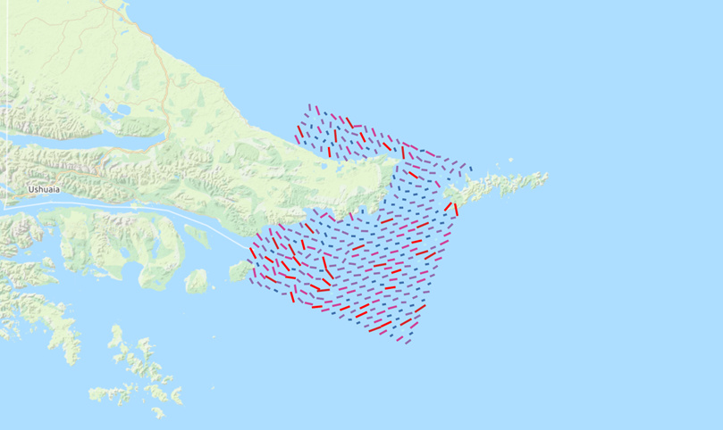
Thanks a lot Gustavo! Actually I am using a Matlab script to extract the informartions and after I create a map in ArcGIS.
Regards!
Thanks Louis, Regards!
Nice map layout, Nicomino!
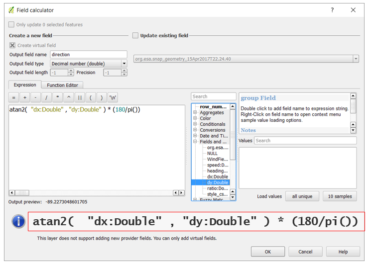
hallo Nico, the xml result of wind field estimation serve lat, lon, speed, dx, dy, and ratio. how do you get direction estimation ?
thanks
Halo sir @ABraun can you help to answer my question, i think because this is old topic (2 years ago) that’s why Nico doesnt notice…
Your help Will open my mind… thank you before…
this is what I did:
atan2( "dx:Double" , "dy:Double" ) * (180/pi()) + 90
Thank you so much for your help sir