Hello!
I have a problem with the export of chl band (sentinel-3) to geotiff.When I open tiff file in arcgis values are different from values in SNAP. Can someone explain why does it happen?
Best wishes
Hello!
I have a problem with the export of chl band (sentinel-3) to geotiff.When I open tiff file in arcgis values are different from values in SNAP. Can someone explain why does it happen?
Best wishes
To what extent are they different?
SNAP, ArcGIS or QGIS differently handle the visual contrast enhancement (smallest and largest value which is used for the color ramp).
To go sure, you can compare the image statistics in the metadata of both programs and check if the minimum and maximum values are the same between the different programs.
Some discussions on this:
Another thing is that conversion to GeoTiff might change the data type (e.g. 8 bit integer 0-255).
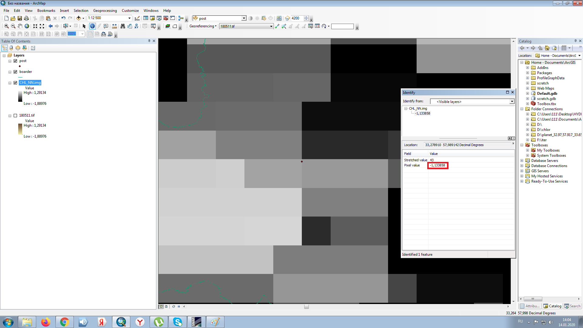
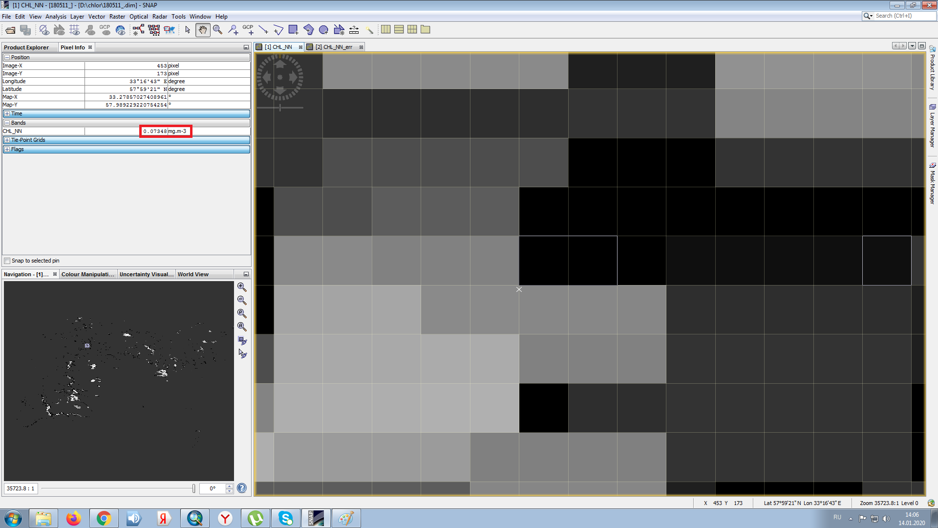
The problem is that, when i convert in SnaP the band i need to geotiff and open it in Arcgis, the values are changing. Like in Snap i have 0.69 and in arcgis at the same point 0.23, or i find out hte minus values in the places they can’t be.
you can open the img files (in the .data folder of the BEAM DIMAP) product directly in ArcGIS. No need for conversion to GeoTiff actually.
maybe there is a valid-pixel expresion defined in the raster’s properties in SNAP?
Or there is a scaling value applied in SNAP but not on the actual raster product (or during the export): S3 WFR values in exported GeoTiff different from DIM
From the topic you attached I found out that I need to scale the values. So I trying like it’s written there, but that ways does’t work.
did you apply the scale value to the raster in ArcGIS?
Do you mean bandmath?
yes. You open the img file in ArcMap and multiply the scale factor to get the values as they are displayed in SNAP.
I have been using these: value = 10^(raw * scalingFactor + scalingOffset), is it ringht for chlorofyll, because after I created a band math all the values turned -12
okay, I opend img in ArcMap with the BandMath, values have chanched but they r steel not right.
please check in the properties of the chlorophyll raster if there is a formula applied as well.
Sorry, I can’t reproduce this error based on this information.
Hello
how can i transfer a SNAP product/image (.dim file) to an ArcMap file. I got a daily ET image and want to open it in ArcMap.