Graph Builder Subset and Terrain Correction Error Sentinel 1

Edit

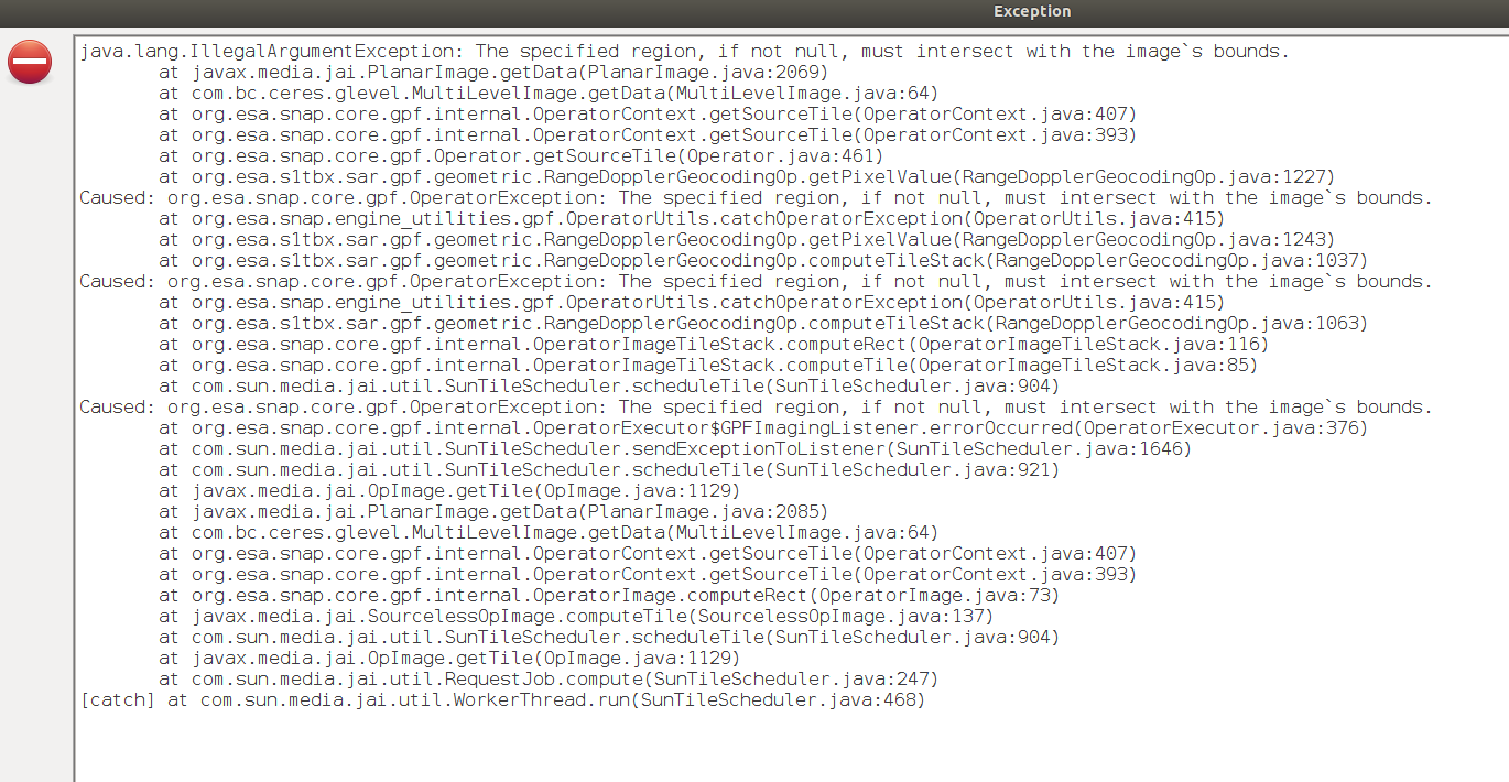
The error now appears to be when I Terrain Correct an image:

Read>Subset>Calibrate>Write - Works fine
Read>Subset>Calibrate>Terrain Correct>Write - fails

Hi there,

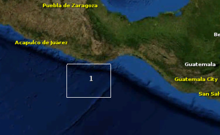
When I use the Subset Operator on its own in SNAP, I can subset an Sentinel 1 scene without issues (Using Geographic co-ordinates), however when I try to automate this using Graph Builder, I get:

The specified region, if not null, must intersect with the image's bounds.

Does anyone have any pointers as to how I can fix this?

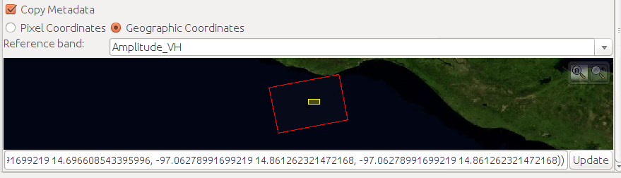
I noticed that SNAP takes co-ordinates whereas GPT seems to take a WKT…

Also just to add that the WKT is displayed in the correct location where the image footprint is.

have you tried creating the WKT outside SNAP, e.g. here: https://arthur-e.github.io/Wicket/sandbox-gmaps3.html

If you use this in the XML of the graph file, it should work.

Funnily enough, that was the very website I used

are you working with GRD data?

Yes, it’s strange as using the same co-ordinates for a top left, bottom right subset window in the SNAP operator works fine

any pre-procesing applied before this step?

Hmmm peculiarly it seems to do it now. I have no idea why it was doing that.

There’s no pre-processing steps ahead

well, this good and bad in a way :sweat_smile:

Right so, if I add terrain correction to the end, the processing dies.

So if my graph is Read > Subset > Calibration > Write (No problems)
But Read > Subset > Calibration > Terrain Correction > Write (Problem)

Did you maybe select a UTM coordinate system in the terrain correction?
This would explain why the geographic coordinates from the WKT are outside the expected bounds.

Edit: Nevermind, it should not make a difference if the terrain correction comes after the subsetting.

Nope, set at WGS84 :slight_smile:

Appears that if I try to Terrain Correct the product, I get the image bound error.

Guess subset isn’t where my issue is?

Sorry for the image, copy+pasting from my VM is a bit broken!

is your region within the SRTM coverage?

Oh wait, read the preview wrong sorry, it’s actually east of Guatemala city:

image

@ABraun

I believe it’s how the Subset Operator in GPT works.

If I run Subset separately with SNAP (not GPT), then Radiometric Calibration, then Terrain Correction, it works fine…

hm, I have often used the GPT to make subsets in batch mode actually.

Just to go sure: There is an option to mask out all water areas in the Terrain Correction, but you probably disabled it because your data is entirely over water, right?

Yep it is indeed disabled, I’m using an external DEM, which does work with the separate SNAP processes :slight_smile:

image

So I ran GPTs Subset (2 in the preview window) with:

Polygon ((-97.56358828861178267 14.96860616344341643, -97.56358828861178267 14.73100794671138303, -97.10260713307185654 14.73100794671138303, -97.10260713307185654 14.96860616344341643, -97.56358828861178267 14.96860616344341643))

And then ran SNAPs subset (3 in the preview window) with:

-97.56358828861178267 14.96860616344341643, -97.10260713307185654 14.73100794671138303

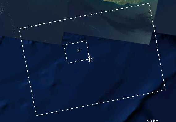
As you can see, SNAPs subset appears to be correct whereas GPTs still looks like it’s the full scene size. I assume that when it comes to Terrain Correction, the data is not mirroring the metadata?