Hello,
I am processing 24 images but in two sets of 12 images, but when the DEBURST step is about to end, this problem occurs.
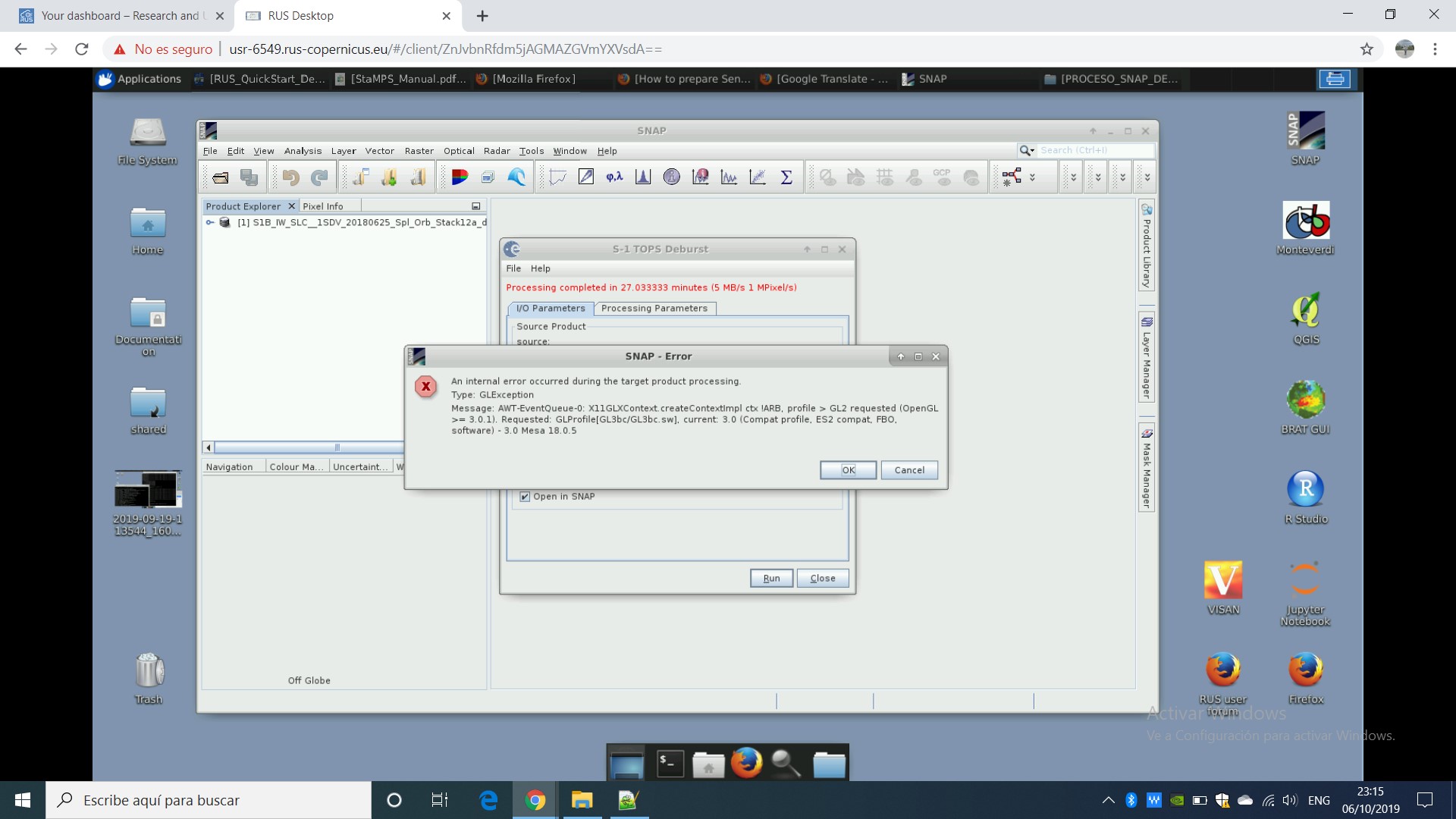
Can somebody help me,
Hello,
I am processing 24 images but in two sets of 12 images, but when the DEBURST step is about to end, this problem occurs.
Can somebody help me,
Similar Error, GLException is discussed in here,
In case this doesn’t solve your problem, please give more details about the steps you did, it could give more details to help you.
Normally snap2stamps does not work with Python 3. In the manual I recommended Python 2.7
Still…which stamps version you used? 4.1b? Or earlier version?
The more information you share with us the easier for us to help you
I have used 4.1b, i saw code inside of py files, there is no big difference working with python3 i have changed just print command (v2.7 print message v3 print (message) ).
I know about the differences, but as said you said nothing about those changes you made. Good. One source of error less
Regarding your error. Please provide more information… otherwise it is difficult for us to identify your problem
Best regards
Dear Mdelgado, I’m just starting to use snap to prepare images for stamps.
I followed the workflow provided by PSI USING StaMPS.docx (185.1 KB), so doing all the steps with no script.
But when I skip to matlab to run the mt_prep_gamma_snap(changed) (6.4 KB) it doesn’t find the slc.par files…no INSAR_MASTER_date folder has been created actually.
I only got the four folder diff0\geo\dem\rslc.
In wich phase something was wrong in your opinion?
thank you so much
the script mentioned in the word file (mt_prep_gamma_snap_changed) is no longer up-to-date.
You find the latest version of StaMPS here: https://github.com/dbekaert/StaMPS
You can then use the mt_prep_snap command to process the data generated by the StaMPS export of SNAP.
Still… it also depends how and where you have launch the command.
Without this info we cannot assess exactly which the reason it, but just guess…
So we hope to be guessing properly.
Let us know
Hello,
I am trying to process StaMPS export and I wanted to check if I need to process radiometric calibration on the SLC images before creating the stack of coregistred images?
Thank you!
No need to apply both calibration or speckle filter to the SLC’s image,
Please take a look at this post,
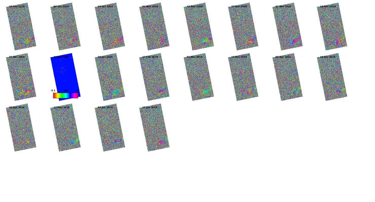
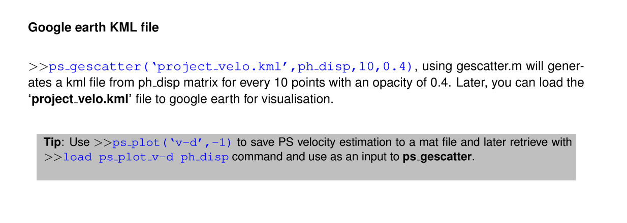
Hi all, please, somebody could tell me how I can export the figure to .kmz format???
Thanks in advance
Within the StaMPS manual it’s mentioned how to export to kml,
StaMPS/MTI Manual Version 4.1b
Source: https://github.com/dbekaert/StaMPS/tree/master/Manual
Later on you could convert the kml file to kmz,
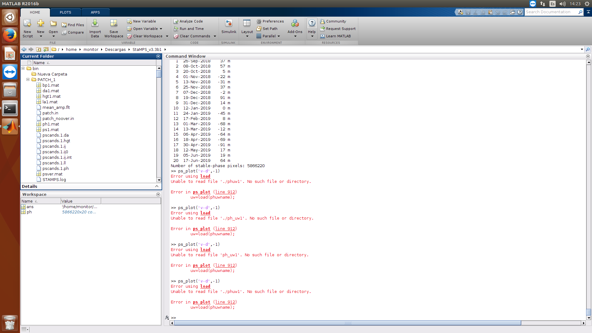
Hi all,
When I type ps_plot(‘v-d’,-1) obtain
Error using load
Unable to read file ‘./phuw1’. No such file or directory
Error in ps_plot (line 912)
uw=load(phuwname);
Thanks for advance
Does this code work?
ps_plot(‘v-d’)
If Not, I think you didn’t properly navigate to the file direction.
Hi @falahfakhri and all
Please, tell me if my folder general of data is complete!!! I have a problem of orden of my files… I am trying of ordered this!!!..
Thanks for advance
looks alright to me, but mostly dependent of the content of all the files and folders.
Just a recommendation: Leave the folder exported from SNAP (dem, diff, geo, rslc) as it is and run mt_prep_snap in a different/new directory, so all new files are written there separately. This helps you to clean up in case you want to start again without having to repeat the StaMPS export. Basically, all other files besides the four directories are required by Matlab (the textfiles and the PATCH folders).
probably you should execute that command being in the parent folder… not inside the PATCH_X
Dear Mehdi I am also working o the same cases as you r working on, i am using SarScap version 5.5 if you interested to work together i have licence for SARscap we can work together
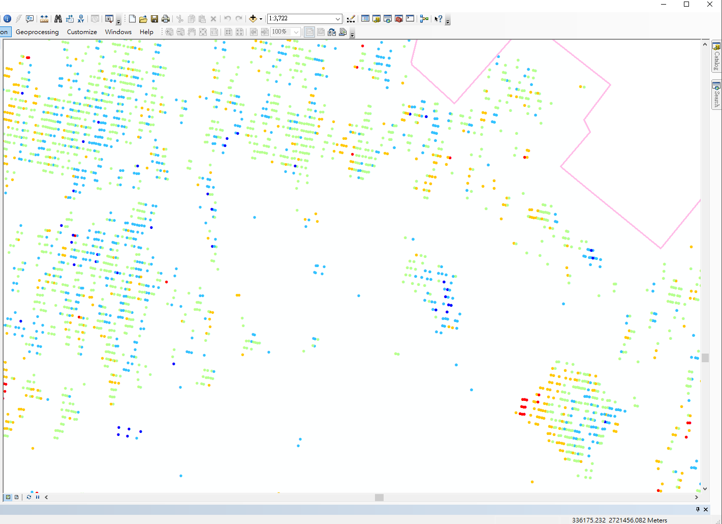
Dear all.,
I have processed with SNAP 7.0.2 and stamps v4.1 at Windows Subsystem for Linux (ubuntu 18).
Everything went well and got no error message. But after all step done, I export the ps_plot(‘v-do’) by ps_output command to display the result in ArcGIS. The arrangement of PS points looks very strange, they are stand in line?!
Because I got no error message, I don’t know how to check and deal with it. Could anybody help me? Thanks a lot!
I’d say the arrangement of points is quite typical actually, because range and azimuth resolution can strongly differ in SLC data (Sentinel-1 5x20 meters). Without a basemap, we don’t know much about the absolute position accuracy of your result, but the linear alignment of the PS does not look like an error to me.