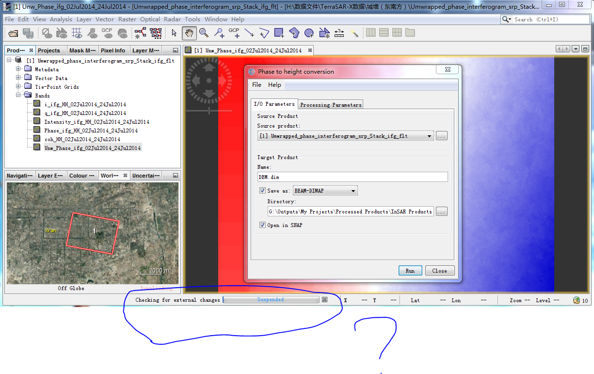
Hello, I would like to use TerraSAR data to do three-dimensional reconstruction of urban buildings. Before creating DEM,I do subset>corregistration>Interferogram>Coherence estimation>(interferogram) Phase filtering>Multilooking for filtered phase>Reconstruct the phase after Multilooking by using the Band Maths >Phase Unwrapping.But I ready to do phase to height,it did not appear results.Besides,I am not clear checking for external changes.I also look tutorial in https://earth.esa.int/documents/507513/0/InSAR_Tutorial_ERS-Etna/41625d92-93d0-41e4-8c7e-c96450d82fdb .
1 Like
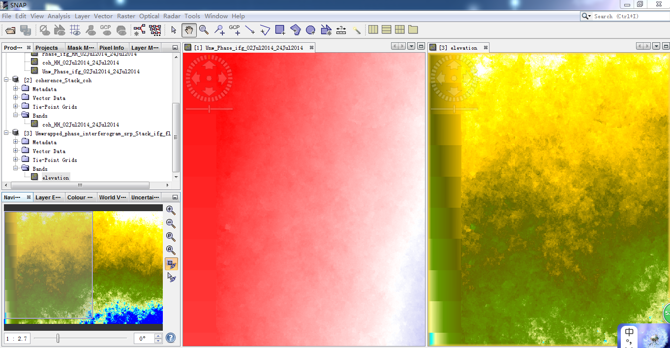
there is a strong ramp in your image. Were your coherence values good?
You can also try phase to elevation module, but I’m afraid it won’t make a difference regarding the ramp.
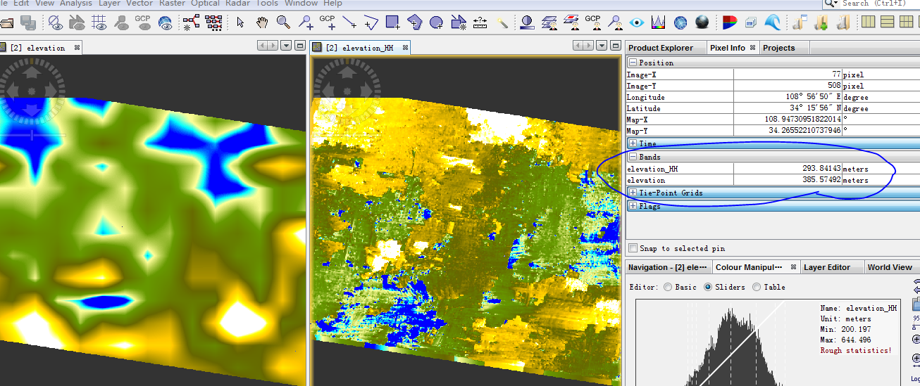
@ABraun I can also try phase to elevation,first picture is phase to elevation ,the second picuture is coherence
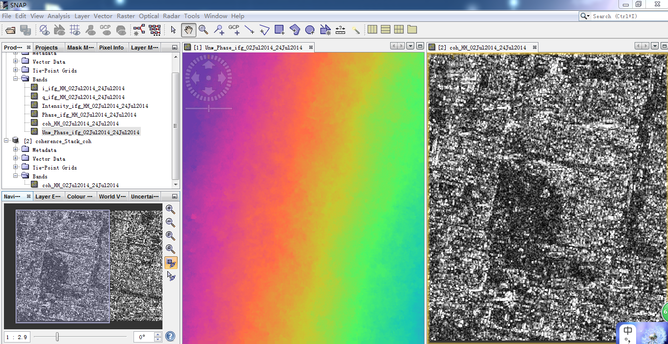
can you show a histogram of your coherence?
What is the temporal and perpendicular baseline?
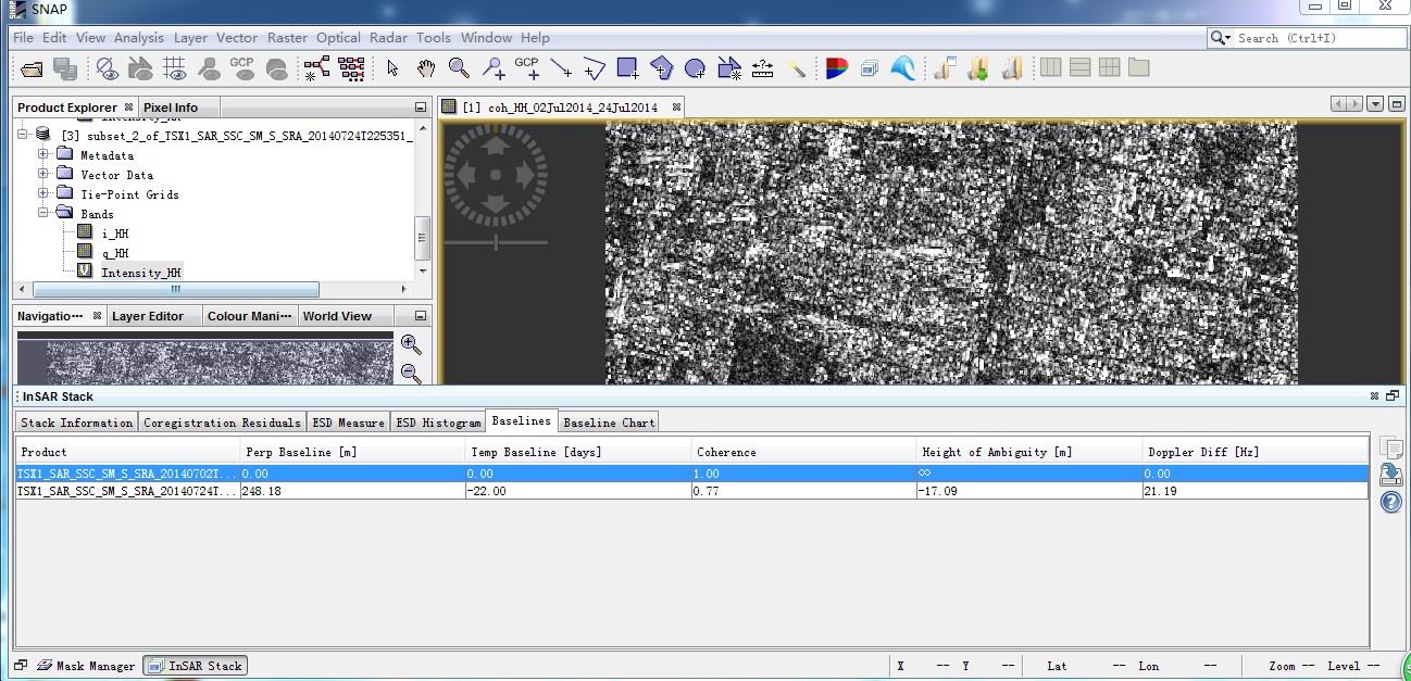
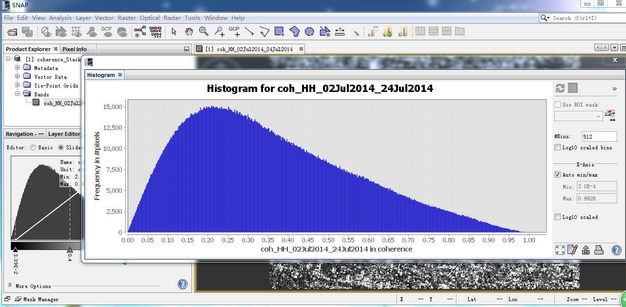
thank you. Coherence is not that bad actually. Values larger 0.4 are good, but for some areas you should be able to retrieve elevations with this. I’m more concerned about the extreme ramping of the values in NNW-SSE direction. Can you make a profile along this direction to maybe estimate the inclination of the whole gradient?
OK,but I’m afraid to ask another problems. You told me about retrieve elevation with this and make a profile along this direction to maybe estimate the inclination of the whole gradient.Could you told me more details steps or releveant ?Please forgive my request,there are many problems do not understand.
 Thanks!
Have a look in the SNAP internal help if you are insecure about different points. There is explained, point by point, how you make a profile for example.
Maybe you should also start a bit earlier with SAR basics before addressing InSAR topics or have a look at the numerous topics in here which are dealing with the same problems:
Thank your help.
Sorry, I open the file which isn’t downloaded from website yesterday night. But I still thank you.
maybe some of these tutorials help you in general on how to deal with SAR data:
https://sentinel.esa.int/web/sentinel/toolboxes/sentinel-1/tutorials
http://step.esa.int/main/doc/tutorials/sentinel-1-toolbox-tutorials/

Input to Google Earth DEM elevation is relative elevation, right? How can I determine its absolute elevation,otherwise, how do I know the accuracy of the generated DEM.Thanks
did you perform Phase to Elevation?
Which steps were applied?
yes,I did perform phase to elevation>Range-Doppler Terrain correction,then export to geogle earth.https://earth.esa.int/documents/507513/0/InSAR_Tutorial_ERS-Etna/41625d92-93d0-41e4-8c7e-c96450d82fdb
after Phase to Elevation you should be getting absolute heights.
The Google Export is not necessary, I would rather choose to include the DEM in the TC module as well by checking the respective box so you can compare your results to the SRTM data.
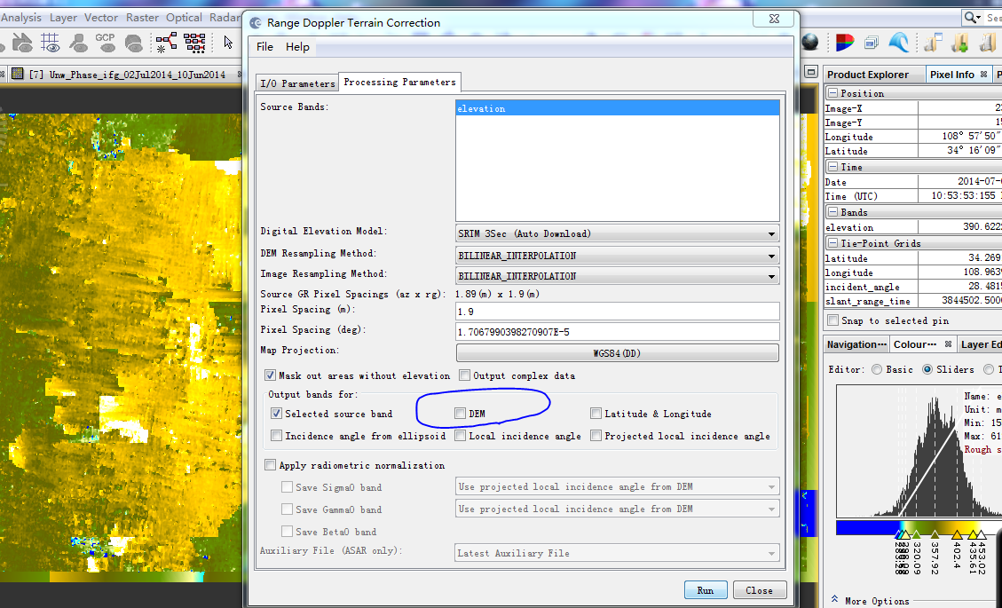
When I do terrain cottection step,show the dialog ,What is the role of “DEM” in the dialog box? Do i need to check it?
It will add a DEM-band, in your example SRTM 3sec (Auto download).