I am working with the Sentinel-1 SAR images. The images are level-1 GRD product. In the documentation:
High resolution level-1 GRD:
EW Swath -
resolution = 50x50 m
pixel spacing = 25x25 m
IW Swath -
resolution = 20x22 m
pixel spacing = 10x10 m
Medium resolution level-1 GRD:
EW Swath -
resolution = 93x87 m
pixel spacing = 40x40 m
IW Swath -
resolution = 88x87 m
pixel spacing = 40x40 m
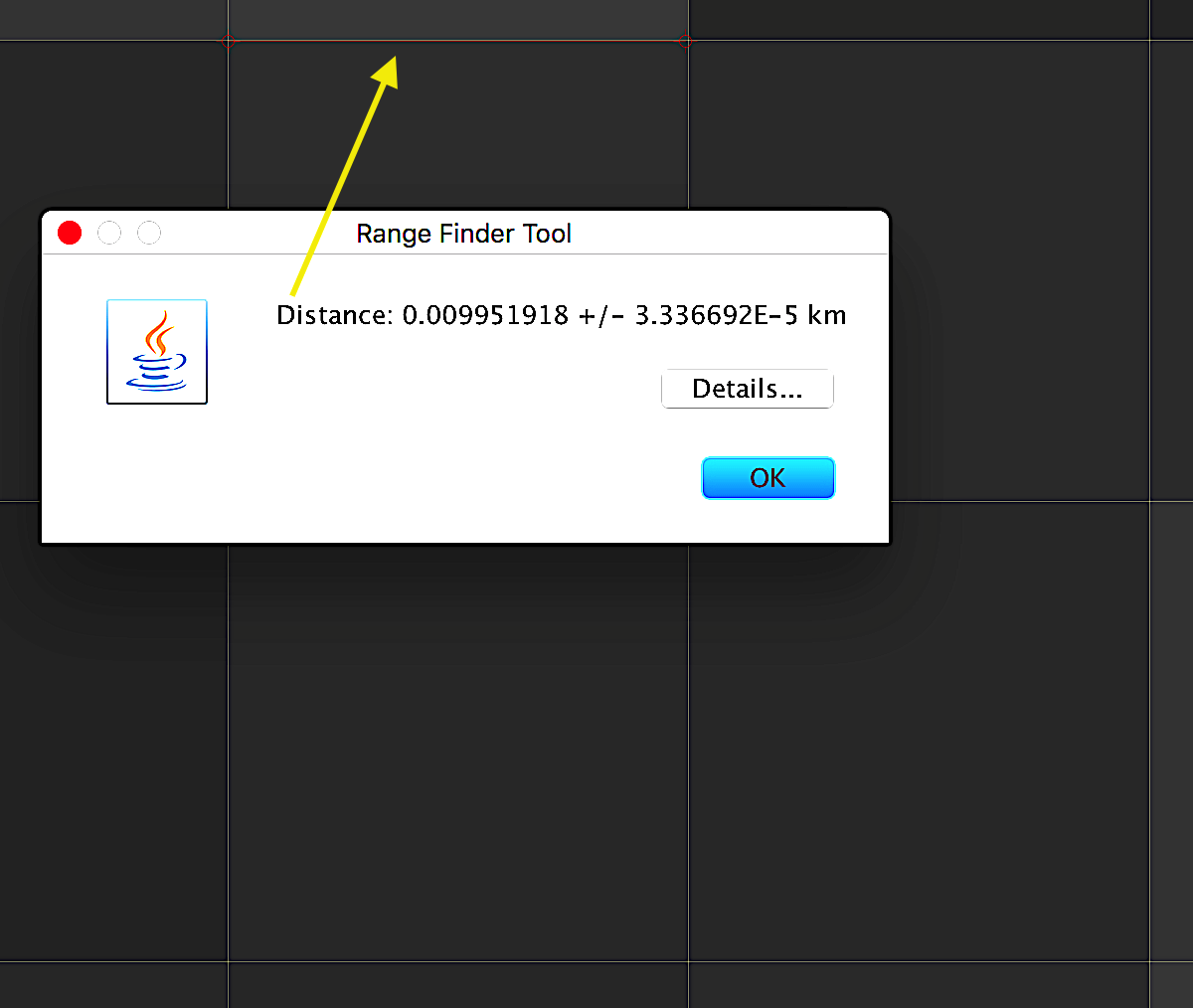
However looking at the image, when I measure the length of the pixel, it is equal to the pixel spacing for both high and medium resolution images which is 10 m and 40 m respectively.
Thanks ABraun! I read the article and I understand that the pixel spacing will be smaller than the image resolution but I have a few follow up questions to that
Does this mean that the spatial resolution of the GRD level-1 with IW swath is 10 meters and with EW swath is 25 meters, instead of the way it is shown in the documentation? Can we present it like that ?
If we compare with an optical image of 10 meter spatial resolution, then will the Sentinel-1 SAR and Optical will have same amount of details at 10 meters spatial resolution?
When doing terrain correction, I have to specify spatial resolution. What should I be specifying there - pixel spacing or the spatial resolution mentioned in the documentation? If spatial resolution in documentation, then what value should be put in there since for IW GRD level-1 is 20x23 m (should it be 20 or 23)?
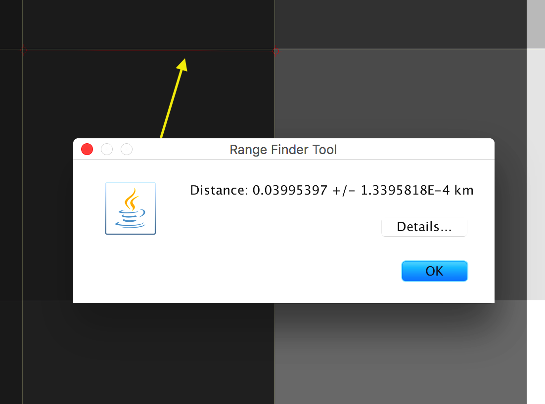
Based on my understanding from the article you listed above, the spatial resolution is 20x23 m in IW but the pixels have been split into 10x10 meter blocks during sampling. Is there a way to see/measure the spatial resolution, as measuring the length of the pixel does not represent spatial resolution?
In general for SAR detected imagery such as S1 GRD images, the pixel size is half the spatial resolution. This is based on the Nyquist requirement to avoid any loss if information in the imagery (e.g. see https://en.wikipedia.org/wiki/Nyquist–Shannon_sampling_theorem). If the pixel size is greater than half the spatial resolution the image is undersampled (some information is lost) while if the pixel size is less than half the spatial resolution there is oversampling (the image has more pixels than necessary).
The spatial resolution of SAR imagery is measured using point targets and in particular from specially deployed corner reflectors such as transponder and corner reflectors (also used for radiometric calibration). The half power width of the point target impulse response function (the point target response in the image) defines the spatial resolution.
Note that for GRD products, the range spatial resolution varied across the swath - it is actualy smaller at far range than at near range. For SLC product, the range spatial resolution is constant across the swath since range is actually slant range rather than ground range in the case of GRD products. You can see more in this presentation: http://sarcv.ceos.org/documents/doc/156/ (note the results are for SLC products) and in the latest S1 N-Cyclic reports such as at https://sentinel.esa.int/documents/247904/685163/Sentinel-1-B_N-Cyclic_Performance_Report-03.pdf.