How can i predict above ground biomass from Sentinel 1 backscatter value?
Thanks All…
as Sentinel-1 uses a c-band radar its wavelength of around 5 is not the most suitable for vegetation analysis.
Higher wavelengths like ALOS PALSAR (> 20 cm) are more sensitive towards vegetation or at least forest as the signal penetrates leaves and smaller branches and more interacts with stems and large branches.
These are two good reviews on SAR and biomass in general and worth reading:
You will probably stumble upon some interesting studies which used c-band (ERS, ENVISAT) but also learn around the limiations of SAR and wavelengths.
Thanks for your information.
Is ALOS PALSAR image free for use?
Thanks…
Data of ALOS PALSAR (2007-2011) is free in the meantime:
- https://alos-palsar-ds.eo.esa.int/oads/access/ (full ALOS archive, requires registration)
- https://vertex.daac.asf.alaska.edu/ (not quite the entire ALOS archive but freely downloadable scenes)
- http://www.eorc.jaxa.jp/ALOS/en/palsar_fnf/fnf_index.htm (yearly mosaics, also from 2014 ongoing )
thanks
But i need 2014 year data. So it is very difficult this ALOS image…
in that case I would have a look at studies using c-band and give Sentinel-1 data a chance. But they also are availably since late 2014.
Thank u very much…
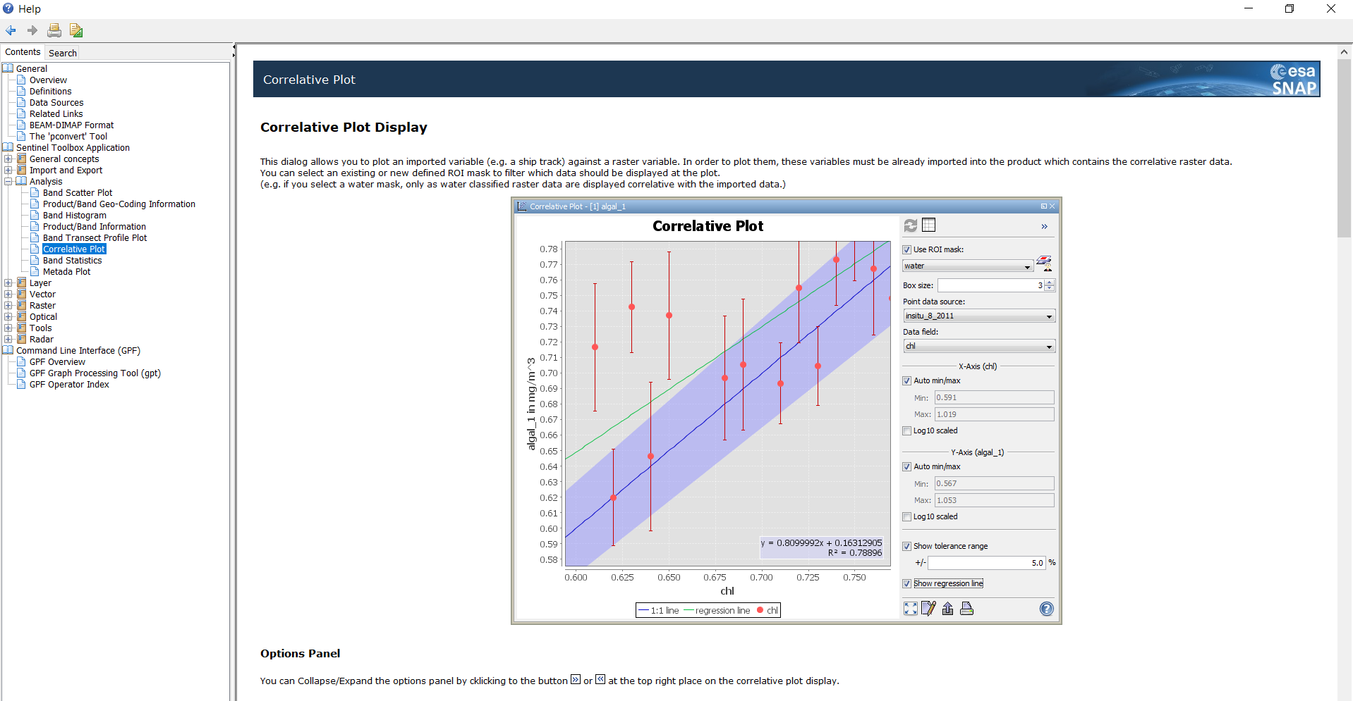
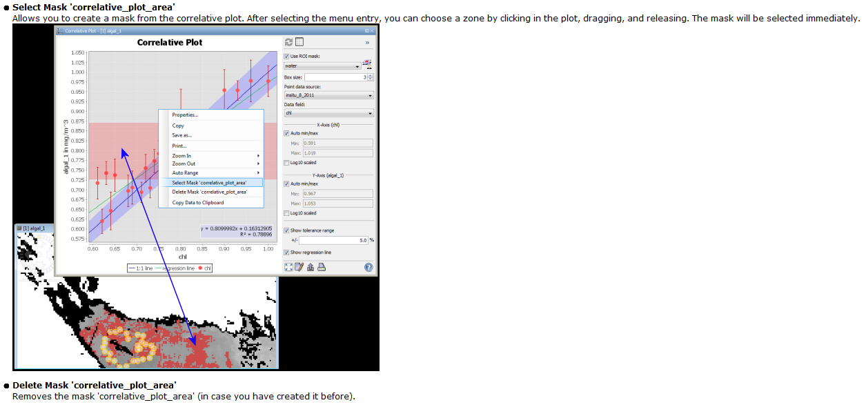
How to use Correlative Plot( analysis tools) for analysis?
please give work flow…
Thanks
Thanks…
I want to use sentinel 1 of 2018 and how can i compute height information from it?
can you please specify ‘height’ a bit?
Where is your study area?
I want to estimate forest biomass using height information from sentinel 1 data,can you help me the steps please?
Estimating the height of vegetation is extremely complex.
Classical radar interferometry is able to measure height of the terrain (as done by the SRTM or TanDEM-X missions). A very nice example using Sentinel-1 data is given here
These principles won’t work for vegetation bodies because phase information decorrelates with subtle changes of a surface within a short time. This is especially the case for vegetation (growth, movement, ect…).
Height of vegetation requires the application of more advanced techniques, such as polarimetric interferometry (PolInSAR) or radar tomography, but these are not featured in SNAP. Furthermore, you need fully-polarized data (HH+HV+VH+VV) and Sentinel-1 is dual-polarized only (VV+VH).
Here is an example how vegetation height is retrieved:
- Estimation of Rice Crop Height from X- and C-Band PolSAR by Metamodel based Optimization
- Related topic in this forum: Canopy/vegetation height
Thank you for your reply and my intention is to estimate biomass of forest ,so is there other data or method which used for this purpose?
have a look at the topics in this forum:
What kind of forest and where? It is pretty certain that nothing will work over tropical or very dense forests. Also my guess is that 6-day coherence-data is needed in less dense forests, so your test area should be in Europe, at least for the time being.
it is around tropics in Ethiopia