I would like to use ALOS data for interferogram stack processing. For ALOS data, most of them can archive in Level 1.0 (RAW), and just a little provide L1.1 (SLC). I know that SNAP can only use SLC data, so I would like to ask is there any way to focusing ALOS RAW data to SLC in the format SNAP can input?
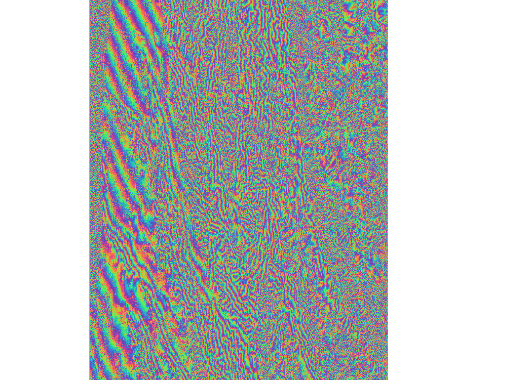
Otherwise, I found that there are systemic ramps in ALOS and ALOS-2 interferogram, like figure shows below
This image is from an earthquake event at 2016/02/06 in Taiwan.
I found that the ramps seem to correlate with spatial baseline,and could reduce by change the “Orbit Interpolation Degree” larger in Interferogram Formation step. After that, the phase caused by earthquake can be identified. However, it can’t be fully reduced while the ramps are too large, and the “Orbit Interpolation Degree” only can set up to 5.
Does the ramps in interferogram caused by perpendicular baseline?
Is it correct to reduce the ramp by changing “Orbit Interpolation Degree”?
With ramps can’t be fully reduced, does there have any solution? Can I set “Orbit Interpolation Degree” to number larger than 5? Or what parameter should I adjust?
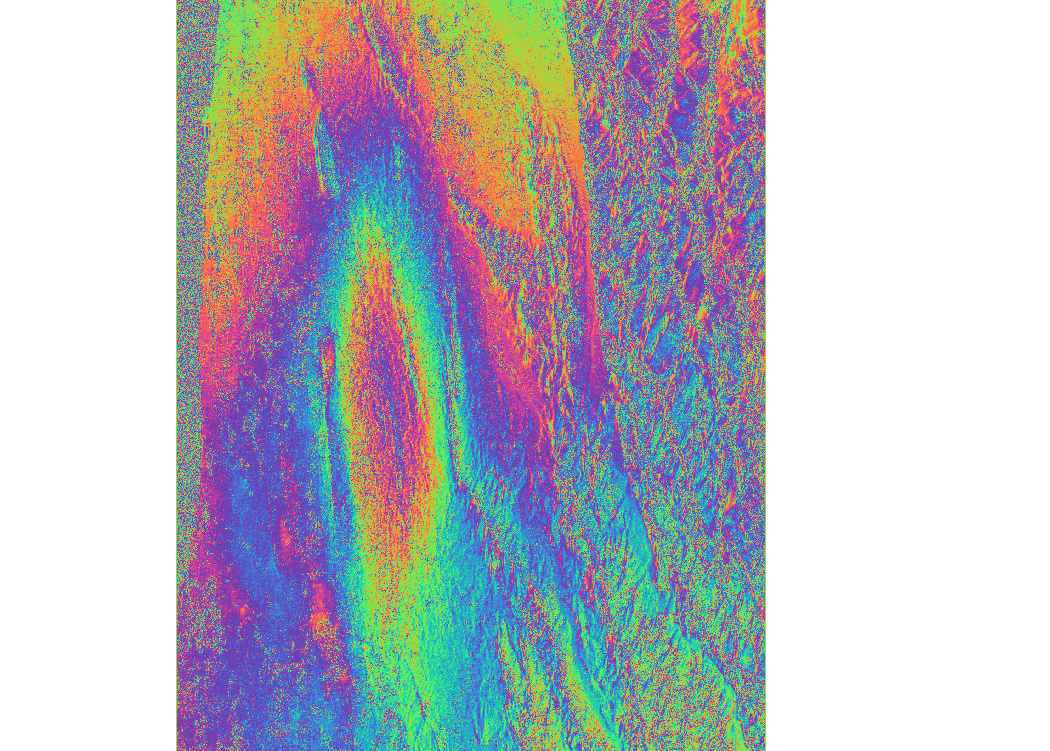
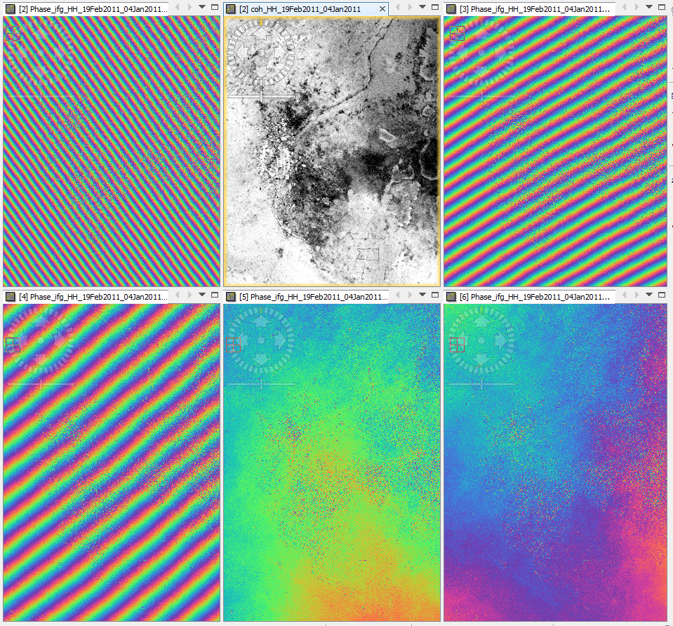
I tested this on my ALOS interferometric pair (perpendicular baseline ~ 330 meters) because I also always struggled with ramps in my interferograms.
These are the results with 1st, 2nd, 3rd, 4th and 5th order polynomial degree for the orbit information (second image is coherence) and I am surprised about the difference this parameter makes.
The notes in the help section might also be mentioned here but I really wonder why no one by now came to this idea because we saw many interferograms with bad ramps in this forum already (including mine).
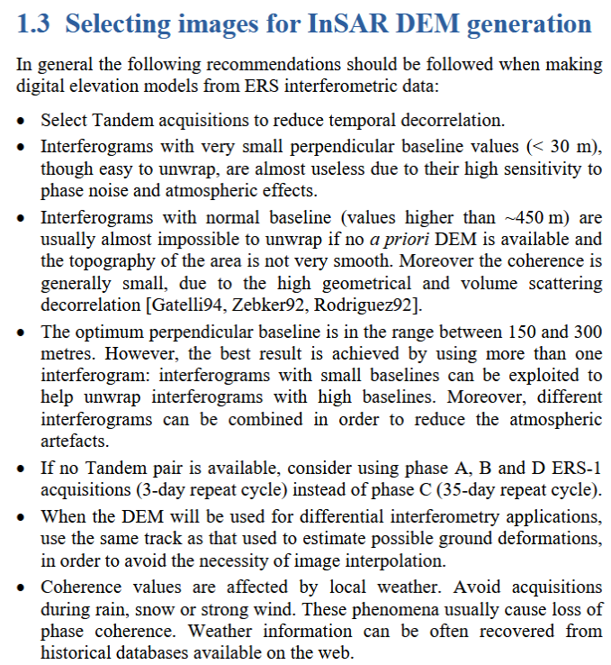
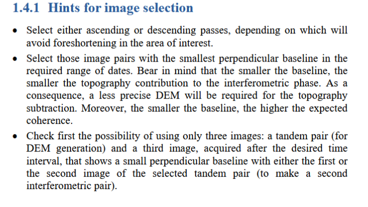
to add here: In some cases I found that if the perpendicular baseline is too small, there is no chance of ehnancing topographic structures or surface movement. This ESA document gives hints on how to get a good image pair.
I know ROI_PAC has additional function for ALOS L1.0 Data focusing, however, I can’t (maybe don’t know) use the focused data in SNAP. If it is possible, could you provide some tips to me? thanks
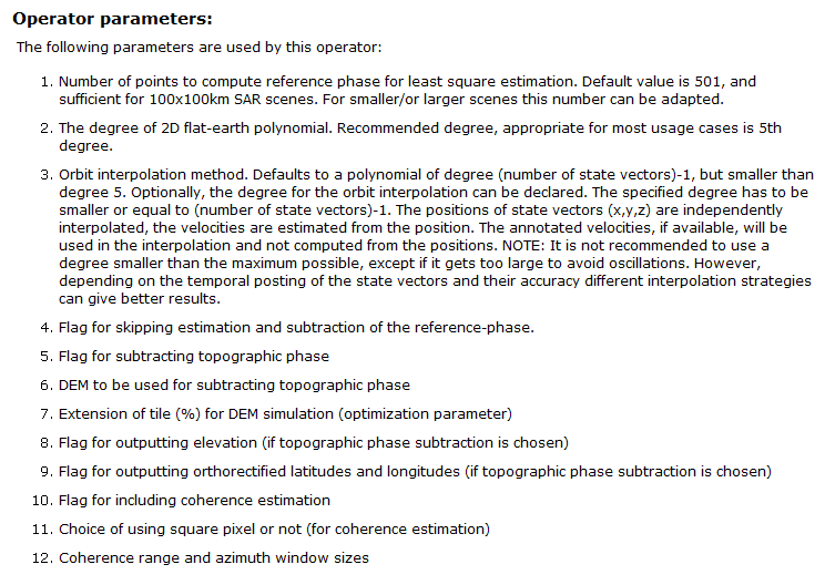
Could you please clarify whether the interferograms presented in this post are the differential interferograms or the raw (flattened) ones? If it is the first case, did you perform interferogram flattening and topographic phase removal at one step or two steps? My question is whether “orbit interpolation degree” in the “interferogram formation step” should be the same as in the “topographic phase removal” tab.