Problems producing interferograms with ALOS

Hello there!
I’m trying to make a DInSAR interferogram in SNAP using a couple of ALOS PALSAR images level 1.1 FBD (HH and HV) ascending geometry with same path and frame.
The 2 acquisitions have a temporal baseline of 1 year (master: 2009/06/12, slave: 2010/06/15) and a perpendicular baseline of 2525m.
I downloaded them from the online service AUIG2 .

I’m a newbie for interferometry, and to produce the interferogram I followed these steps:

  1. Select the HH polarization
  2. Coregistration
  3. ALOS deskewing
  4. Interferogram formation
  5. Topographic phase removal (DInSAR)
  6. Filtering
  7. Terrain correction

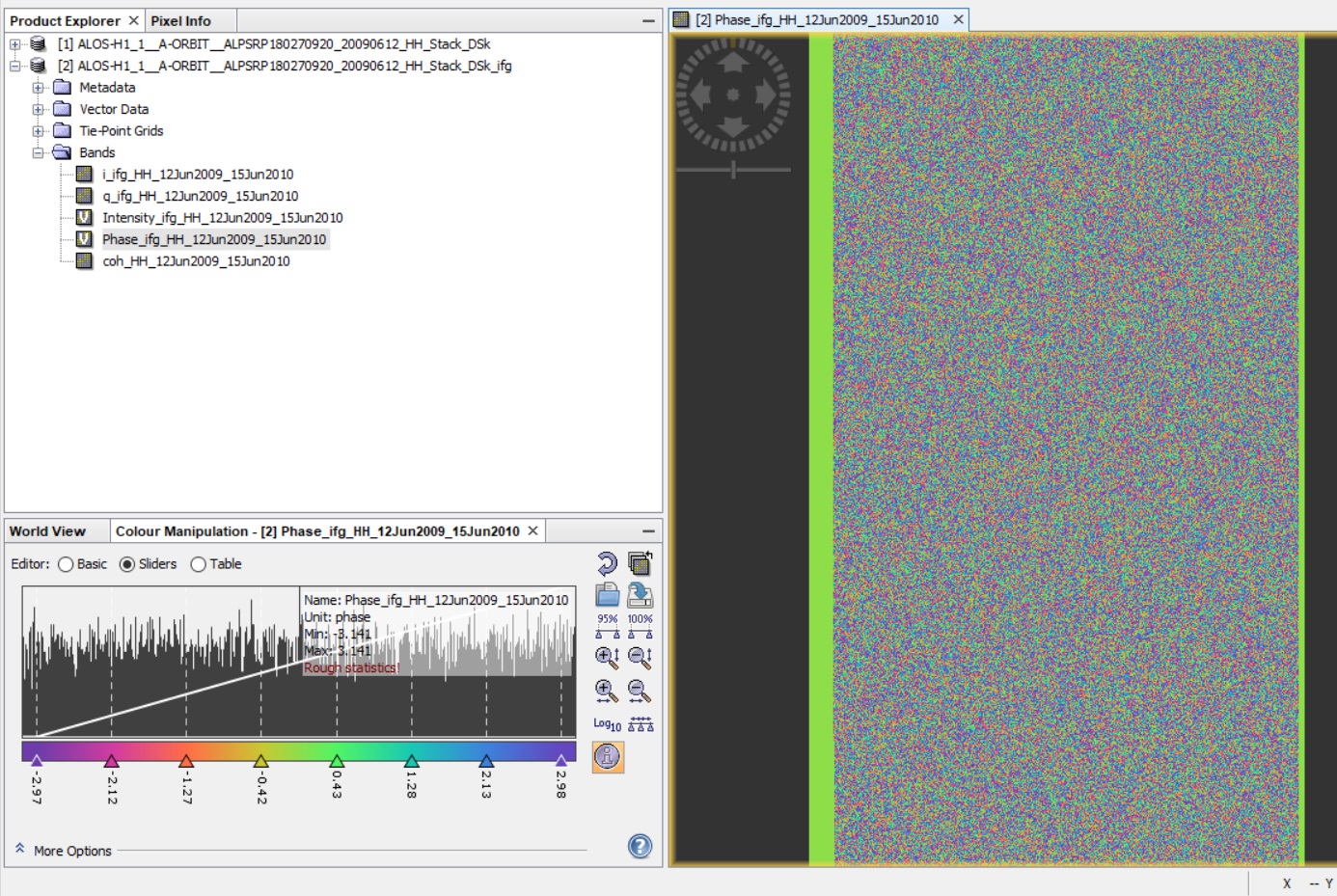
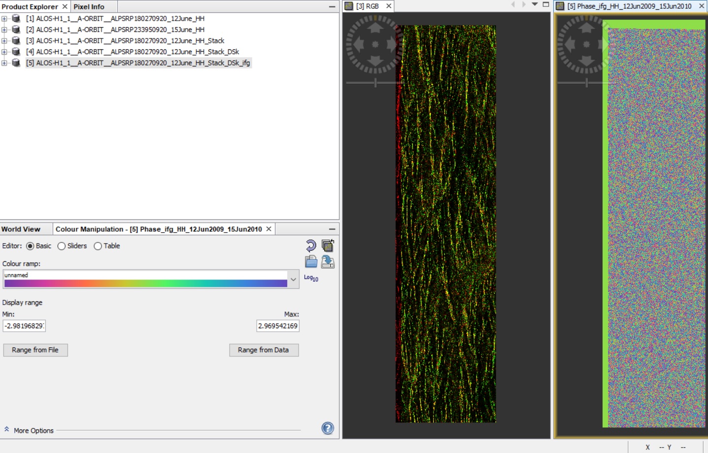
The problem is that when I produce the interferogram I only retrieve noise

I did other interferograms using sentinel 1 data and had almost zero problems… but now I’m stuck with ALOS.
Could anyone help me understand where I am mistaken?

Thank you in advance for your help!

1 Like

Are the intensity-bands well co-registered?

Hi mengdahl,
yes, they seem to be well co registered.
The intensity bands look like these

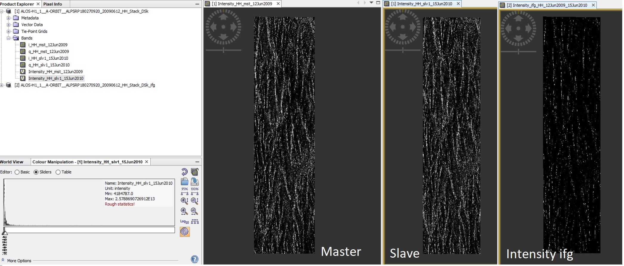
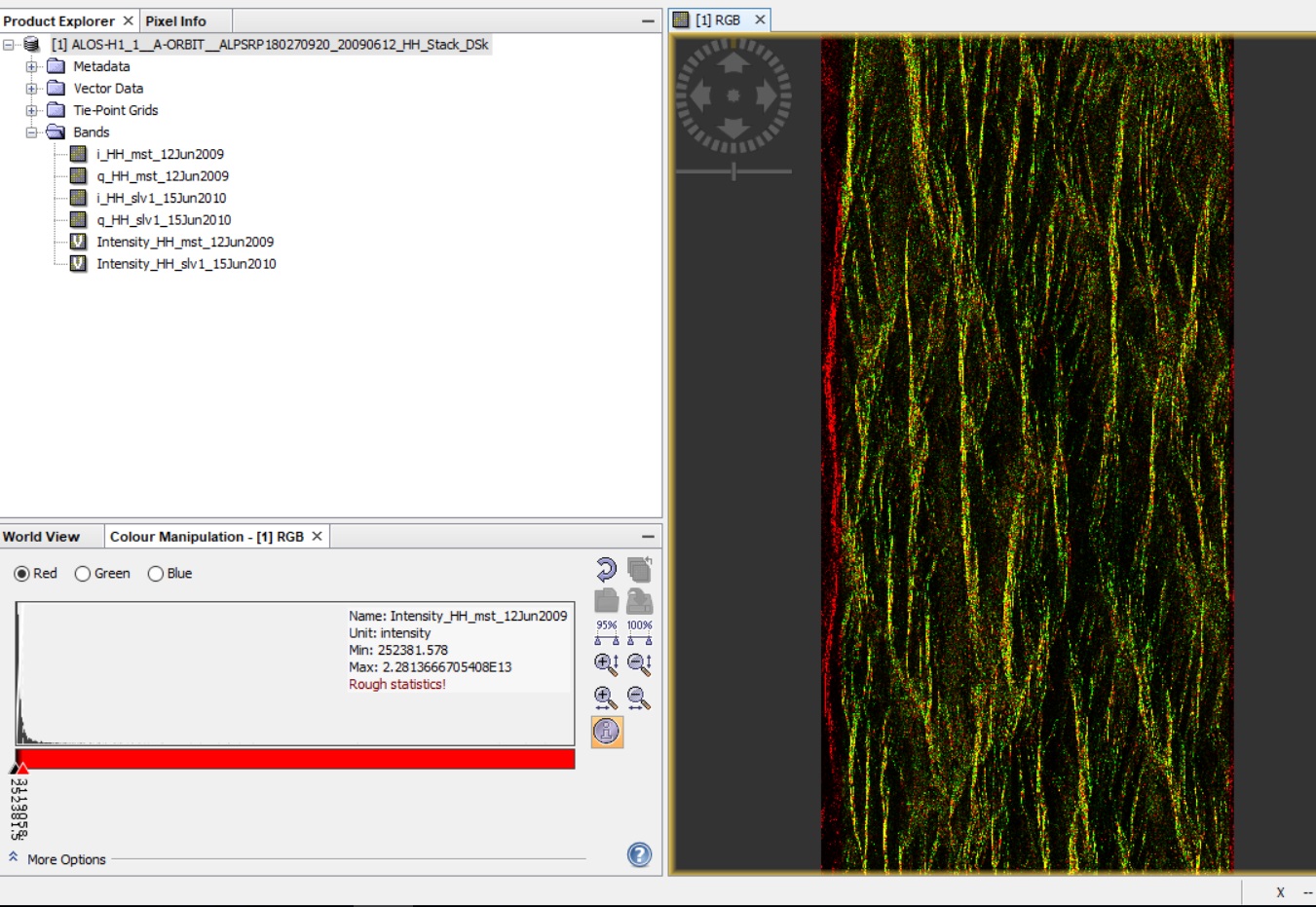
The first 2 images are the intensity bands for the master and slave images in the coregistration step and the last one is the intensity band after the interferogram formation.

you see it best if you create an RGB composite of the two bands. Right-click > Create RGB image. This overlays both scenes in red and green.

What are the dates of your master and slave image?

Hi ABraun,
I visualized as RGB image too and it looks like this:

the date of the master image is the 12th June 2009 and for the slave image it’s the 15th June 2010

thank you for your help!

the coregistration seems fine but maybe there is too much temporal decorrelation between both dates.

Have you already had a look at the coherence layer? It should be above ~0.3 in the areas which you are interested in.

Well actually coherence is very low, but I can’t figure out why.
Using sentinel data on the same area and for a similar time span (temporal baseline 1 year) the coherence was much higher.

Thanks a lot

Is the ALOS baseline very long by any chance?

The perpendicular baseline between these 2 ALOS acquisitions is 2525 m…

That is definitely on the long side given that your area of interest appears to have significant topography. Do you have access to a shorter-baseline pair?

Unfortunately for ALOS 1 I don’t have a shorter baseline pair.
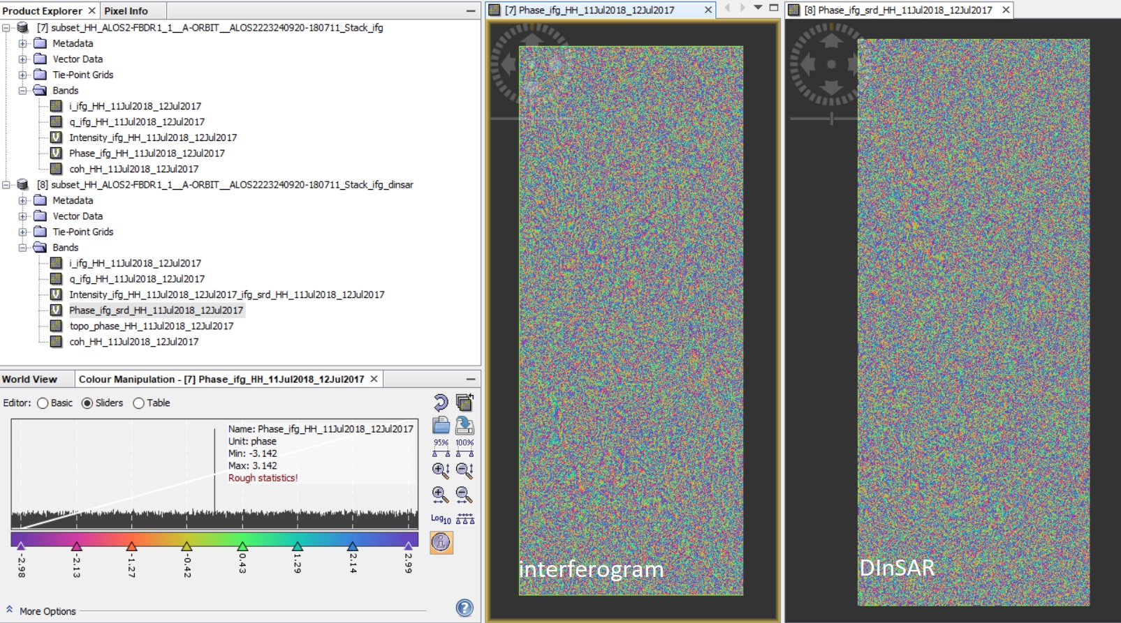
I tried to use ALOS 2 instead because for this one I have a pair with a spatial baseline of 368 m (but still 1 year of temporal baseline), but I had the same problem with the interferogram formation.

I really don’t understand where I’m doing wrong

Thank you for the help

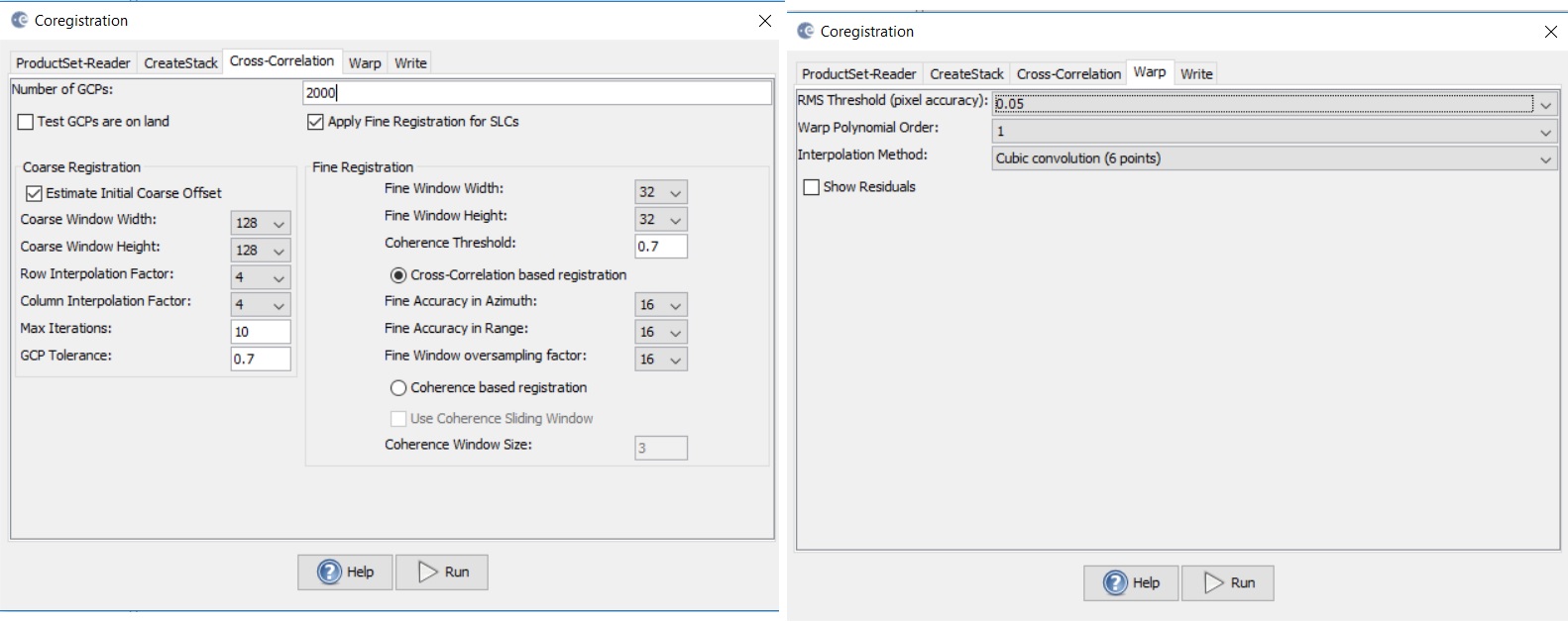
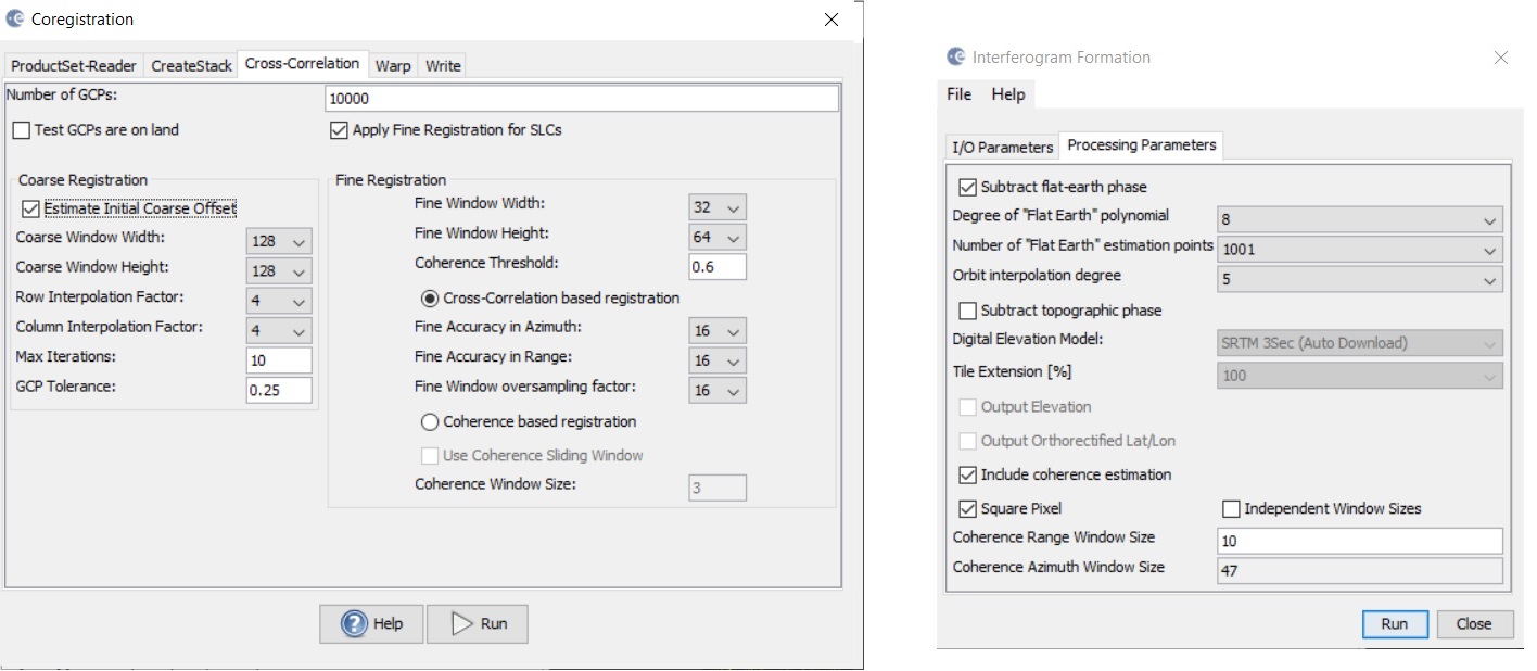
Can you please specify the parameters employed for the coregistration?
Or put here the xml (if any) you used?

I believe as well as @mengdahl that the coregistration needs to be improved. L-band normally has high coherence values. 2km baseline seems fine to me. It may reach even with 8km baseline if I remember my passed eperience with ALOS.

Let us know

Hi mdelgado,

these are the parameters I set for the coregistration step.

thank you for you kind help!!!

As mentioned on my post on 1st August on the thread: Interferogram from Alos palsar 1.1 data

Try to use lower coherence threshold and lower GCP tolerance.
I have used in the past these parameters:

Steps:

  1. Read master and slave
  2. Create Stack :
    extent: Master
    resampling type: Bicubic interpolation
    initial offset method: orbit
  3. Cross-correlation
    fineRegistrationOversampling: 16
    only GCPsonLand: false
    gcpTolerance: 0.25
    fineRegistrationWindowWidth: 32
    fineRegistrationWindowAccAzimuth: 16
    fineRegistrationAccRange: 16
    rowInterpFactor : 4
    InSAROptimixed: true
    ApplyFineRegistration: true
    fineRegistrationWindowHeight: 64
    columnInterpFactor: 4
    maxIteration: 10
    coarseRegistrationWindowHeigth: 128
    numGCPtoGenerate: 10000
    coherenceThreshold: 0.6
    coherenceRegistrationWindowWidth: 128
  4. Warp:
    interpolationMethod: Cubic convolution (6 points)
    warpPolynomialOrder: 1
    rmsthreshold: 0.05
  5. Interferogram:
    substractFlatEarthPhase: true
    srpPolynomialDegree: 8
    srpNumberPoints: 1001
    orbitDegree: 5

Please try with this and let us know. I hope this helps
Cheers

3 Likes

thank you for your time and help!
I tried using the parameters you suggested

but the result was almost the same

Can you tell us give us some more info about the filenames?
I may try to process it if I might be able to get the data.
Let us know.

Thank you so much for your time!

the 2 files name are:

0000230545_002001_ALPSRP180270920 --> acquisition date 12 June 2009
0000230545_001001_ALPSRP233950920 --> acquisition date 15 June 2010

sensor: PALSAR
path: 642
frame: 920
mode: FBD
geometry: ascending

Good morning everyone,
here the data I used.
https://drive.google.com/open?id=1et9Ss51WTfeDoeHi_8GwhUPv5smhNFh9

I downloaded them from Jaxa. Using SNAP I still have problems… is it possible that it doesn’t elaborate data from ALOS well? Has anyone used ALOS data successfully yet?

Thank you for your precious help
V.

one year a part will be too long especially in vegetated areas. Try with one two consecutive revisits (about one month apart)

Dear Vileda,

On other thread we have showed that it is possible to do DInSAR with ALOS data. Unfortunately with your pair, I am getting the same results than you.

I will keep trying and I suggest you to do the same.
Please the one who manages to get some result will write here a post.

@lveci, normally L-band should be able to make the work, but for sure @Vileda can follow your advice to see whether other results may come.

Cheers