Hi
I have corregister two SLC S-1 Images and then subset. Thereafter I did coherence estimation of subset image. But to have Terain Correction it require TOPS Debrust. But I am facing any error
" The specified region if not null, must intersect with image bounds"
Screen shot is enclosed
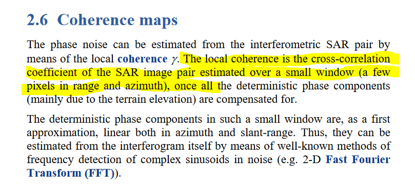
The right sequence of coherence estimations is as bellow,
1- Split, Select where is your AOI in which subswath IW1-IW2-IW3,
2- Apply orbit,
3- Back geocoding
4- Apply ESD
5-Coherence Estimation
6- Deburst
7- Multilooking
8- Range doppler terrain correction.
In the step of corr. and also the step T.C. please select SRTM dem 1sec,
Concerning the subset you could apply it after step 6,
Thanks for Help and kindly clear about step of Back Geocoding and ESD.
Should I have to backgeocoding of individual image to be paired for coherence estimation?
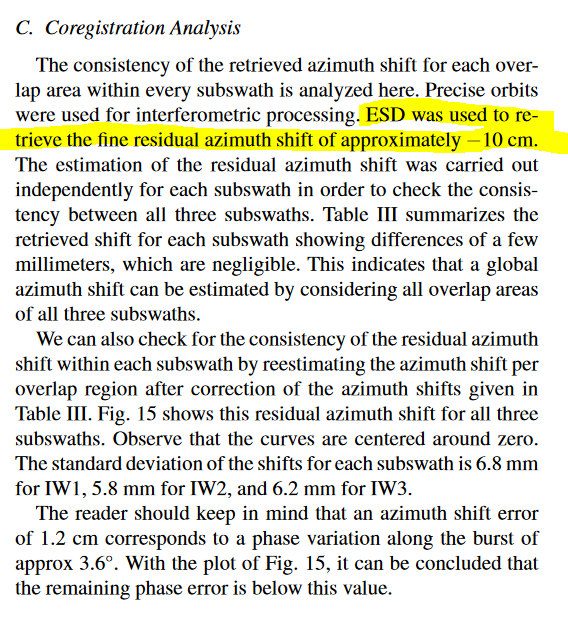
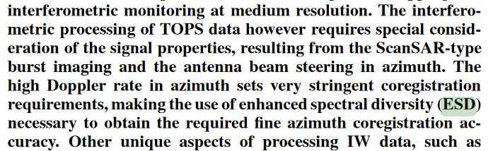
Secondly ESD is one which is used for co registration of pair images?
Basically back geo-coding is co-registers of the two S-1 SLC split products (master and slave) of the same sub-swath using the orbits of the two products and a Digital Elevation Model (DEM).
Thanks for your kind guidance. I just need your help to know about the chorence estimation. Actually I am estimating coherence of a glaciated area over a period of one year
My master image is from 04 July 2018
Slave image for pair on 18 July
Slave image for pair 2 is 04 August
Slave image for pair 3 is 11 August
I just want to look into deformation in that area during these months using coherence so I need your guidance in this regard
I did guide @najamsyed to the previous thread, because of his above comment in the previous post, and I think he wont intend to create interferogram, so the coherence estimation is his final step.