Hello,
I am currently experiencing a problem with the Sentinel 1 data on a region that I am currently studying (Reunion Island), it is in the southern hemisphere and I can not re-project the data on SNAP. Could you help me?
I have already tried to change the type of capture (ascending/descending) but nothing helps. For information I try to obtain the data concerning the winds that cross the island in.shp to be able to exploit it on Qgis.
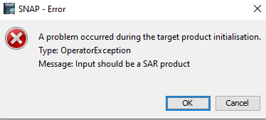
The reprojection on the RG92/UTM 40S - EPSG2975 does not work I have an error message that appears.
I can provide screenshots if needed.
Which steps were applied tot he data so far? Actually, if you follow these steps and select the required coordinate reference system in Range Doppler Terrain Correction, it should work without additional reprojection. Proceedings | Free Full-Text | Sentinel-1 GRD Preprocessing Workflow
So I won’t be able to use them in GIS software like Qgis ?
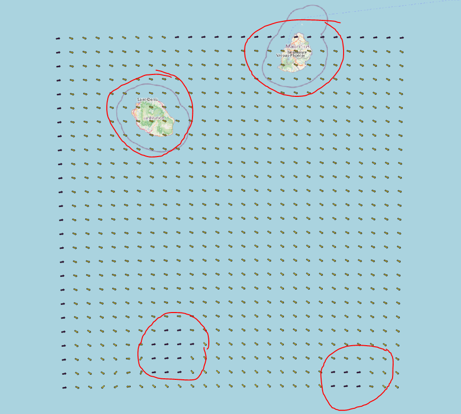
I just need corresponding data on this canva
Where both entities at the bottom are over those two Island is there any software who can handle that ?
I often encounter this when importing data in R, but can “flip” the images using matrix manipulation. The QGIS community is much larger than the SNAP community, so posting in a QGIS forum may be more helpful. You should provide access to a small sample data set that illustrates the problem so people can duplicate the issue without investing a lot of their time.