measure soil moisture in your study area at the time when the image is acquired and locate the meastrements by a GPS device, for example.
Yes sir, I have these data
But i don’t know how to import these data to SNAP
Why not try this one - https://land.copernicus.eu/global/themes/Vegetation . This is verified product.
For SHP files import just do File->Import->VectorData->ESRI Shapefile
Hi @hriston_bg,
But when I search Surface Soil Moisture, I don’t find my study area because Spatial information is only in Europe
Hi @ABraun, how to use the correlative plot?
@Andiray I didn’t know that your area is outside EU. Sorry.
Hi @hriston_bg, thanks for your response.
@Andiray You may try Vegetation Condition Index as a proxy for SM.
The global product is here - https://land.copernicus.eu/global/products/vci
First you need a shapefile with numerical values (hoehe_cm in my case)
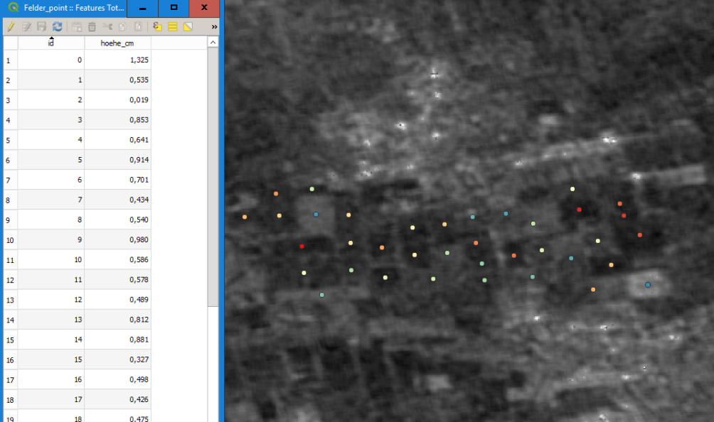
Load it into SNAP and overlay it with your SAR data
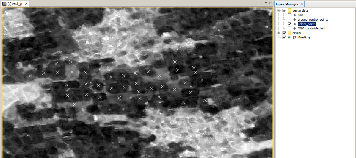
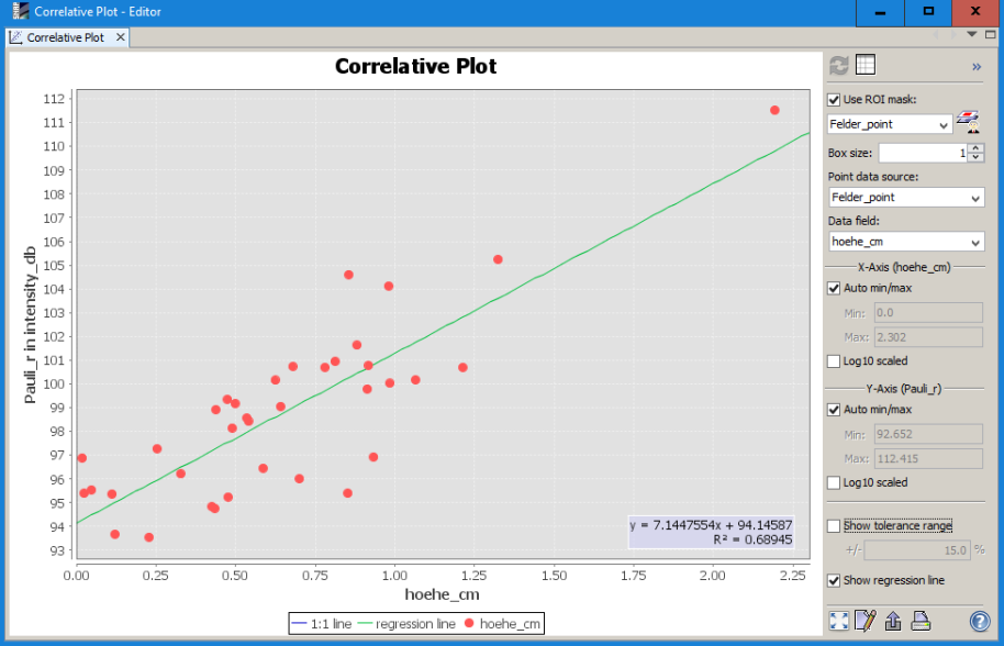
Then open the correlative plot view ![]()
Select the point shapefile and the attribute and correlate the raster values with the point information
1 Like
Hi @ABraun, how to make this shapefile? I only have ground data but I don’t know how to make it to shapefile.
I have coordinate point and value of soil moisture in ground data. I’m so sorry. I don’t have basic in SNAP
Thanks
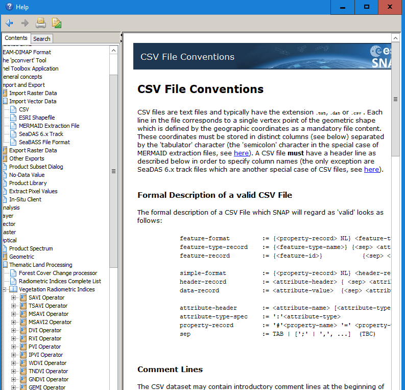
SNAP can import csv files when they are formatted correctly.
If not, load the coordinates (and moisture attribute) in a GIS and export it as a shapefile. There are lots of tutorials on this around.
Okay sir @ABraun, I will learn about it
Import of CSV files into QGIS: https://www.qgistutorials.com/en/docs/importing_spreadsheets_csv.html
Import of CSV files into SNAP: Import CSV File

I have correlative plot now.
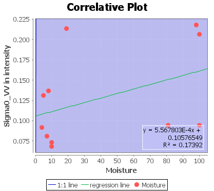
whether this graph is true to soil moisture validation?
My step backscatter is:
- Multilooking (4:1)
- Calibration: Sigma 0
- Speckle Filter : Gamma Map
- Terrain Correction
Does it only at this step? Shouldn’t I find its polarimetric decomposition?
Regards
R²=0.17 means that you can currently only explain 17% of the variations of both variables by the each other. For statistically valid predictions you need probably more measurements and higher R² (0.5 and above).
If you have the chance for polarimetric decomposition, you can correlate the moisture with new rasters and see if their predictive value is higher. But Sentinel-1 is dual-pol only.
What kind of new raster can i use sir?
Can’t I use sentinel 1 _SLC for calculate Polarimetric Decompotion?
Apply Orbit file>>Calibrate>>Tops Deburst>>H/A dual deccomposition.
yes, this is probably the only one which works for Sentinel-1. Then you can correlate each band with the moisture. I would also try VH as well.
When I do step Apply Orbit File, why in https://qc.sentinel1.eo.esa.int/ is not provide update POEORB?
what do you mean?