you could try to find ENVISAT data here: ESA - Online Dissemination - Homepage
Can Snap software process Envist satellite images?
yes, it’s fully supported.
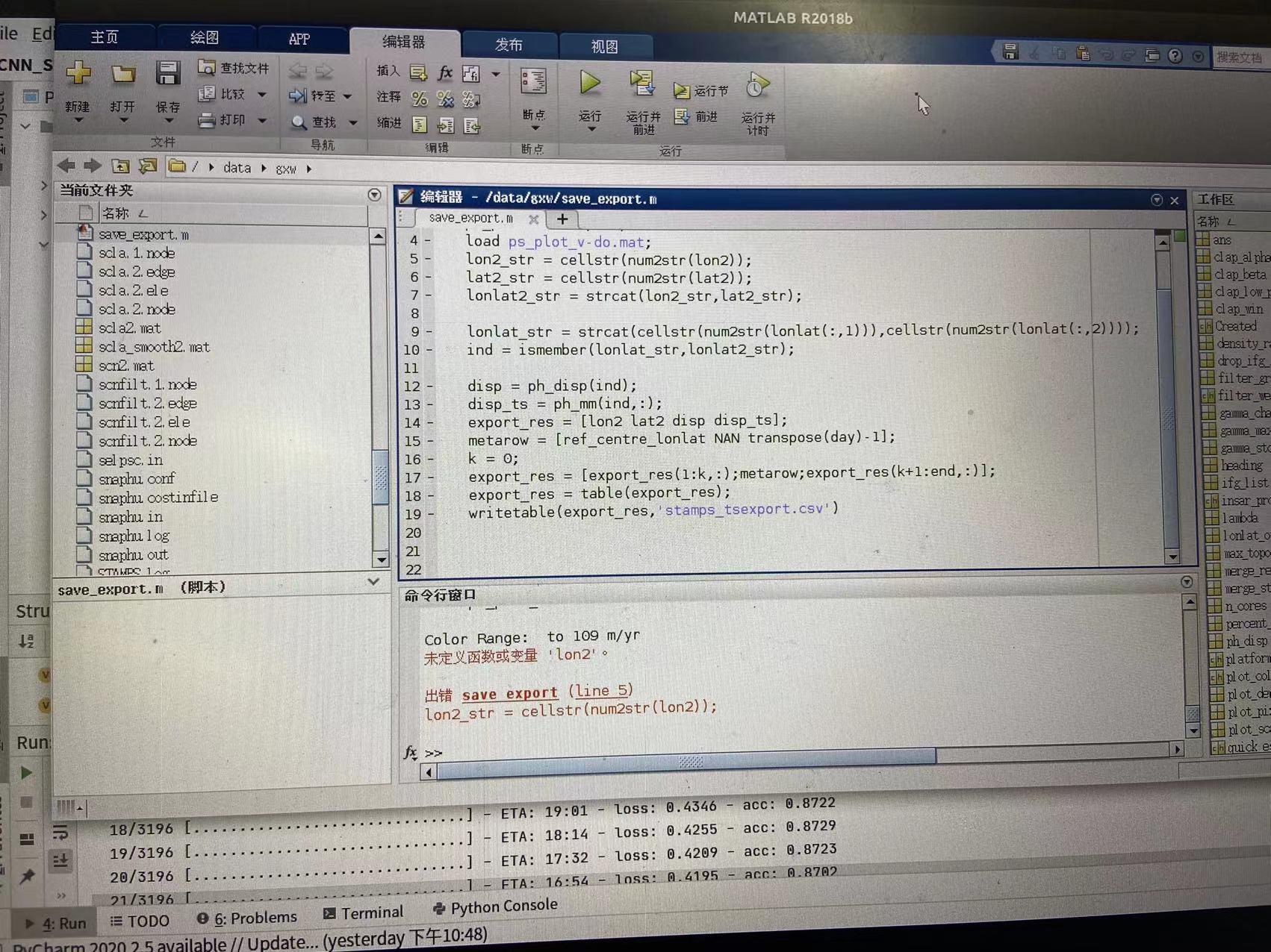
I got an error when exporting the csv file. The reason is that the lon2 and lat2 variables are not defined. I checked my directory and it did not appear lat2 and lon2, so I would like to ask you how to export the resulting deformation rate graph
Just follow below commands,
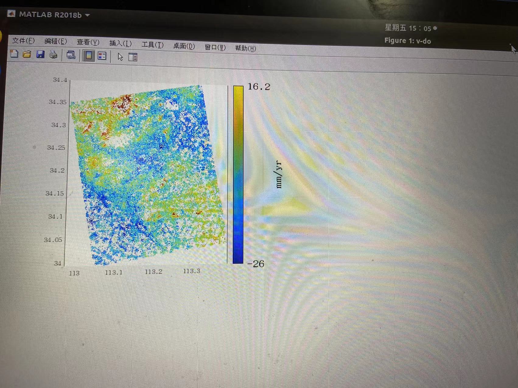
ps_plot(‘v-do’,‘ts’)
Then select the maximum area, and select reference lat long by click on plot (selected point should outside our study area).
Then use these below steps,
% the 'v-do' parameter is an example you can change it to your needs
ps_plot('v-do', 'ts');
% a new window will open
% in the new window select a radius and location of the radius center to select the PS to export
load parms.mat;
% the 'v-do' parameter is an example you can change it to your needs
% but be sure that you use the same paramters as above in the ps_plot()!
ps_plot('v-do', -1);
load ps_plot_v-do.mat;
lon2_str = cellstr(num2str(lon2));
lat2_str = cellstr(num2str(lat2));
lonlat2_str = strcat(lon2_str, lat2_str);
lonlat_str = strcat(cellstr(num2str(lonlat(:,1))), cellstr(num2str(lonlat(:,2))));
ind = ismember(lonlat_str, lonlat2_str);
disp = ph_disp(ind);
disp_ts = ph_mm(ind,:);
export_res = [lonlat(ind,1) lonlat(ind,2) disp disp_ts];
metarow = [ref_centre_lonlat NaN transpose(day)-1];
k = 0;
export_res = [export_res(1:k,:); metarow; export_res(k+1:end,:)];
export_res = table(export_res);
% you can specify the location and name of the .csv export by renaming the second parameter
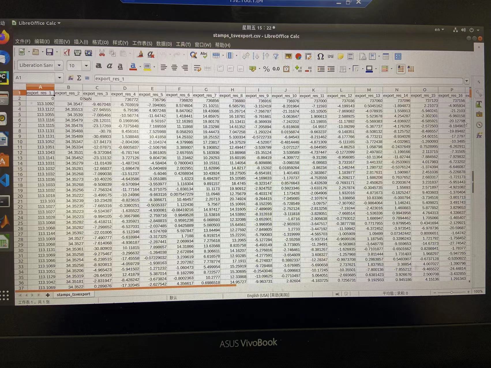
writetable(export_res,'stamps_tsexport.csv')
1 Like
Thanks for your reply!!!,I will try it 
Dear suribabu,
when I run this script,it reported a error,which shows “NAN” is not defined
metarow = [ref_centre_lonlat NaN transpose(day)-1];
sorry,I mistake ‘NaN’ to ‘NAN’ 
Are you successfully completed all the steps upto stamps(1,8)?
Is it generating the time series plot?
please send me screen shot (error).
yeah,I have done all step in Stamps,and I don’t know what each line in the csv file means, and I don’t know how to visualize the results
1 Like
It’s looking good. You generated both velocity plots and time series. For better visualization @thho developed one tool. please find the below link
GitHub - thho/StaMPS_Visualizer: Shiny application to visualize DInSAR results processed by StaMPS/MTI
2 Likes
Thank you for your patient answer, I will try it later 
Can Landsat satellite imagery or Alsopalsar sensor be processed with SNAP? I need your help, please help if possible.
Both sensors are supported for SNAP, but only radar data (Sentinel-1, ENVISAT, ALOS) can be used for subsidence mapping. Have you seen the tutorials? Tutorials – STEP
1 Like
when I run ui.R script,it reported an error: there’re some trouble in loading shiny package,but I checked the package “shiny” successfully installed.I wondered how to solve this problem?
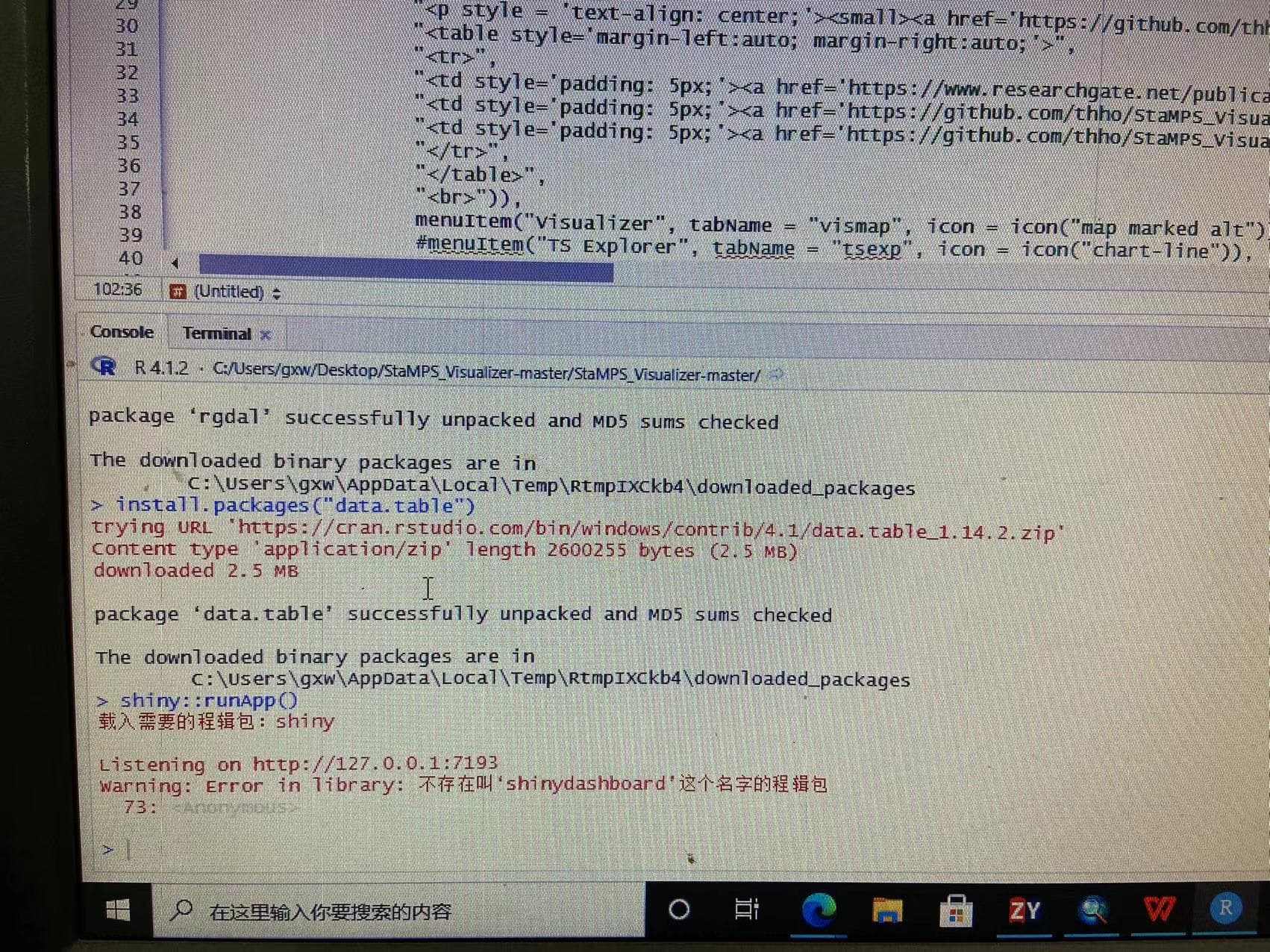
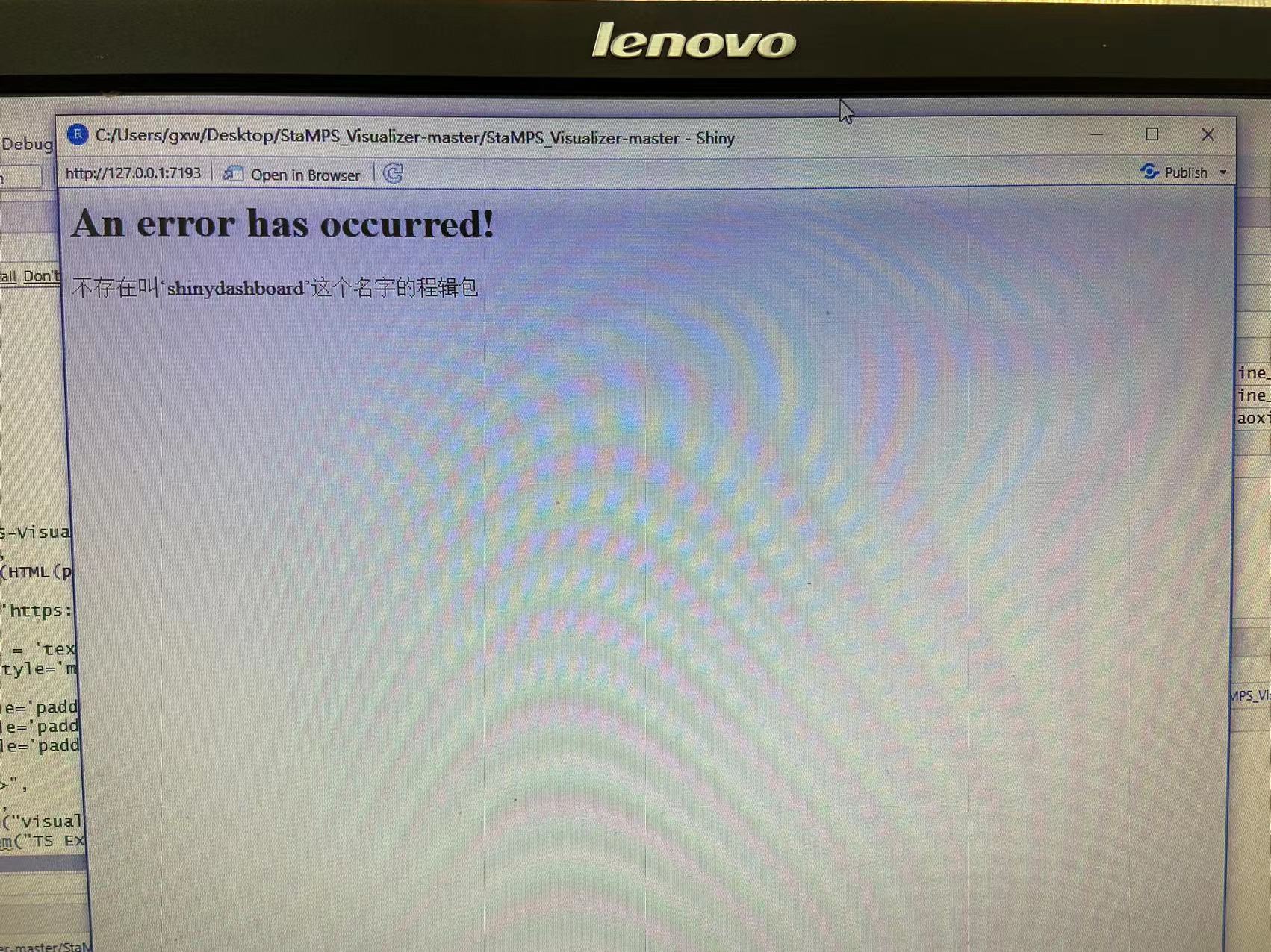
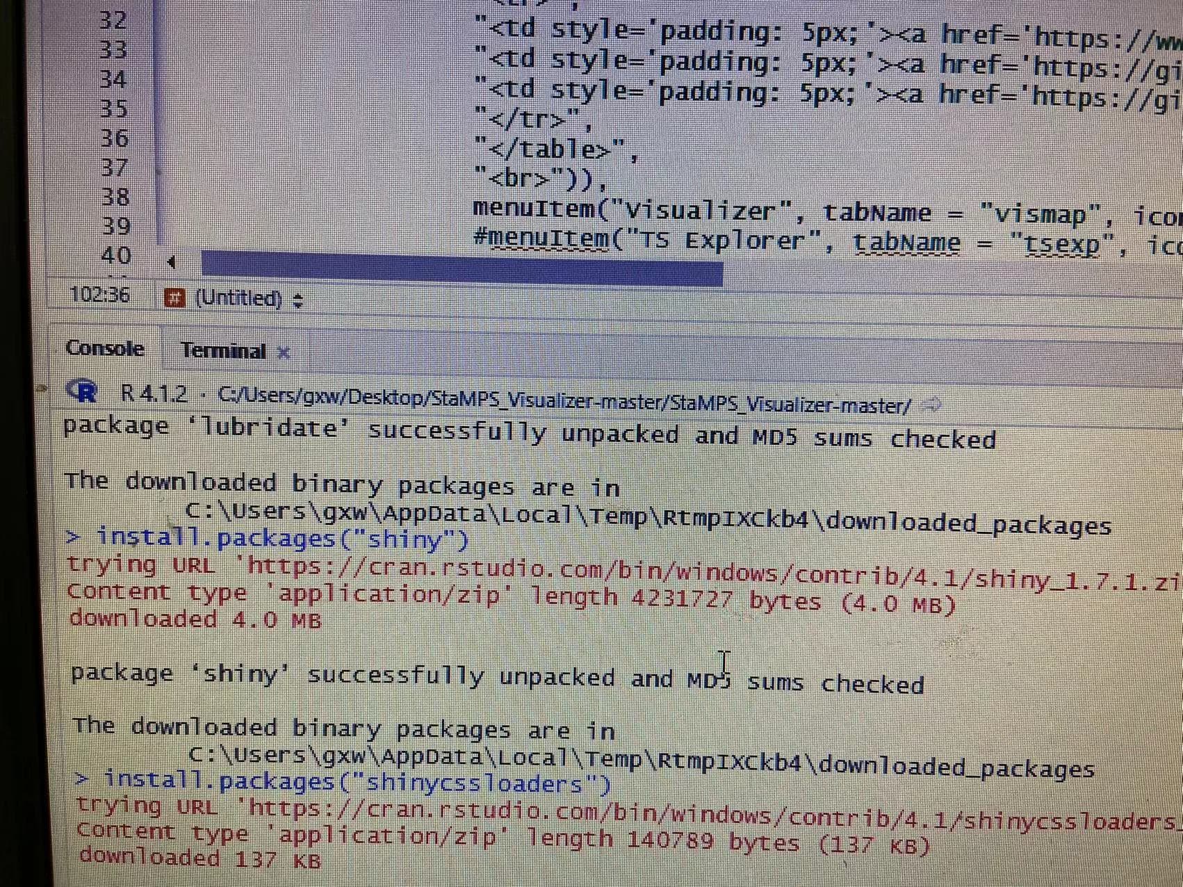
@xwguo Hi, to me it looks like the shiny package is not the problem but shinydashboard please check its installation too. Besides, I would highly recommend to install the Visualizer using the renv approach documented in the installation guide.
Dear thho,
thank you for your reply,I will try to use renv approach later
And I found another problem. When I increase the radius to select more points, an error will be reported as an error using horzcat.

do you use the latest version, and the latest export script provided by this repository?
thank you,I have run this script successfully and got a good result