I opened an issue at the plugin page. You can try telling too (:
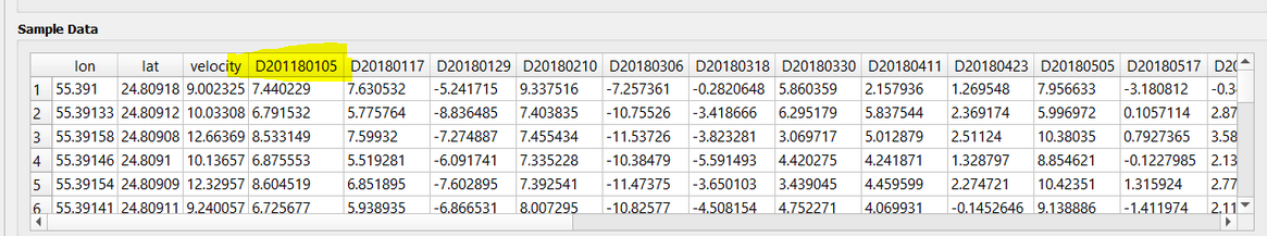
Yes, you are right, I gave the same names in different test folders, Sorry for that, but here is the entire formatted file,
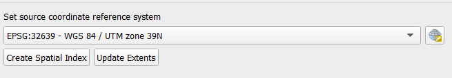
Your geometry CRS is UTM. Are you sure it is not WGS84?
The same error I got
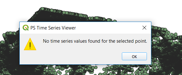
I now opened your data and can confirm that (same as volkan’s case) the data looks alright but somehow the tool does’t like it
To reduce the amount of data, I would still recommend a stronger weeding (increase the standard deviation). Many areas are unncessarily dense.Of course it depends on what you want to find but for the overall patterns, they look a bit too much to me.
1 Like
Yes sure, but why for me is still dislocated, what is the problem here?
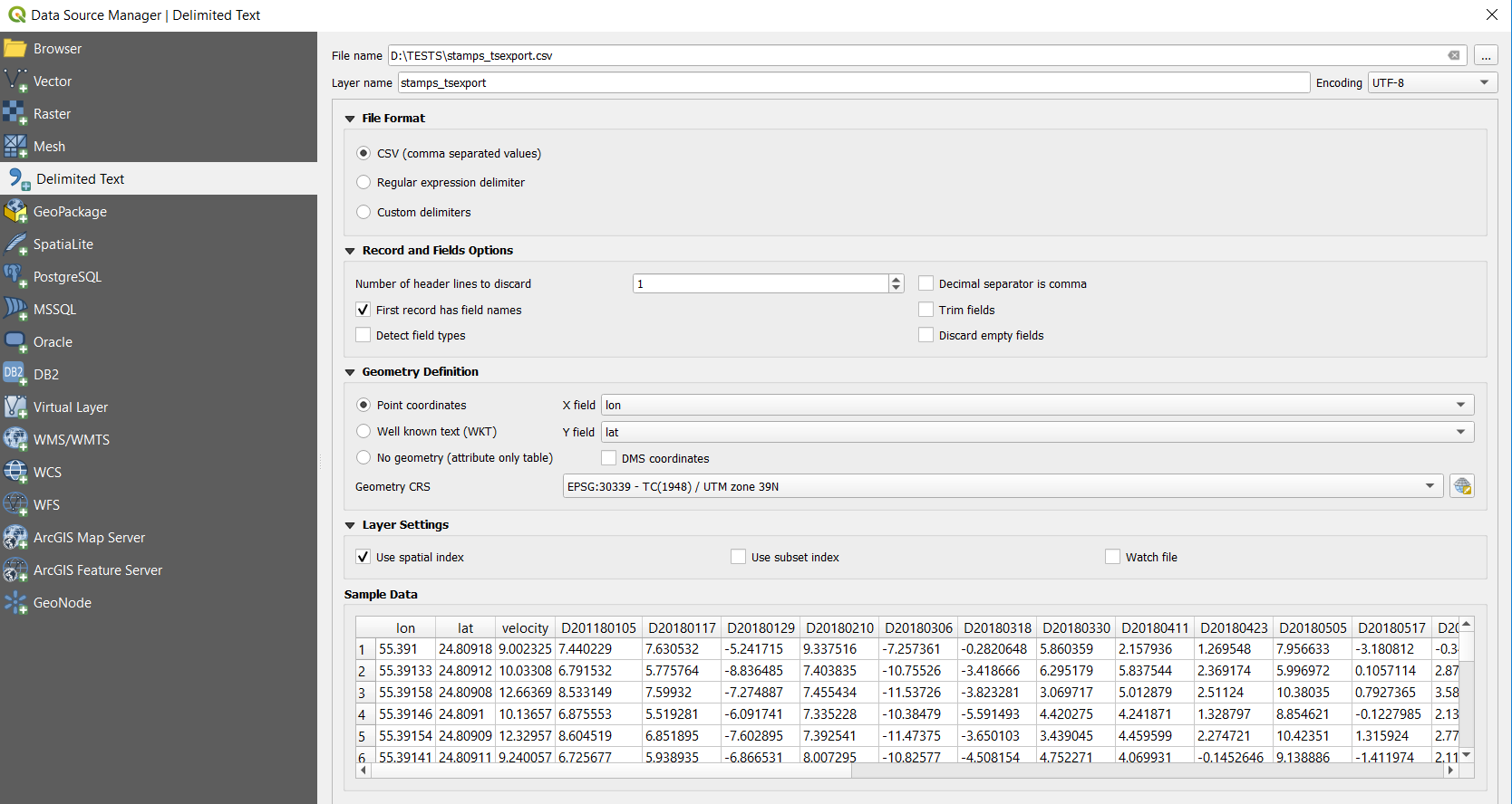
as Volkan suggested, you have to select WGS84 in the import because the coordinate units are decimal degrees. In your image WGS84 is only the geoid used for the UTM coordinate system which uses meters as spatial unit.
It is WGS, But still, the same error,
I am sorry, it is not.
WGS 84 / UTM zone 39N is not the same as WGS84.
The first is a projected coordinate system (with a given datum called WGS84), the second is a geographic coordinate system designed for a spherical surface. StaMPS puts out gegraphic coordinates in latitude and longitude. You have to select WGS84 (EPSG:4326) so that QGIS understands that the coordinates are decimal degrees. Once you have imported the data, you can export it in any reference system you want. But before that they have to be located at the right position.
Some good resources on this:
1 Like
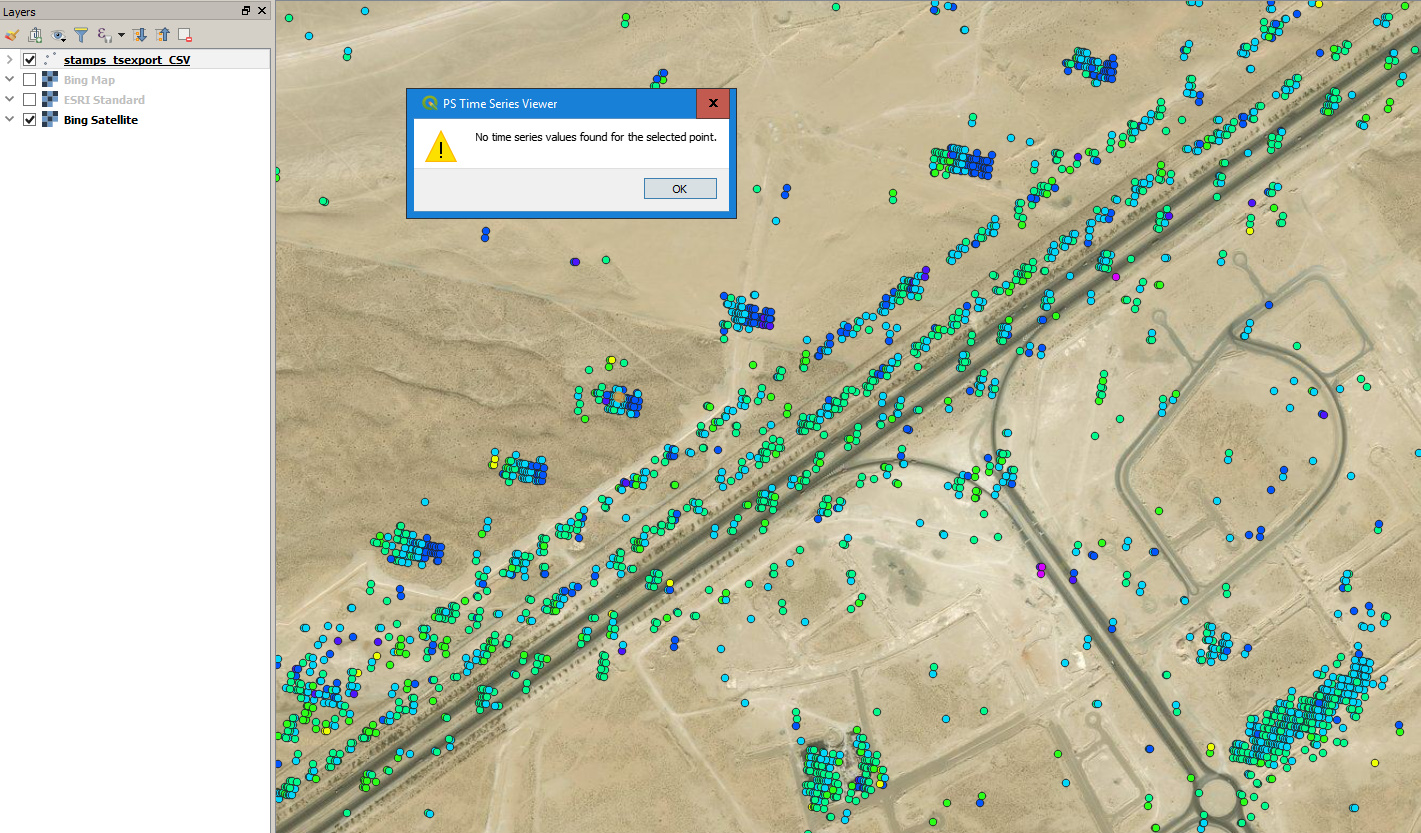
Using with ArcGIS, I solved the problem. @falahfakhri, please follow the steps:
- File/Add data/Add XY Data -> call the edited CSV file.
- Right click the filename and Data/Export/ select shp
Then open with QGIS. And use the PS Time Series Tool.
4 Likes
@falahfakhri, I have a question for you. Your exported CSV file is very big. How did you export it to CSV? Which code did you use?
@volkan the same as you, provided in the StaMPS/Visualizer manual page, but with a ts plot using a search radius which is huge 100000 or something. On the other hand, as @ABraun pointed out, there are, in addition to the huge search radius, very dense areas of PS…therefore the CSV becomes so large.
What just came into my mind reading your solution @volkan, it seems like, that the problem is somehow the way a shp file is generated by QGIS. In the troubleshooting part of the StaMPS/Visualizer manual page, is a R script which deals with spatial subsetting, thereby a spatial object is made out of the csv. I could easily provide a code where you can enter the csv file and get an output in shp format…you can then try if the QGIS plugin works with that…this way you do not have to do much extra manual steps, but can bind the script into your workflow…send me a “problematic” csv file and I will provide you with the code you can try.
1 Like
@thho When I enlarge the radius, I get an error at the export_res = [lon2 lat2 disp disp_ts]; step. So I cannot create a CSV file.
And yes, I think like you. The problem is probably is the way of creating shp in QGIS.
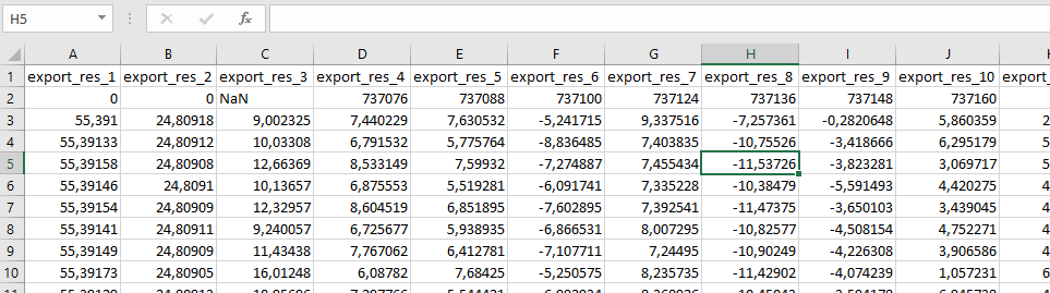
https://forum.step.esa.int/uploads/default/original/2X/0/036e61477eee08cd7cd4fcce3f1820b155172bb3.csv is my edited CSV file. You can work with it.
As @thho answered, and thanks a lot for the advice, I’ll give a try,
Hi Throsten,
I asked you here, would you please to to take a look if that possible,
@volkan have not tested the plugin, but it should work, concerning your error, please provide a step by step description until you come to this point and a screenshot of your matlab and all the objects within the environment panel to the right. Cheers
processed shp file
kitap1.zip (10.1 KB)
R script
shp_from_csv.R (1.2 KB)
1 Like
Hi @thho
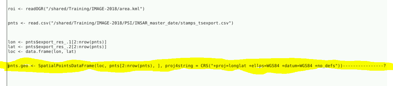
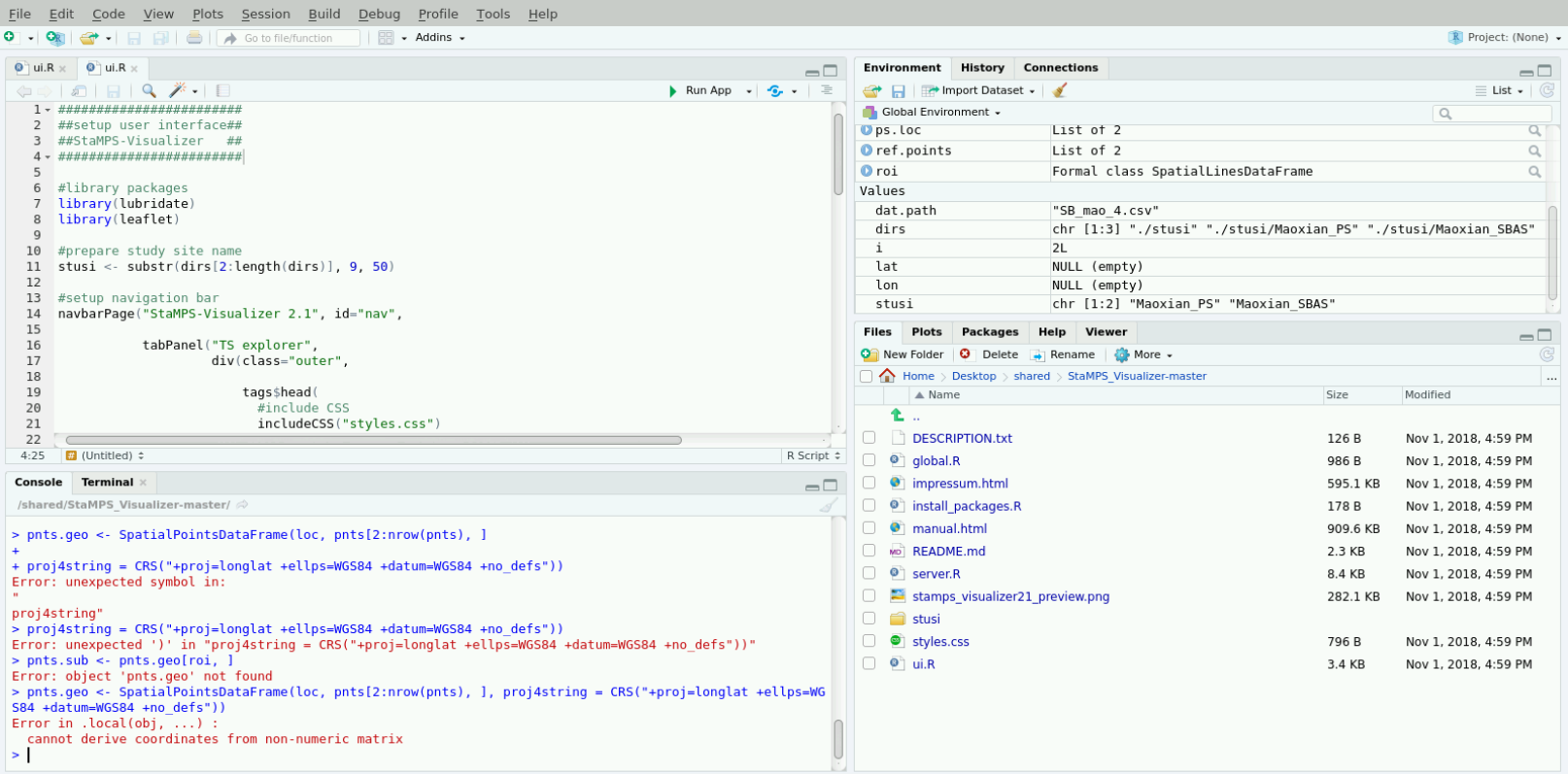
I’m now trying up to use R scripts to create small subset area, I did get this error, after applying the highlighted script