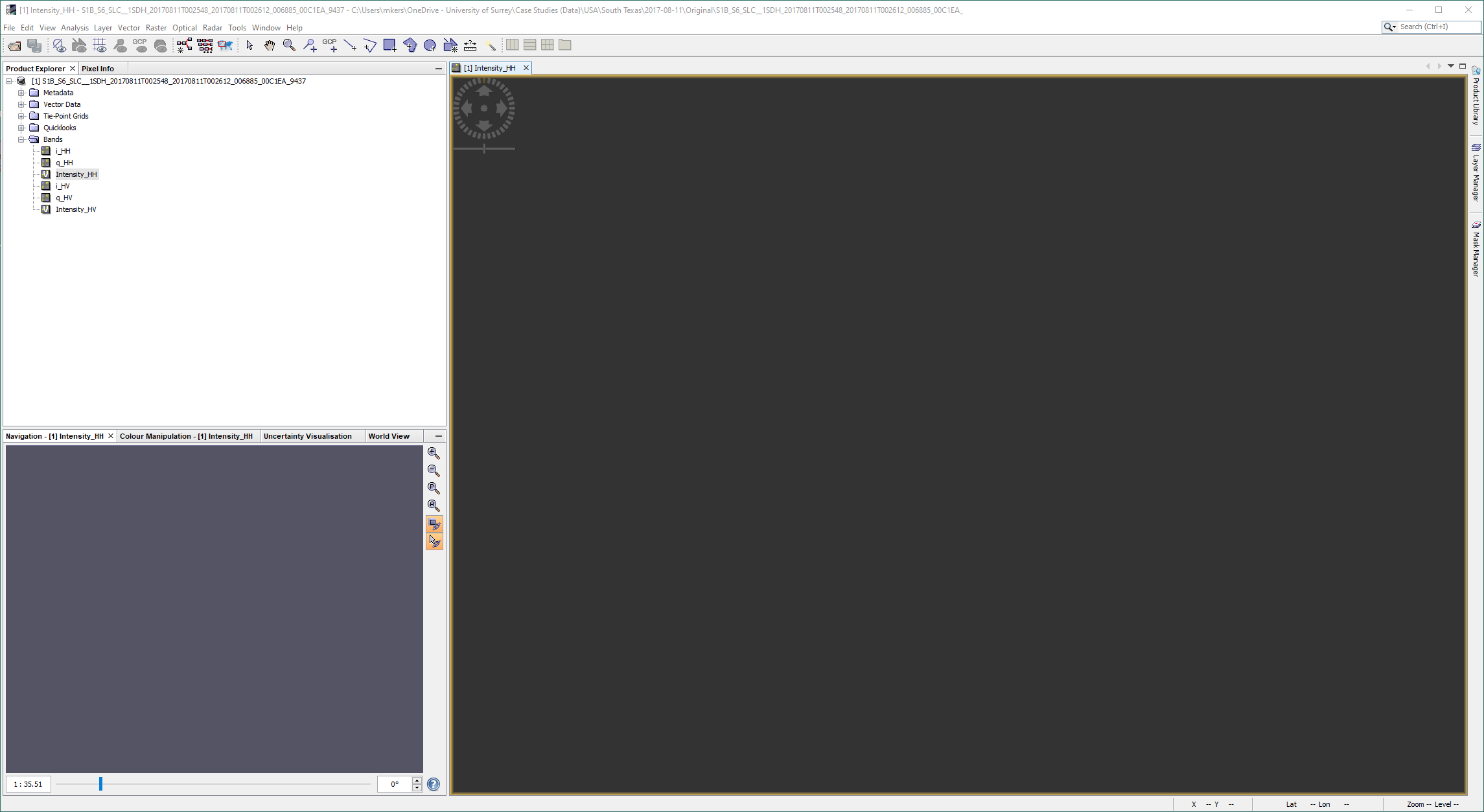
I just downloaded your product and tested it on my machine. I can confirm that the product is somehow corrupt and cannot be displayed in SNAP. I was not able to load it in ERDAS Imagine either, so I suspect that the file structure has somehow changed.
I remember working with S1 SLC SM products in SNAP, so this was possible at a time.
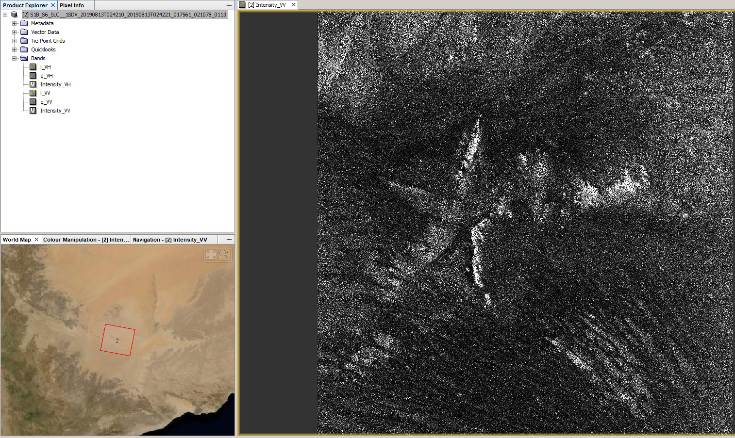
I’m particularly interested in the coastline near Houston, TX as I’m trying to extract the dimensions of SAR ship detections.
I’ve processed the GRD version of the same SLC product I’m having trouble with, but due to signature blurring/smearing the dimensions are significantly overestimated.
My idea is to process and multilook the SLC product myself to see if I can get a better estimate of these dimensions.
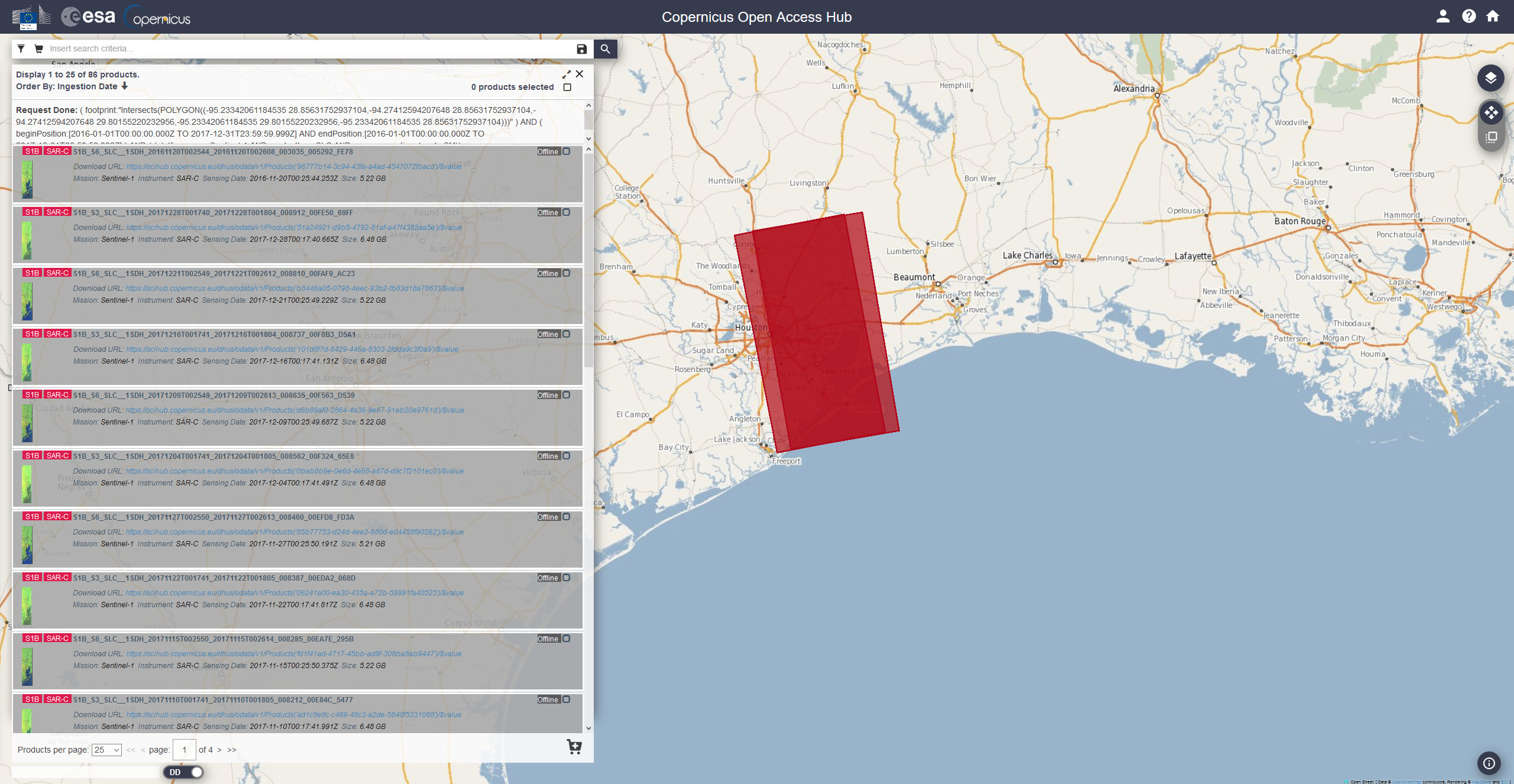
There appears to be many products so hopefully it’s only a few which are corrupted:
have you checked if you can apply radiometric calibration first so maybe the Sigma0 product gets displayed correctly.
As an alternative you can use the Land/Sea mask operator to mask out land.
I checked this product: S1B_S6_SLC__1SDH_20170811T002548_20170811T002612_006885_00C1EA_9437.SAFE
Yesterday it was not available (as archived) and I had to wait for unarchiving before completing the download today.
However, I tried to open it from another tool (neither Snap nor ERDAS) and it works fine.
I did not spotted issue with this product so far.
Maybe there was some kind of product corruption when you downloaded it first (during the initial unarchiving).
Could you please try to download it and open it again ?
I’ve re-downloaded the product from the archive but I still face the same issue.
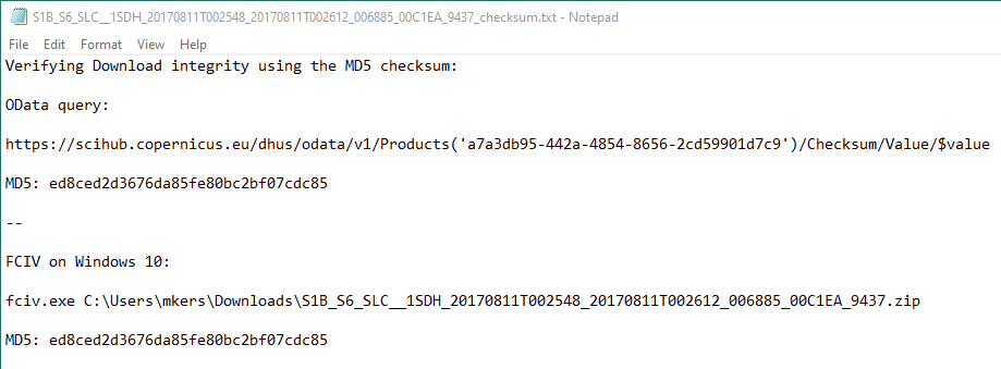
I’ve also verified the download integrity using the MD5 checksum (as described here). As you can see the MD5 of the product at the source and on my system are identical:
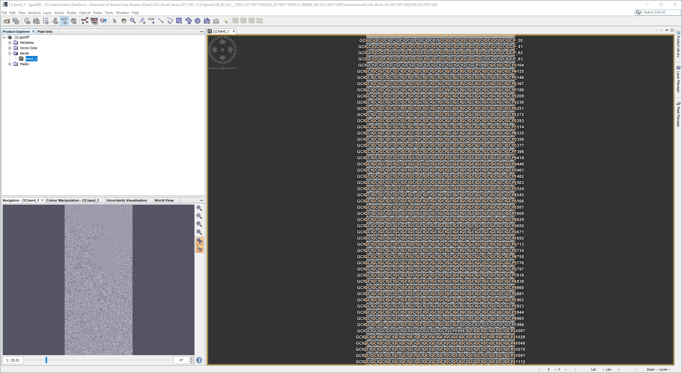
First: generate an intensity image with gdal opening directly the Tiff image. This works. Thus the data contained in the tiff is fine.
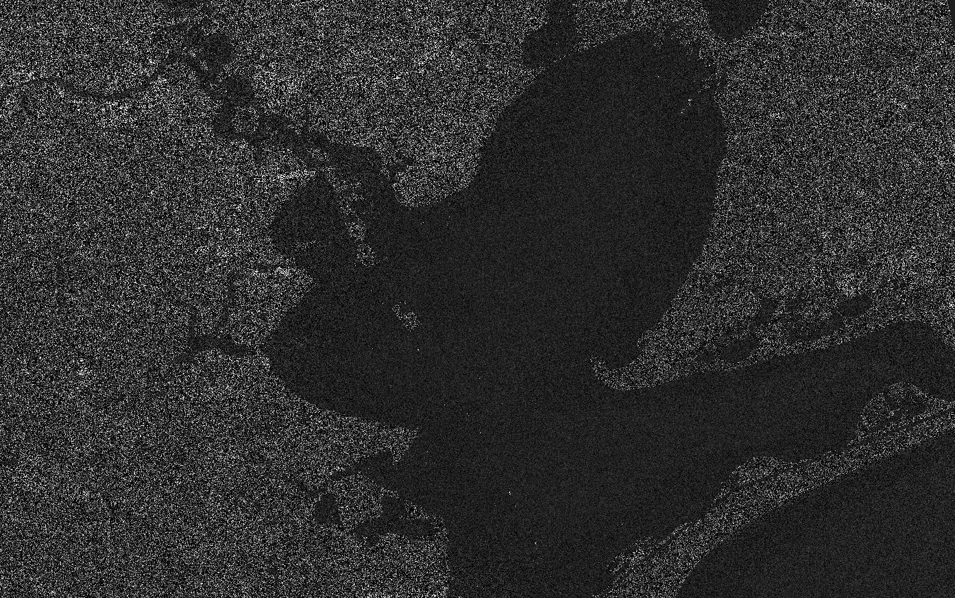
Below a snapshot of the corresponding intensity image (generated through gdal) and displayed in QGIS.
Please notice that there are some saturation as the intensity was computed as integer instead of float, thus introducing saturations (just a quick check).
Second: generate an intensity image with gdal opening the product and selecting the dataset (on polarisation or the other). This fails as all values are then 0.
However I don’t know the level of support of StripMap SLC for the Sentinel-1 driver in Gdal.
I crossed checked with SNAP and I have the same status as yours.
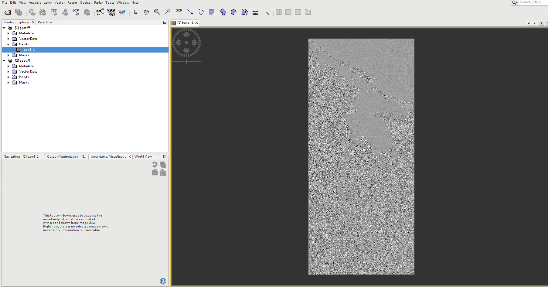
When opening the S-1 product, the intensity is 0 for all bands.
When opening the geotiff, the values are fine (see snapshot below after removing of display of GCP).
I think that there is something not properly managed by GDAL and SNAP between the tiff and the manifest. But I don’t know what. @ABraun: do you know if SNAP is using GDAL as a driver to read the data ?