As you might know, the back geocoding and topography removal operations can use external DEMs. These DEMS are supposed (correct me if I’m wrong) in geoTIFF format.
In these file first bytes contain metadata for image decoding but also for georeferencing. Many GIS softwares such as QGIS are able to read these images but also change the projection on the fly, if needed.
In my case, as it often happens when studying Antarctica, the default coordinate reference system is not WGS84 (EPSG:4326) but Antarctic Polar Stereographic (EPSG:3031).
Theorically, it’s not a problem for SNAP since though the projection is different, the pixels are well-geocoded.
However, I noticed that problems can occured (see one of my old topics -> External DEM - Not continuous topographic phase). With the new high resolution DEM for Antarctica (REMA), I wanted to give it a new attempt. Unfortunately, the same problems occured. I’ve got huge gaps in my study area.
If you encountered this situation, my advice is to reproject the image to create a new geotiff with a new default CRS (EPSG:4326). To do so, just drag and drop your geoTIFF in QGIS, right clic on the image and select “save as …”. Then, you select the “good” CRS, that is to say EPSG:4326. save the result as geoTIFF
This new file can be read and used by SNAP.
Here is the comparison between the two. The left image is the “raw” geoTIFF and the right one is the reprojected. The image is reprojected slave intensity after a back geocoding.
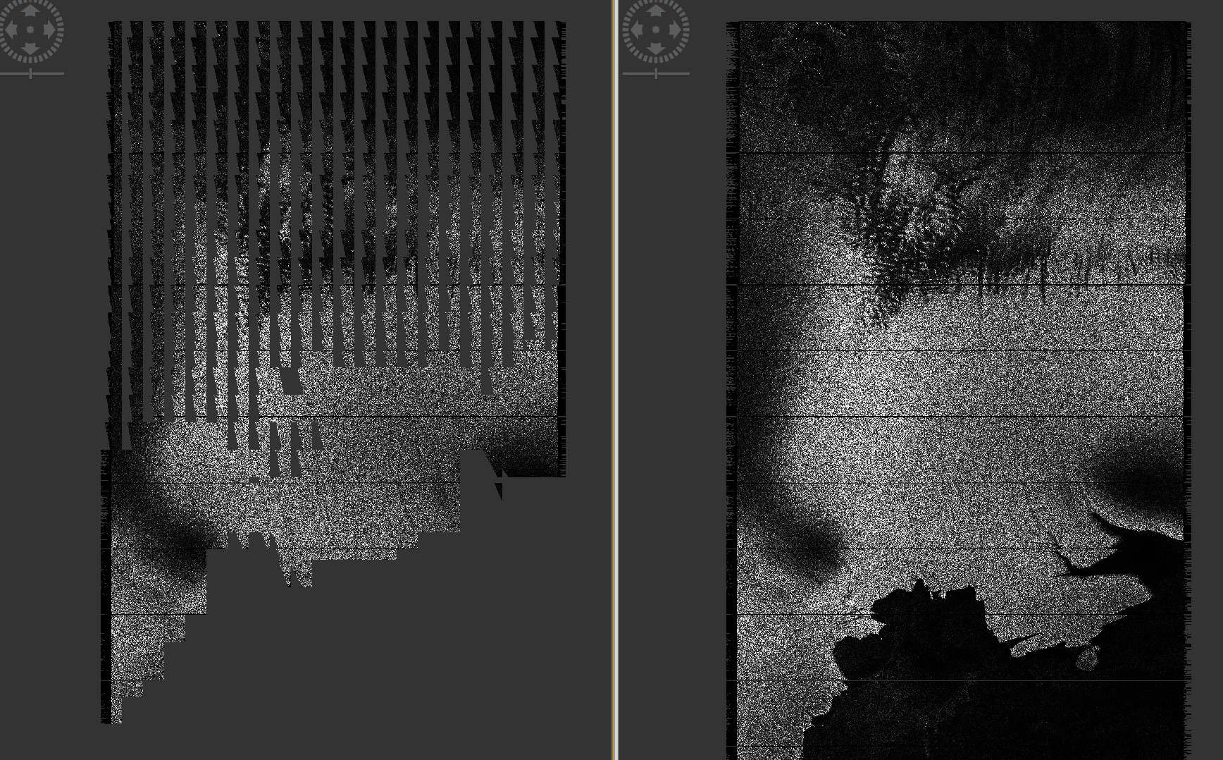
Although I created this topic to provide a solution for users that may encounter this problem, my guess is that any geotiff should work, as you can see that it partially worked with the “raw” geoTIFF. @marpet any ideas for this issue?


 Still I guess that SNAP tries to use the “raw” geotiff but cannot do it properly. I don’t know why