I want to ask for your help in solving a problem with geometric parameters. I would really appreciate if you can help me.
I would like to know if there is currently any way to have the value in degrees of azimuth and incidence angle. I have tried everything they have written on similar topics, but I cannot solve it (even in metadata).
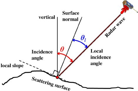
Sorry for not indicating it and thanks for your reply. At the moment, with Sentinel 1. what happens is that I review in metadata but the value of these (in degrees) is not indicated. The incidence angle (near / far) indicates 999999 and I do not know which to use, if the near or far in the case of having a correct figure. On the other hand, the azimuth angle is not indicated anywhere.
Thank you very much for your reply! Yes, I have tried to do that but I think it is an image problem. For the other question about the incidence angle, do you know where I can get that data in degrees?
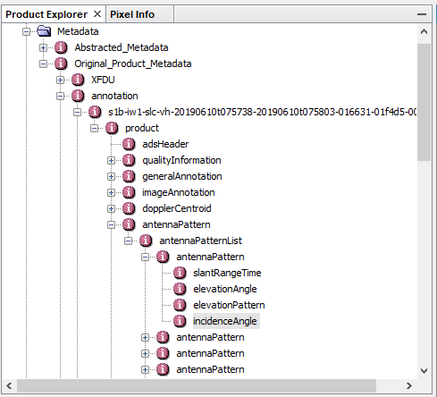
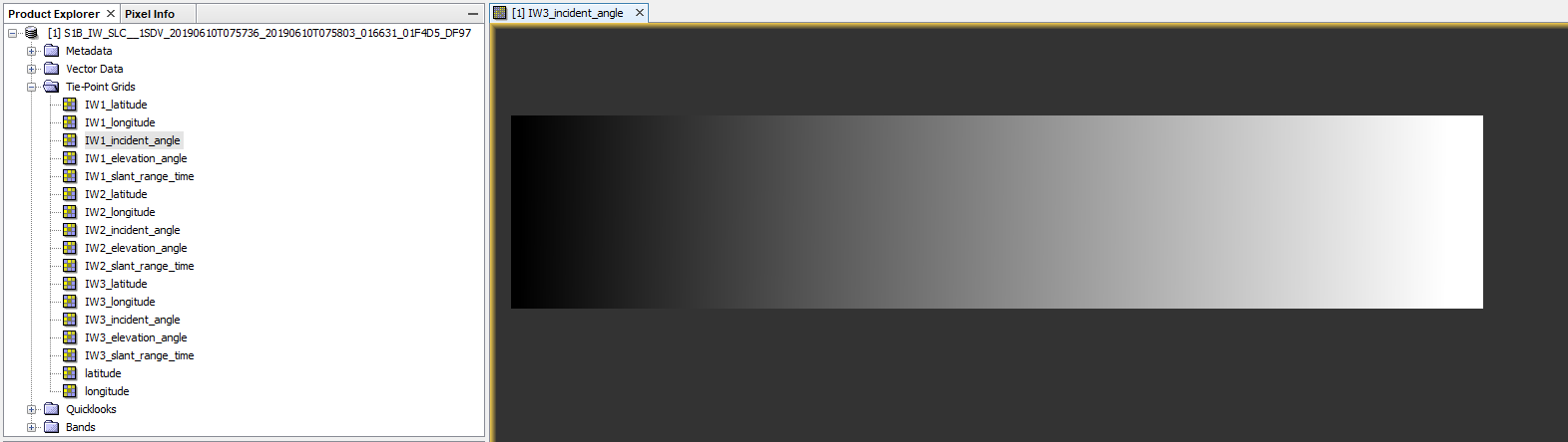
the “incidence angle” is present in the metadata of any Sentinel-1 product and as a raster.
But Sentinel-1 SLC products are divided into three swaths because of the TOPS acquisition principle: S1 Applications
So there is an incidence angle for all three swaths (and both polarizations in case of the metadata).
Thank you very much for your response, I really appreciate your kindness. I only have one question left and I don’t take more of your time. Do you know how to have the value in degrees of the angle of azimuth?
I have checked these topics. I only get the look direction with a cyan arrow overlaid on the image by the step of adding the mapping tools layer in SNAP. But I want to get the azimuth angle for every cell of S1. I cannot find any method to get a quantitative value for every cell of the image.
I need “satellite heading” value of the Sentinel-1 images to combine asc. and desc. images for the calculation the vertical component using the equation given below;
Hello hiny, have you solved this problem? I’m now having this problem too, and I want to extract the angle of incidence information of sentinel-1 data with latitude and longitude information. How does this need to be achieved? Thank you very much.
Hello, ABraun. The problem I have now is that I want to use SNAP software to extract the radar incidence angle of Sentinel-1 data, how to extract it, and look forward to your suggestions. (In fact, I have used “band mathematics” to extract the radar angle of incidence information, but there is no latitude and longitude information, how to export radar angle of incidence information, including latitude and longitude), thank you very much for your technical support