I guess we both haven’t found them yet 
 I think the raster I already posted is not correct, so I believe we could solve this issue, because we are almost on the end, actually this issue in my mind from almost one and half year ago, and now I’d reach the last solution, of course your help is very important.
1 Like
I have an idea, I don’t know if you like it,
We could try out to edit the same average file, by deleting all unnecessary files and rename the averaged files, later on export the same one to snaphu!!! What do you think?
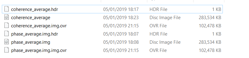
And rename to be accepted by SNAPHU
I mean, while assisted dem cor. is used , the phase is missed, what we did is the retrieval the phase by applying bandmath , phase(I,q), it means each phase includes I,q what it could be done after an average is to convert the average phase to I,q, .
you mean to average all i and all q rasters separately and then rename them accordingly (and replace them in an existing product)?
I don’t think that works because the fringes occur after the formation of the phase. I haven’t tested it but I expect that averaging i and q separately will not bring higher details in the resulting interferogam (compared to averaging interferograms themselves).
What I tried above was exporting a regular interferogram using the snaphu export and then replace the img file of the exported phase by the img file of the created average. But despite the number of pixels was the same, snaphu didn’t like it (abnormal error). Maybe you want to try it on your side as well.
Good morning Andy,
Any idea, or to close this issue!
I had implemented the STACKING in my PhD study using GAMMA software. Basically the processing is a cor-registration of multi INFGM’s, using one Master image or/and using multi Master image, the goal is to get the average of ground movement subsidence and uplift,…, . But I think here in SNAP the cor-registration function of multi INGM’s to get one INFGM, could be unwrapped is not possible!?
I’m not talking about exporting to SBAS or PSI, Here the issue is different, in case of any participation from our colleagues.
I’m out of ideas. Generating the average interferogram works but to be able to unwrap it, we need its i and q components in the product.
assisted corr. and later on the phase retrieval followed by manually phase average, if you mean this, personally I don’t recommend this.
it technically works but the result is questionable, yes
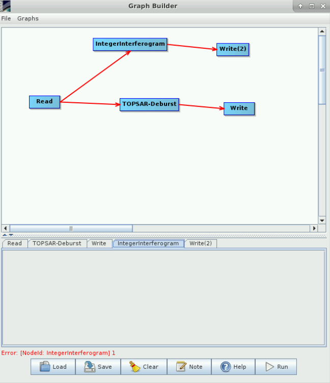
If only the integer interferogram module worked…
If there’s a bug let’s fix it. Has the bug been described somewhere?
Hi Marcus,
Basically there is no bug, however we we are trying to create a stacking of Nos. of interferograms to ultimately create one averaged infgm, could be unwrapped to decrease the atmospheric effects, ,
I tested it here and failed to get a result.
But, as we have discussed before this concatenation procedure is questionable, in this case I’d recommend other path of stacking average stacking to get one product being able unwrapped it . I’m wondering why you still like to continue with this way?
why not, if it is an official module for exactly this purpose?
As you know very well, exporting to snaphu is the case of matter, and the way of replacing the file as well, ,
I don’t think our ways of producing interferogram averages produced correct results.
Hi Andy,
So finally you get agreed with me ![]()
that’s why we need the integer interferogram combination module even more.
Let us try,
Hi folks.
I read this forum a lot before make my first question.
I ask in this topic, because I trying to combine interferograms, but I got a doubt (ok, millions of doubts, but for now just ask one):
¿When SNAP apply the “topographical phase removal”, the compute topo phase goes from –pi to pi (or 0 to 2pi)? ¿Or is like the unwrapped phase from –inf, to +inf?
example: the optional “Output topographic phase band” of one interferogram
go from 0.397273 to 8.308663, but applying a height ambiguity of 959m that means 60 to 1268m, and my zone is in the Andes, with a height difference of 3400m (heights from 600 to 4000m)
I’m lost.
Art