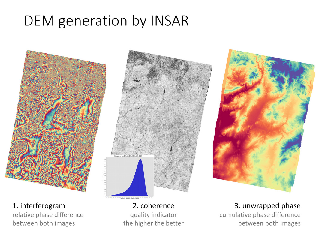
I generate INSAR SENTINEL-1 DEM , following correct procedure as:
Sentinel-1 Tops split
Caliberation
Apply Orbit File
Coregisteration: Back-geocoding
Interferogram formation
Deburst
Topographic phase removal
Goldstein filtering
Snaphu Export
Phase unwrapping
Snaphu import
Phase to elevation
geocoding: I used SRTM-1SEC As a Refrence dem
The elevation values are disturbed a lot and Negative as when compared to SRTM and other DEMs
As you see, most of your study area consists of dense vegetation, leading to phase decorrelation and loss of coherence. InSAR measurements are not possible here. This is underlined by the quality of the interferogram which hardly shows any fringes.
In that case you should choose less vegetation cover season, because it could affect the quality of your coherence, furthermore, the selection of small temporal baseline as much as possible, other solution, you could choose more penetrated wavelength such as L band , Alos PALSAR,
I also explained in here, the disadvantage of S1, selection for DEM creation,
I agree with @falahfakhri if you can select a study area, try to find one with little or no vegetation. All vegetated areas cause decorrelation and therefore loss of usable phase information.
Also, try to avoid images acquired during heavy rains, so images from the dry season are to be preferred.
Ok sir and what should be approx perpendicular baselines for these kinds of terrain…
Like i have selected 65 to 70meters for this terrain
and 24 days temporal
Because…
I have to work with Sentinel data only as per the project given
And i Cant change the broad study area, But yes can shift in that Uttarakhand Region only., though it would be difficult to find the area in Uttarakhand with Little or no vegetation, But will try to see any area with Minimum Vegetation
So i have to start again now with Final & Fresh ,because of short of time
Therefore, i am asking more information about Baselines
for Sentinel-1, values over 100 meters are more suitable according to the ESA guidelines
Have a look at this document http://www.esa.int/esapub/tm/tm19/TM-19_ptB.pdf -> Section 1.3 Selecting images for InSAR DEM generation
About your study area: Whoever gave you the task to build a DEM based on Sentinel-1 must have no idea on the limitations of this kind of data and I personally think such tasks shouldn’t be given by supervisors.
to evaluate your elevation information, you can select the “elevation” checkbox in the terrain correction step and have both the InSAR DEM and the SRTM used for terrain correction in one product and compare. This idea is illustrated at more detail here: Making interferogram for TANDEM-X bistatic mode
My colleague made them covering New Delhi and Harayana Region, which is plain area only
Then also the values are very high in Positive as well as Negative
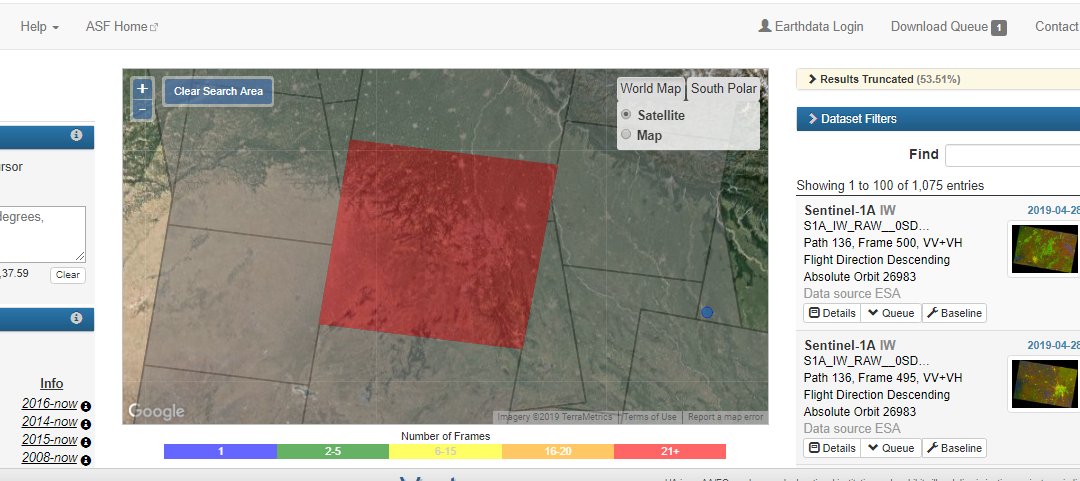
Why is it so happening in other area also . I dont have the product name right now, so have uploaded the screenshot of the area to get some idea.
ok fine sir…I will forward these tutorial to my colleague also to read.
After discussions and all , now I AM FINALLY making DEM using Sentinel only of the RAJASTHAN area which is like desert area, having least vegetation in North INDIA
And the data i got of Ascending pass with baseline as 108 meters and -36 days temporal
Descending pass: 113 metrers baseline and same -36 days temporal. of April-may dry season
As i was not getting good baseline with least temporal days so have chosen this
And 36 days will not cause much change to the topography of the Terrain so thatswhy i chose same temporal for both, since finally i have to fuse the two DEMs