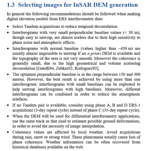
I think this post is quite good start for you, also remember the criteria of SAR IMAGES before to go a head in the processing for example the perpendicular baseline is a key point of created the elevation map,
Also, please have a look at this,
I think it is very nice tutorial, but let’s do it easy,
1- Split, Select where is your AOI in which subswath IW1-IW2-IW3,
2- Apply orbit,
3- Back geocoding
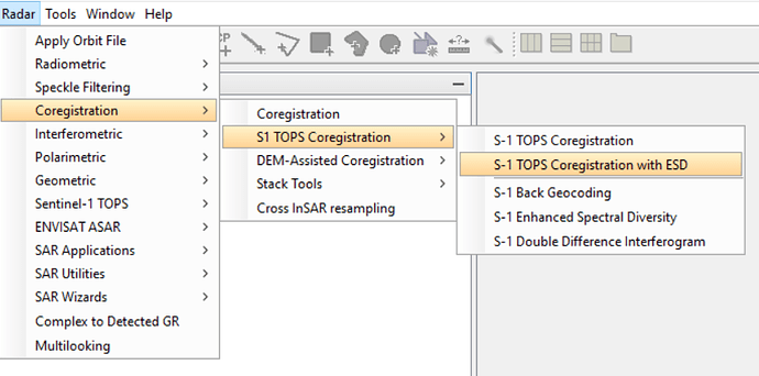
4- Apply ESD
5- Create an Interfogram
6- Deburst
7- Goldenstein Phase Filtering
8- Multilooking
9- Phase Unwrapping by selecting TOPO mode and and MCF, in the step of the SNAPHU EXPORT
10- Phase to elevation
11- Range doppler terrain correction.
Put in mind that the parameter altering is important and according to the many conditions, use the default in the beginning and then start to change them.
For the step of applying ENHANCED SPECTRAL DIVERSITY ESD, it could be found from here,


