Hi everyone 
I’m doing a project about determing changes on land using Sentinel 1-A images and PolSARpro_v5.0 software.
I don’t have any experience in this area, soo I need some help if anyone is interested please
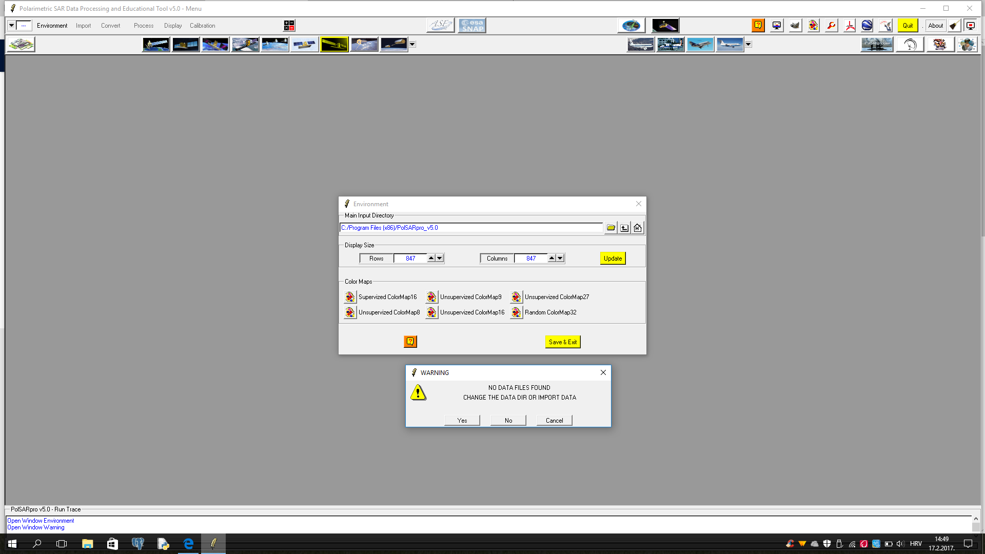
I have problem before import images, in heather Environmetn it is necessary to determine Main Input Directory but every time I determ it I get this message “NO DATA FILES FOUND,CHANGE THE DATA DIR OR IMPORT DATA” does anyone know what that means??
you know this forum is about SNAP, right? 
Anyway, PolSARpro is a bit tricky when it comes to the correct order what to click.
- Choose ‘single data set’
- Environment > Select your folder (*.SAFE)
- the message pops up - select ‘no’
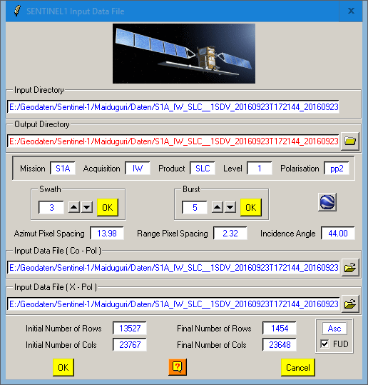
- Import > Spaceborne Sensors > Sentinel-1
- You shoud get a dialogue then where you can select the Swath and the Bursts (see below). Select them with ‘ok’
- You’re asked if a new directory for the PolSARpro files should be created > select ‘yes’
- The fields for Input data files are now filled (Co-Pol and X-Pol) > select ‘Ok’
- A message comes 'don’t forget to extract the data > this is not an error.
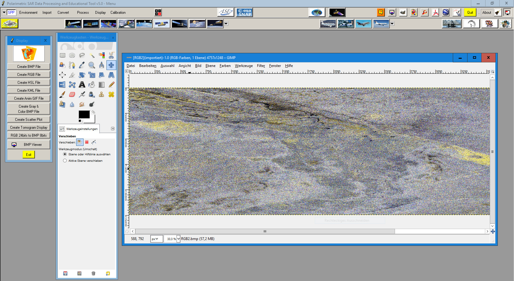
- Import > Extract > Full resolution (if you want a subset, create a subset first). This actually loads your data.
To view the data you need to install Gimp and link it in PolSARpro
Of course, dual-pol data of Sentinel-1 is not the optimal case for polarimetry but there are some applications which also work on two polarisations.
You’ll find information on the single steps in the documentation:
https://earth.esa.int/web/polsarpro/technical-documentation
1 Like
Thank you for answer , I’m new in this and every answer helps me a lot 
I don’t have any folder .SAFE 
Do you know maybe where can I get it? Does it come with installation of PolSarpro or what
P:S. Sorry I didn’t know this forum isn’t about SNAP. Do you know any forum about SNAP which will be useful for me? Thank you
when you download Sentinel-1 data the extacted folder should be named something like
S1A_IW_SLC__1SDV_20160819T180458_20160819T180529_012673_013E7D_A686.SAFE
This forum is about SNAP. I don’t know if many experts for PolSARpro are here as well. That’s all
Sorry stupid question  I just found it
Can you PLEASE write mi in few steps all what I need to do to determine changes on land using Sentinel 1-A images 
take 2 images, make a stack of both, create a colour composite to observe backscatter intensity changes.
Not necessarily with the use of polarimetry.
You’ll find many of these applications in the forum.
Thank you
But I don’t know how to make a stack and create colour composite can you describe me in few steps please
Unforunately I must do tad with polarimetry
Please have a look at the tutorials. I don’t see much sense in telling you what to click when you don’t know what you’re doing?
Why do you have to use polarimetry for change detecion at all? This is far from being trivial.
Here are some great documents / tutorials if you are new to SAR remote sensing:
Introduction to SAR remote sensing
A tutorial on synthetic aperture radar
Forest Monitoring with multi-temporal SAR data
Agricultural Applications with SAR Data Guidelines for SAR interferometry
Helpful topics in this forum:
Supervised classifications
NDVI correlation
polarimetric approaches
You are right
That is sugesstion from my mentor to use polarimetry for change detection. For you, which method is better to use than polarimetry? And what accuracy I can get?
thank you a lot for help
totally depends on what you are doing. Changes in ice, landcover, water, elevation, ocean currents…
There is no standard approach to change detection in remote sensing.
I need to determine changes on landcover and urban area.
Maybe interferometry is better option?
interferometry uses the phase of a signal instead of the backscatter intensity. It can be used to discriminate areas with high and low coherence. Unless you are not targeting one special class you can’t retrieve much information about changes with it. But you can use coherence as one parameter for change.
Ok thank you for explanation, you help me a lot
I have a problem with images. When I try to load images in PolSARPro i got this message “…the BMP file is not valid”. Another problem is when I look on google earth area of image it doesn’t match with that same area of image that I have download from Sentinel Data Hub. Do you know maybe why is that hapening?
If you are just importing the bmp in Google Earth, it won’t have any georeferencing.
No, I go to icon of Google Earth in Polsarpro and than “Open GEARTH_POLY File” --> find data with .kml extension in file of image I have download click Open and image open in Google Earth application. And it doesn’t match with area od image that is shown on Sentinel Data Hub??
I have a problem “error not enough memory space” in PolSARpro as below:

Please let me know how to solve this problem.
Thanks a lot in advance.
that means you don’t have enough RAM installed. Try to run on a PC with better hardware.
I use 32 Gb RAM in my laptop so that it should be no problems related to the memory space issue.
I have had that problem when I try to import images. I also have a good laptop and that sholudn’t be a problem, so I just restart it and try again and it worked 
I see you also work with Sentinel 1A images SLC, do you try to load images in google earth aplication?