Yes, I tried another images too, this is same problem.
I have a used your suggested workflow for the GRD with topography.
The results are shown,after your proposed methodology, at the img below.
Can I extract amplitude images (VV-VH), variance texture images (VV-VH), contrast texture images (VV-VH) based on your methodology? And if so, at which step should I do that? And more important, how can I extract them?
Thank you in advance.

The amplitude is the calibrated signal (Gamma0), nothing more to extract here.
Texture can be calculated with the GLCM module under optical > image analysis
From the same image, depend what format to save and results difference
Pict 1: without Thermal Noise Remove, but save on Sigma dB to display
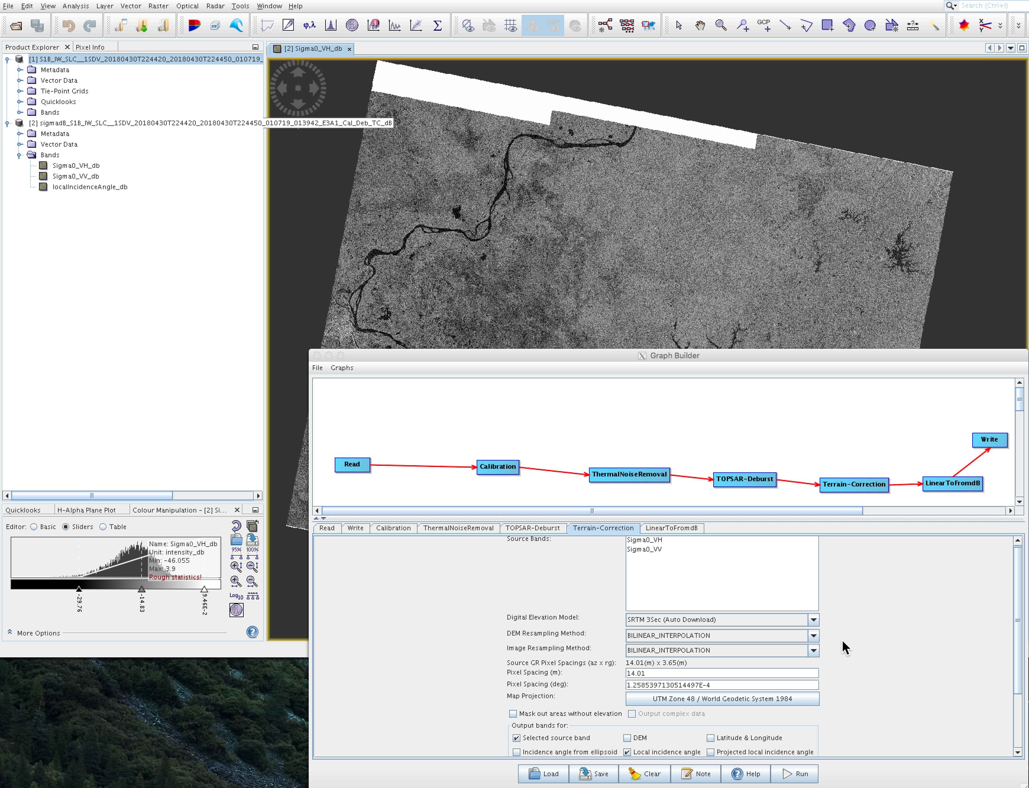
Pict2: without Thermal Noise Remove, save in complex, then save on SigmadB to display (so can see the lines)

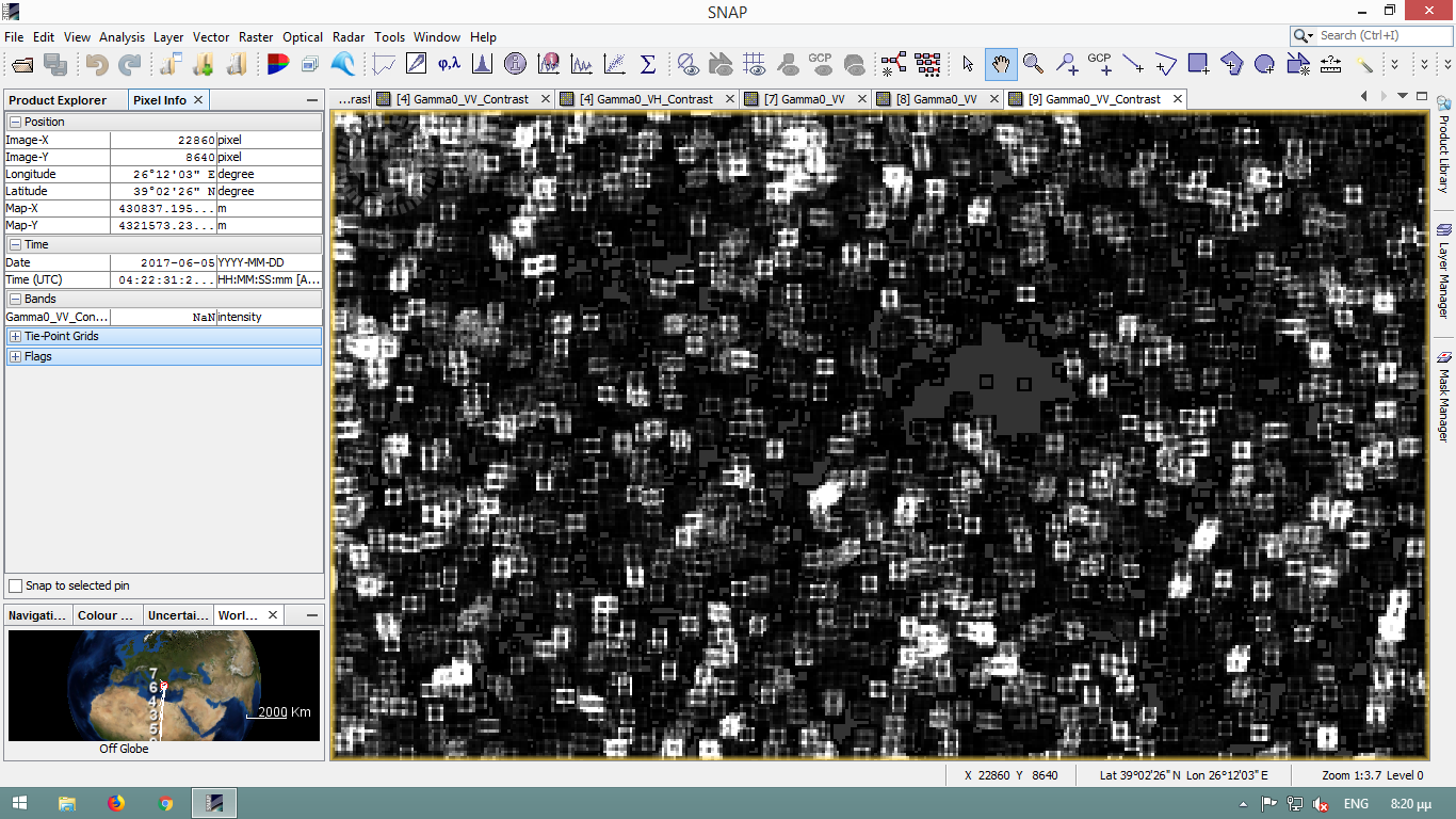
In the picture above is the result after the GLCM (Gamma VV Contrast). Here is the problem: The study area has NaN values, as well as other areas.
The image which I have download is Sentinel 1 IW GRD.
Before the GLCM step, I have apllied Noise calibration, Apply orbit file, Calibration, Radiometric terrain flattering & range doppler terrain correction.
Why I get these NaN values? How I can correct the problem?
Thank you.
After which step do the NaN values occur?
Is there extreme topography in your image?
After GLCM, at Gamma0 VV Contrast band. I dont have extreme topography (Study area Lesvos island, Greece)
if the NaN occurs after GLCM it means that the texture is 0 at those locations. You can disable the NaN display in the band properties by unckecking “No Data Value Used”
Do you find out what the problems and how to resolve? Thanks advantage.
I have no idea, sorry
Somebody already mention about 2 years ago
Problem I believe about save from ThermalNoiseRemoval, if s/w continue with complex they can able to save
complex and the lines on images will be solve too.
I have topography in the subset image but there is no topography in my ROI. Should I do terrain flattening you think?
flattening only changes the radiometric properties of areas, so if you make sure that they are correctly georeferenced (Range Doppler Terrain Correction), you can skip Terrain Flattening and directly calibrate to Sigma0.
hi, i would to know a simple software to do the calibration of sentinel 1 image except SNAP toolbox, as it is not working in my p.c. (with windows 10, 4 gb ram ) despite my repeated attempts. Also i’d like to know how to access the metadata of sentinel1 data.
Excuse me. There is one question during my process of “Radiometric Terrain Flattening”. Should I check the “Re-grid method” checkbox? Thanks.
if everything works fine, don’t select it.
I have to do post-classification comparison between ERS 2 and Sentinel 1.
Could I use the same workflow for ERS1/2?
If not, could someone suggest me one tested workflow?
Radiometric Calibration, Terrain Correction, Classification.
However, ERS has only one polarization. Classification is not easy then.
1 Like
At first, thanks for your fast response and your help!!
Could you explain me the reason that the ERS needs only Radiometric Claibration and Terrain Correction for classification and S1 needs all these steps from your suggested workflow? Do you have some reference for that?
So, are you suggesting me to use only the 1 polarization (same as the ERS polarization) of Sentinel-1?