I have a general question:
Is there any “SAR Time-series Analysis tool” in SNAP?
I have a general question:
Is there any “SAR Time-series Analysis tool” in SNAP?
There is a “Time-series” tool which helps to investigate the temporal profile of a pixel:
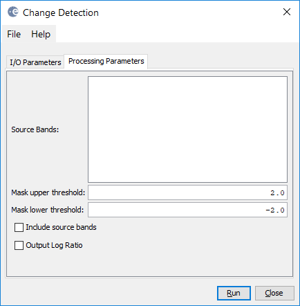
There is also a change detection module based on log-likelihood estimation:

Thanks, ABraum! Would you please let me know where "Time Series " tool is located in SNAP? Can it be used for either Optical or SAR dataset?
You can find it in the menu under this icon ![]() and you can use any data with it as long as it is calibrated and the values are comparable.
and you can use any data with it as long as it is calibrated and the values are comparable.
It is also important that SNAP is able to read out the data of acquisition from the metadata.
Abraun,
Just for testing, I have 2 SLC, and one ROI opened on one of SLC. But still no result for “Time series” shows up. I am probably missing some steps here. Please advice!
Thanks ABraun!
To have a time series analysis on SLC dataset, should I first “Create a stack on SLC” (radar>Coregistration>stack tools> create stack)? If so, the obtained product removes Intensity band and all would be complex based. However, I need to work on Intensity band.
Or I should first perform the Radiometric correction (sigma0) and then stack bands, and test the time series on?
Another question is about ROI, can I import my ROI to have the time series analysis?
Thanks again for your sincere assistance.
Calibration is always a good idea when working with images of different dates.
Stacking is not needed, you can move the files separately into the time-series tool. But you will have to make sure that the images are correctly aligned. SLC data should probably coregistered first to ensure this.
A ROI can be imported as vector shapefile, you will find many topics on this in here.
ABraun,
So, Time-series Analysis works when ROI is defined. The average ROI literally average out the backscatter values for the entire ROI?
Regarding the “Change Detection”, should I “Coregister sigma0 images” or “Create Stack” would be enough?
Thanks again!
yes.
Regarding the “Change Detection”, should I “Coregister sigma0 images” or “Create Stack” would be enough?
Depends on if your data is already geocoded. If you use SLC data coregistration is necessary. If your data is already in ground range (after Range Doppler Terrain Correction) creating a stack might be sufficient. But you will have to check with an RGB image to see if the images are aligned.
ABraun,
Is there any tutorial for “Change Detection”? I can’t get what is the benefit of threshold -2, 2 by default? Or what is the use of either ratio or log ratio (outputs)?
Thanks again
Thanks for the reference! so, Change Detection method proposed in SNAP is "Incoherent change detection, ratio(linear, image difference), or log ratio"-based.
Here I have changed thr threshold (-2,2) to (-1,1). Still I have a hard time to understand what does really this threshold range say? significant changes are expected at the tails of the distribution. How we should know what threshold is a better choice! What does really this histogram reveal for change detection of ROI defined!
Also wondering in SNAP how to show the value bar for the log ratio output obtained!
Thanks!
log ratio. Coherence is not involved in the SNAP change detection.
The threshold defines above which value something is considered as positive or negative change.
ABRaun
I have tested the Change detection over my two SLC time series stack, and selected a ROI, but I am not getting any specific graph out of it as you did!
Also, I am wondering how the “Change Ratio band” produced can be helpful?
I have a hard time to understand how to benefit from “Change detection” output in SNAP? 
click on the filter icon to see if the correct raster is used for the time series tool.
Yes, I did. But no graph is generated!
Also, wondering what kind of statistical info I can get out of Change ratio band?
Thanks!
For Sentinel-1 SAR time series analysis and change detection, I would also like to refer to Google Earth Engine, which allows per pixel time series analysis of GRD images.
mdkwant,
Thanks for your good advice. Does GEE provide an open source software for RS data analysis? I didn’t find anything related to Download! https://earthengine.google.com/
that is quite a large area by the way. Remember that you will only get one mean pixel value for the whole polygon. In case something changed between two observations you will probably see no big difference in that. It is actually designed to compare the mean value of a small homogenous area for different points in time.
Maybe you don’t see anything because it still computes the mean?
I would suggest to try it with a very small polygon to see if it technically works first (or simply by using the mouse cursor).
In case that works you need to click on the polygon when you want its statistics displayed in the graph because there are cases when you have multiple polygons and want to switch between them.